
June preview: pushing 80 this weekend?
Go Deeper.
Create an account or log in to save stories.
Like this?
Thanks for liking this story! We have added it to a list of your favorite stories.


This may be the most classic Minnesota spring in recent memory.
We've enjoyed a slow, gradual temperature climb. With a few of the usual speed bumps. The tulips and daffodils are having a good run this year. The lilacs are ready to burst. Deep blue spring skies languish overhead.

Farmers making progress
Remember the days of the noon hour farm report on local AM radio? If I were program director I'd create an updated version of that show again, and fold in some weather and climate. There is so much to talk about, and I'd let Minnesota farmers tell me about the changes they are seeing as climate shifts unfold in the field right before their eyes. Would you listen to a show like that?
Turn Up Your Support
MPR News helps you turn down the noise and build shared understanding. Turn up your support for this public resource and keep trusted journalism accessible to all.

Farmers made significant planting progress in the past week. A dry week with plenty of sun boosted planting progress. Here are some of the positive details from this week's Minnesota Crop Report.
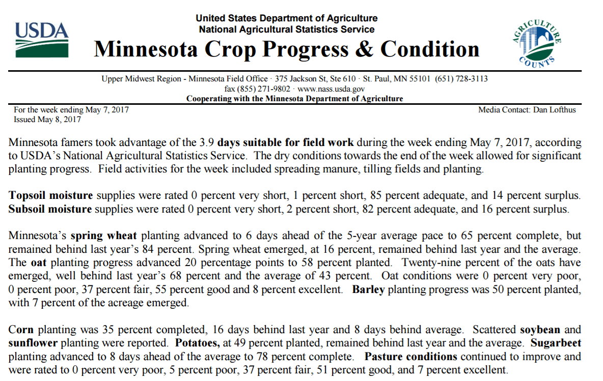
Spring wheat planting took a big step forward in the past week.
Soils warming up fast
With abundant sunshine and warmer temps, soil temperatures jumped 10 to 15 degrees across Minnesota in the past week.

With another mostly dry week ahead farmers should be in excellent shape by next week.
Wednesday shower chance
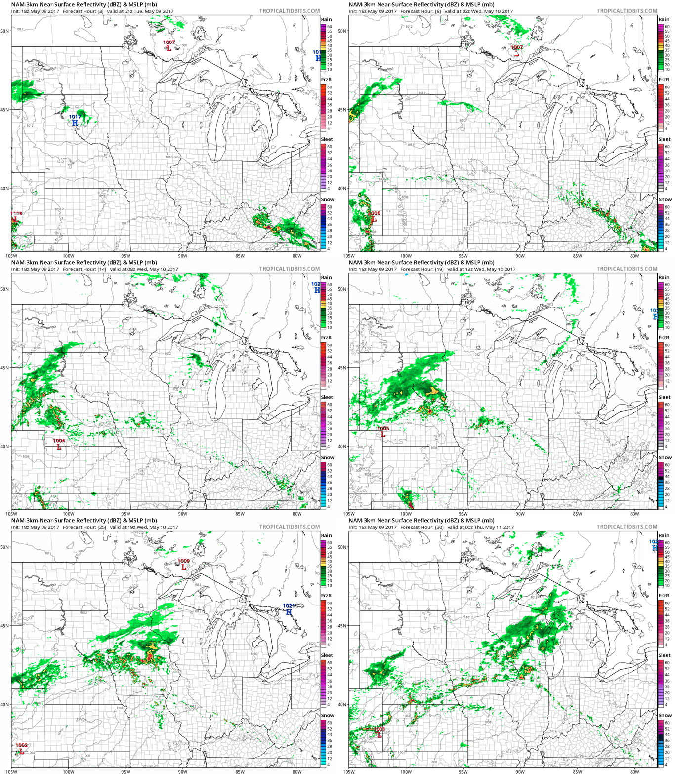
A minor low-pressure system slides through Iowa Wednesday. Southern Minnesota and Iowa are favored for the most concentrated showers. A few may sneak as far north as the metro, but rainfall totals look light.
The National Oceanic and Atmospheric Administration's North American Mesoscale Forecast System 3 km resolution model captures the notion of higher shower coverage in southern Minnesota and Iowa Wednesday, with the Twin Cities riding the northern edge.
Blissful weekend
This weekend is shaping up to be a blissful taste of summer. The latest model trends push a warm front north through Minnesota this weekend. Mostly sunny skies and temps warming into the upper 70s to near 80? Works for me.

Wetter next week?
NOAA's GFS model picks up on the trend of light rain Wednesday. We stay mostly dry through this weekend, but next week looks potentially wet again. Check out the notion of multi-inch rainfall again by late next week across Kansas, Missouri, Nebraska, Iowa and southern Minnesota. Remember model trends are usually more accurate than rainfall totals for specific locations in the 10-16 day range.

Stay tuned.

