
Edge of showers today; another amazing weekend ahead?
Go Deeper.
Create an account or log in to save stories.
Like this?
Thanks for liking this story! We have added it to a list of your favorite stories.


It was nice to see the sun this morning at the Weather Lab.
Our next weathermaker pushes in today with clouds and a few more showers on the radar scope. This is the same Colorado low that produced the ridiculously large damaging hail event in Denver Monday.
The system takes the southern route toward the Oklahoma Panhandle today. The Twin Cities rides the northern edge of shower chances. More concentrated showers and thunderstorms favor southern Minnesota and Iowa today.

Showers favor the afternoon hours today. Here's a look at future radar from the Twin Cities National Weather Service office.
Turn Up Your Support
MPR News helps you turn down the noise and build shared understanding. Turn up your support for this public resource and keep trusted journalism accessible to all.
Iowa severe risk
Storms across Iowa get a little frisky today. The National Oceanic and Atmospheric Administration's Storm Prediction Center paints a slight risk for severe storms as close as parts of Iowa and Illinois. A more concentrated risk zone favors Oklahoma.

NWS storm spotter training
Interested in becoming a trained storm spotter? The Twin Cities NWS offers excellent courses.
Warmer days ahead
Warmer weather and more sunshine returns to Minnesota Thursday, and lingers through most of this weekend. We enjoy a string of days in the 70s through early next week.
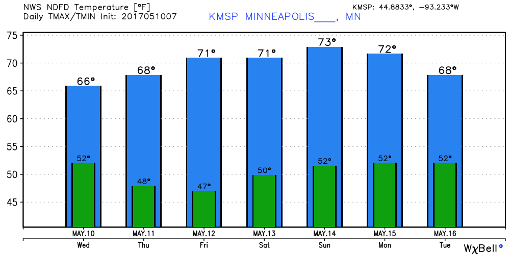
Wet again early next week?
NOAA's Global Forecast System model and the European Centre for Medium-Range Weather Forecasts advertise wetter weather early next week.

Next week also looks warmer than average. May appears to be trending warm in the Twin Cities for the 21st straight month in a row.

Stay tuned.

