A whiff of spring next week; NYC thundersnow
Go Deeper.
Create an account or log in to save stories.
Like this?
Thanks for liking this story! We have added it to a list of your favorite stories.


The first week of March in Minnesota is still more winter than meteorological spring. It's also seriously beautiful.
Gradually warmer
Temperatures budge slowly the rest of this week. Highs above freezing return this weekend.

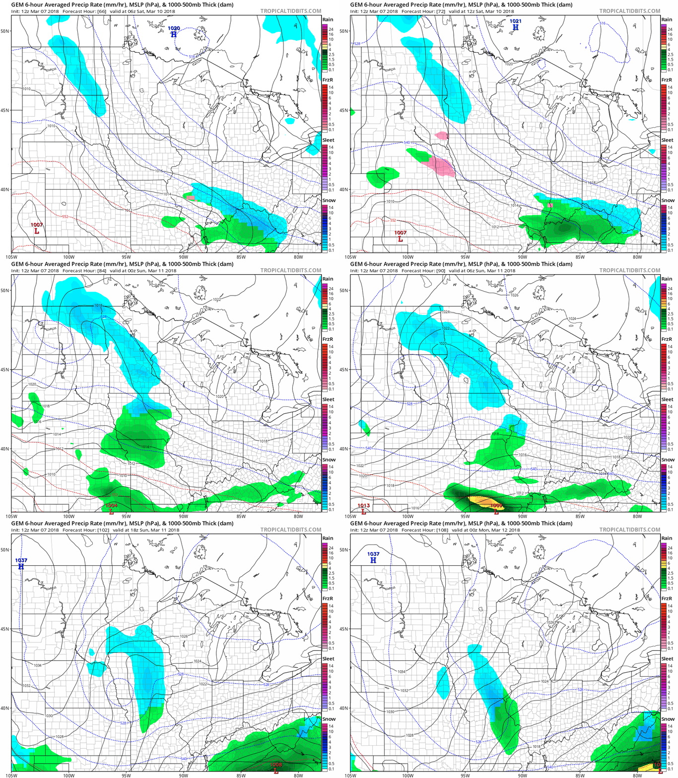
I'm still watching a minor system that brings a chance of light snow to parts of Minnesota this weekend. So far the key words are "chance" and "light." Here's the Canadian GEM model version of events this weekend.
Turn Up Your Support
MPR News helps you turn down the noise and build shared understanding. Turn up your support for this public resource and keep trusted journalism accessible to all.
40s likely next week
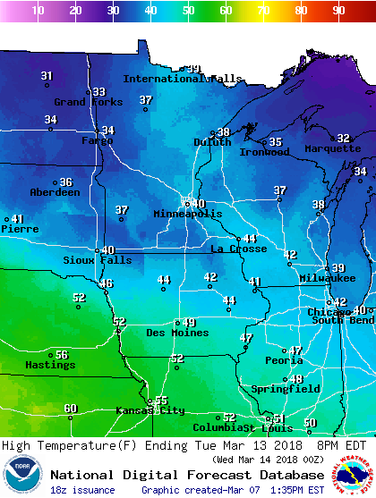
Milder air pushes north next week. A string of days in the 40s with a shot at 50 degrees by Thursday looks increasingly likely. Here's the early look at projected highs next Tuesday across Minnesota.
NYC thundersnow
Our latest powerful Nor'easter is pumping bands of thundersnow into New York City.
The National Oceanic and Atmospheric Administration resolution satellite images captured the convective snow bursts rolling into Long Island and New York City.
Intense updrafts within the icy convective snow bands generate electrical charge separation. That's what causes thunder snow.
Snowfall rates in convective snow bands often reach 1 to 3 inches per hour. This nor'easter is taking full advantage of a fire hose moisture plume from the Atlantic.
Shifting rain-snow line
We're not the only ones with forecast challenges centered on the infamous rain-snow line. Check out the evolving forecast from the Boston National Weather Service.