
AM thunder gives way to a nicer afternoon
Go Deeper.
Create an account or log in to save stories.
Like this?
Thanks for liking this story! We have added it to a list of your favorite stories.


Today started with an impressive Mesoscale Convective System (MCS) rolling across Minnesota in the wee hours of the morning. The storms produced wind gusts in excess of 60 mph in western and central Minnesota.
Here are the NWS local storm reports.
4 W Fergus Falls [Otter Tail Co, MN] AWOS reports TSTM WND GST of M66 MPH at 1:42 AM CDT
Benson [Swift Co, MN] AWOS reports TSTM WND GST of M67 MPH at 3:05 AM CDT
ST. CLOUD,MN (STC) ASOS reports gust of 54 knots (62.1 mph) from NNW at 4:08 AM CDT
Turn Up Your Support
MPR News helps you turn down the noise and build shared understanding. Turn up your support for this public resource and keep trusted journalism accessible to all.
Fortunately for the Twin Cities, storm intensity dropped off quickly as the squall line moved in. Here's a look at the radar loop via College of Dupage.

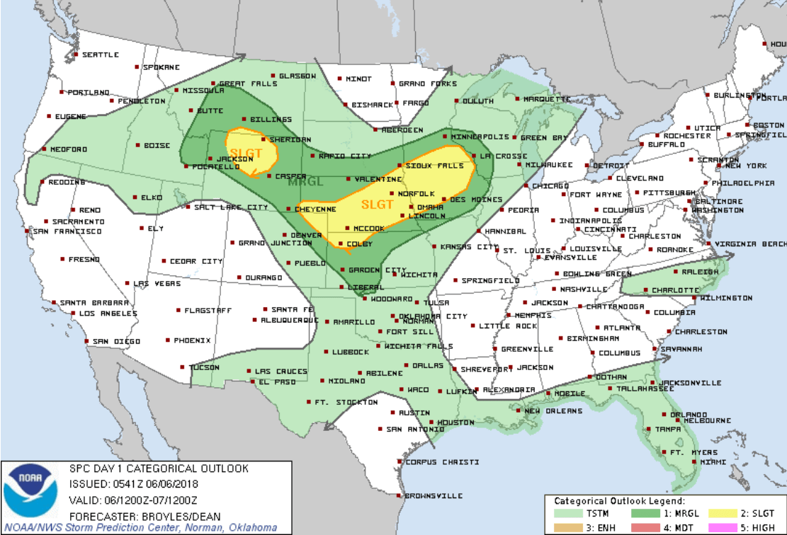
Severe risk shifts south
The risk for severe weather shifts south this afternoon to far southern Minnesota and Iowa. Any storm development this afternoon will likely be south of the Twin Cities.
Beautiful afternoon
Our rain-washed sky turns a bright blue today. Temperatures rebound into the 80s once again.

Feels like summer
The next week feels a lot like summer around most of Minnesota. Highs in the 80s will be common in southern Minnesota, with 70s up north. Cooler by the lake most days.
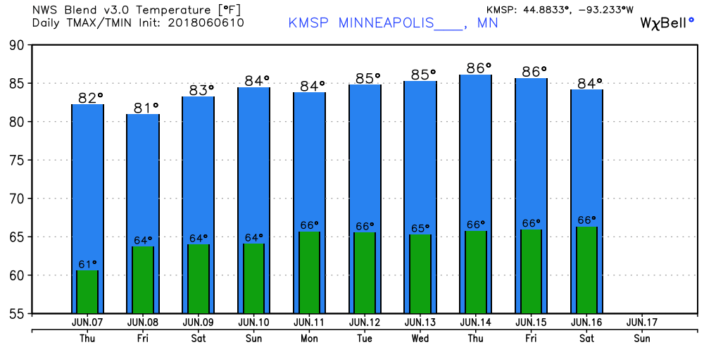
The next chance for scattered rain and thunder arrives Friday and Saturday.

