
Icy start today; 40s ahead?
Go Deeper.
Create an account or log in to save stories.
Like this?
Thanks for liking this story! We have added it to a list of your favorite stories.


Widespread fog, freezing drizzle and snow combined for an icy start Wednesday, as expected. Driveways, parking lots, sidewalks, and roads sport a thin film of glaze ice. Roads are slick across the region.
The Minnesota Department of Transportation reports several spin-outs on the glaze-covered roadways.
Warm air aloft
So, what's causing our freezing drizzle? A strong temperature inversion about 5,000 feet up is producing liquid precipitation that's freezing on contact with the pavement. Even a little glaze ice can ruin your day.
Turn Up Your Support
MPR News helps you turn down the noise and build shared understanding. Turn up your support for this public resource and keep trusted journalism accessible to all.

Want warmer weather? All you have to do is drive 1 mile to enjoy temperatures near 50 degrees. Straight up. Temperatures about 5,000 feet above us are in the upper 40s
Milder air getting closer
That Pacific air mass mixes down to ground-level as winds pick up late Thursday into the weekend. That will boost temperatures on the ground where we live.
I still think 40 degrees is a real possibility Friday and Saturday. Milder than average air lingers into next week.

Air quality alert
The inversions and light winds trap pollutants near the ground. Air quality index readings are rising across Minnesota Wednesday.
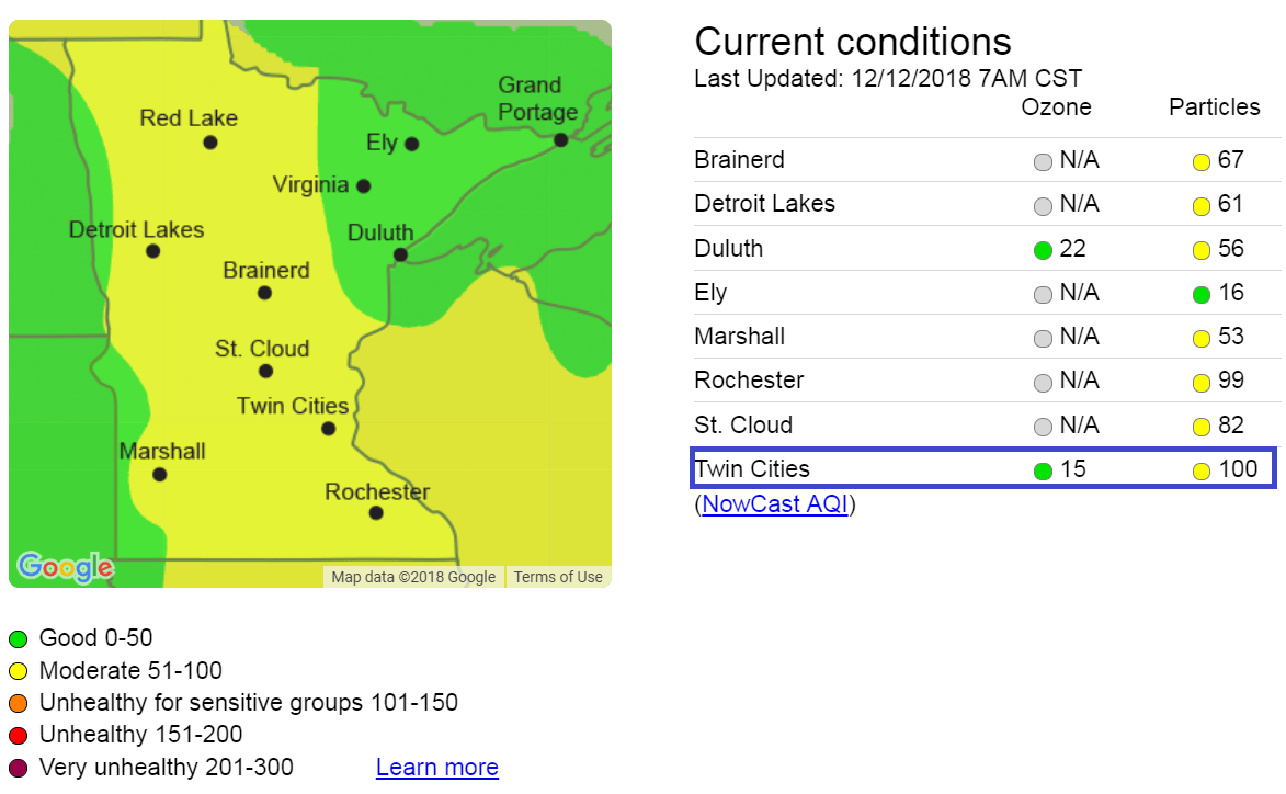
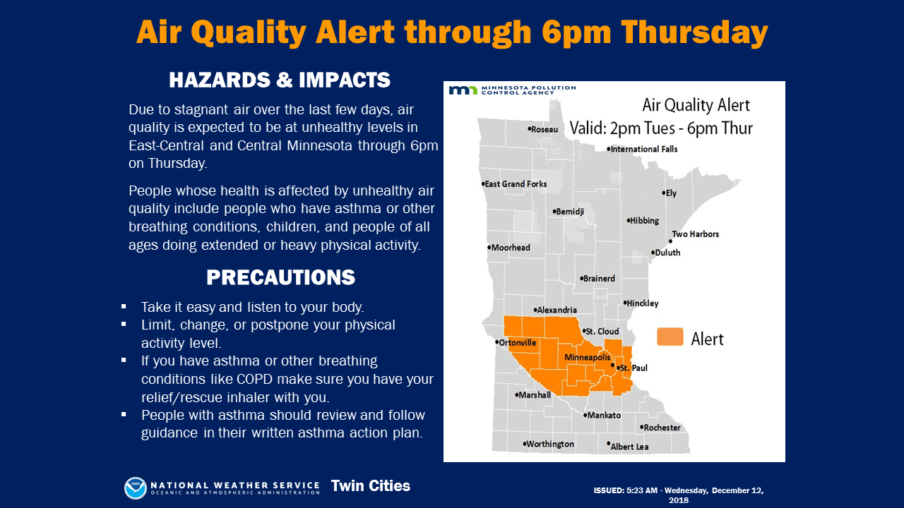
The air quality alert is in effect until 6 p.m. Thursday.
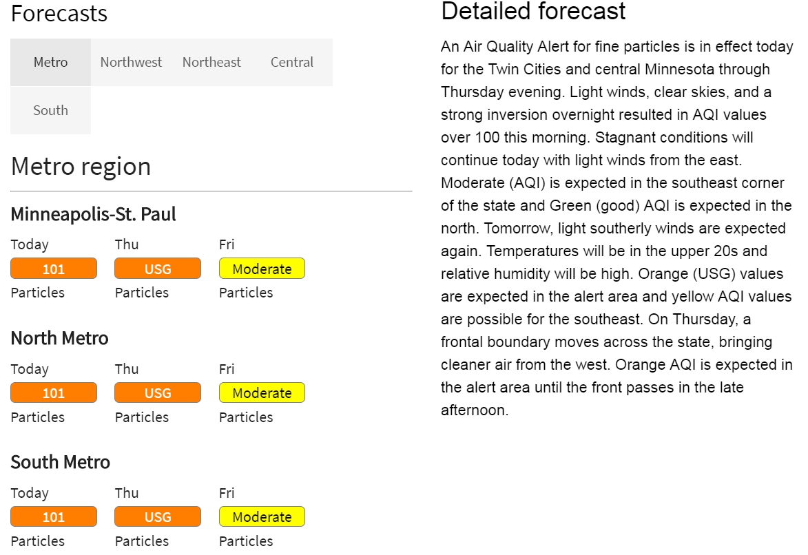
Breezes blowing in Thursday night will mix in cleaner air and bring milder temperatures.

