
Cooler weekend; rain late next week? First 70s in sight?
Go Deeper.
Create an account or log in to save stories.
Like this?
Thanks for liking this story! We have added it to a list of your favorite stories.


A cool front swept across Minnesota today. Our inbound Canadian air mass blows in seasonably cooler air the next few days. Cooler? Yes. But I don't see any bracing, eye-watering cold fronts on the map next week.
Temperatures bottom out Saturday across Minnesota. We'll rebound through the 50s next week.
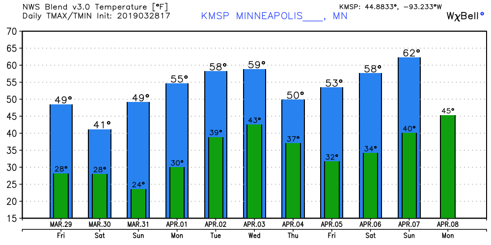
First 70s in sight?
The medium-range forecast maps suggest the season's warmest air so far may arrive the weekend of April 6-7. The upper air maps favor a warm ridge of high pressure moving into the Upper Midwest. Warmer colors return to Minnesota.
Turn Up Your Support
MPR News helps you turn down the noise and build shared understanding. Turn up your support for this public resource and keep trusted journalism accessible to all.
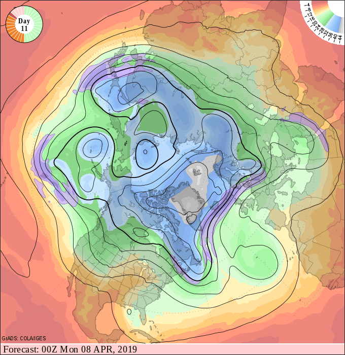
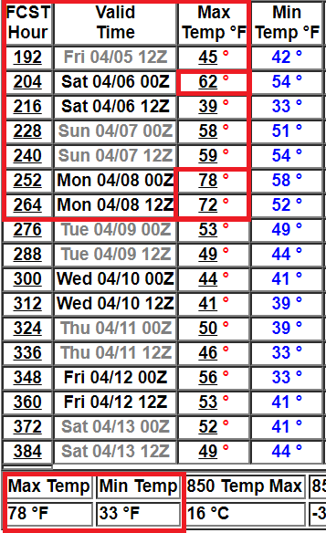
Models hint at the 60s, or maybe even 70s, by the weekend of April 6-7. The longer range outlooks show higher skill levels with temperature trends than with daily precipitation timing. Don't put too much faith in the precise numbers below, but the trends strongly suggest higher temperatures in about 7 to 10 days. Encouraging news for those with spring fever.
Dry spell continues for now
Thursday was day 14 of basically dry weather across Minnesota. Just 0.01 inch of precipitation has fallen in the Twin Cities since March 14. There may be a few light rain or snow showers late Sunday night. But little significant precipitation is likely through next Wednesday. That's good news for many rivers that will crest in the next week.
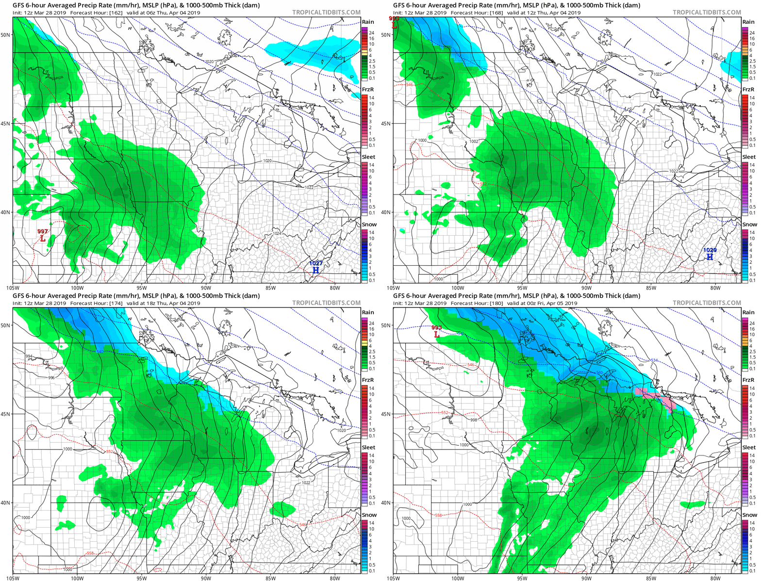
Models are beginning to grab hold of a possible rain system next Thursday, April 4. Here's NOAA's GFS model.
Coldest spot on earth
We know 2019 is off to a cold start in Minnesota so far. But it's been much warmer than average in most of the rest of the world.
That pattern is likely to flip at some point this year.
Stay tuned.

