
Monday soaker; sunshine and milder air returns this week
Go Deeper.
Create an account or log in to save stories.
Like this?
Thanks for liking this story! We have added it to a list of your favorite stories.


At least it fell on a Monday.
Monday's rainmaker brought soaking rains to already wet soils. The convective rainfall was spotty with embedded thunderstorms putting on a light show Sunday night. Most rainfall totals are coming in between one-quarter and three-quarters of an inch, so far.
Monday's weather system pulls out of Minnesota Tuesday. Sunshine and milder temperatures return Tuesday and Wednesday. Cooler temperatures return by Sunday and the last days of April.
Yes, it's still April.
Turn Up Your Support
MPR News helps you turn down the noise and build shared understanding. Turn up your support for this public resource and keep trusted journalism accessible to all.

Wet pattern ahead
The jet stream pattern looks active for Minnesota over the next two weeks. Weather systems in the upstream cue will arrive every 2-3 days. The next shot of light rain arrives Thursday morning. Saturday looks wet and possibly stormy. More rain may arrive Monday and Wednesday of next week.
The National Oceanic and Atmospheric Administration's Global Forecast System model grabs hold of light showers Thursday and the stronger storm moving in Saturday.

High water continues
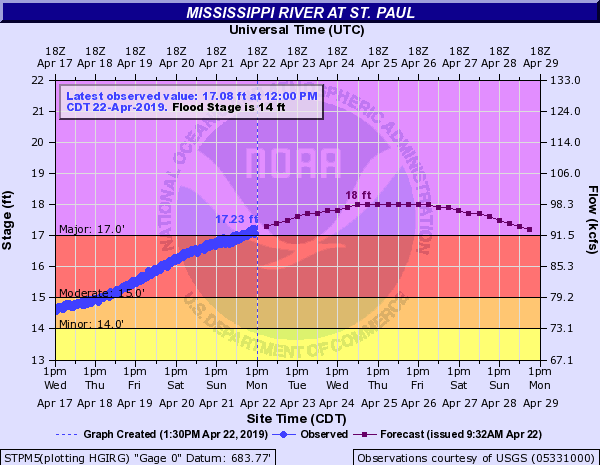
Flooding continues on many Minnesota rivers. The rainy pattern over the next two weeks will keep rivers running high in many locations.
A second crest occurs in St. Paul the next few days.
NOAA's GFS model suggests 3.5 inches of rain in the next 16 days. If that's even close, the flood threat will continue for the next few weeks on many Minnesota rivers.
Stay tuned.

