
Northern snow blitz; unsettled spring week ahead

Go Deeper.
Create an account or log in to save stories.
Like this?
Thanks for liking this story! We have added it to a list of your favorite stories.


This week begins with a tale of two seasons in Minnesota.
Spring clings to life in southern Minnesota. But up north, winter hangs on decisively. Fresh snow covers the landscape across much of northern Minnesota.

Impressive snow totals up north
Okay, heavy snowfall totals up north in the last days of April are impressive, or depressing, depending on your perspective. Nearly a foot has fallen up on the hill at Wolf Ridge Environmental Learning Center near Finland.
Turn Up Your Support
MPR News helps you turn down the noise and build shared understanding. Turn up your support for this public resource and keep trusted journalism accessible to all.
Wet pattern this week
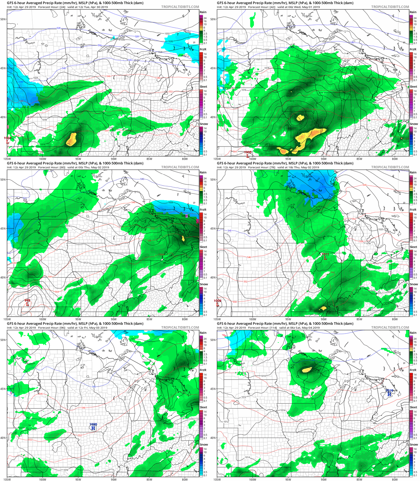
Snow pulls out of northeast Minnesota overnight. But the next weather system is loaded and ready to move into southern Minnesota Tuesday afternoon. This week features weak but frequent weather systems zipping along an active jet stream. Expect rain showers late Tuesday, Thursday, and Friday night.
I'm just the messenger folks.
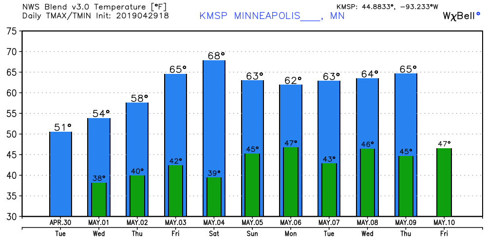
60s return
Temperatures do slowly rebound by the weekend. Saturday looks very nice right now. Even patio-worthy.
Milder in May?
That's usually a safe bet. NOAA's Climate Prediction Center 3-4 week temperature outlook for mid-May favors near to warmer than average temperatures.
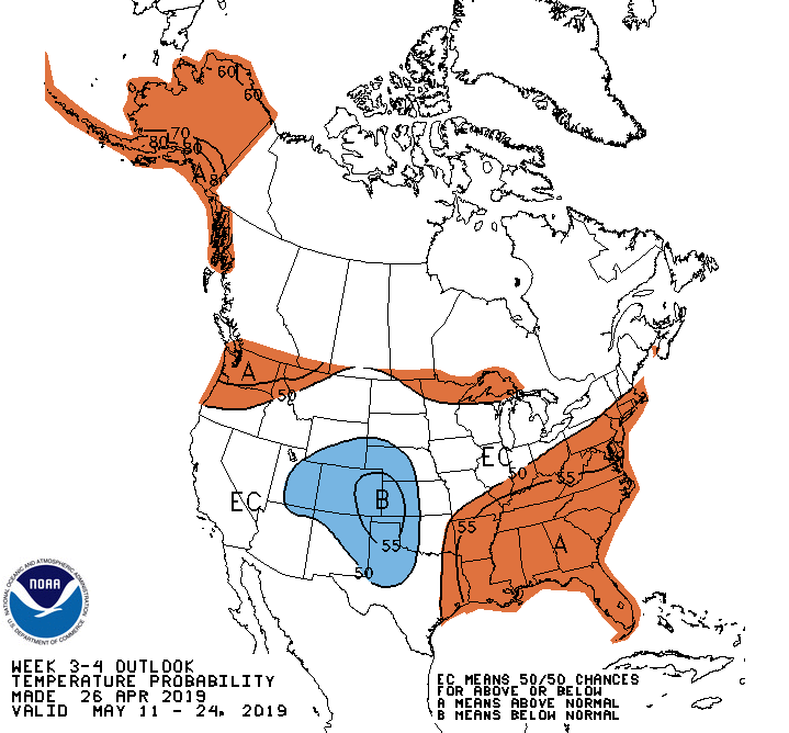
The average high temperature hits 70 degrees in the Twin Cities on May 17. For many Minnesotans, average never looked better.

