
Wind then rain Tuesday night; pretty nice Memorial Day weekend
Go Deeper.
Create an account or log in to save stories.
Like this?
Thanks for liking this story! We have added it to a list of your favorite stories.


The jet stream has been dealing Minnesota's weather cards since February. The deck is still stacked in favor of frequent storm systems. Our next system arrives late Tuesday.
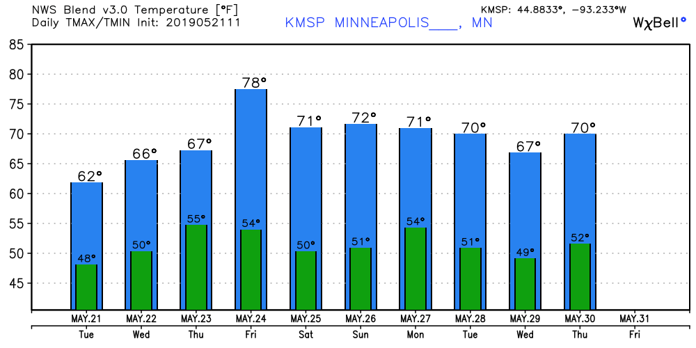
Spotty showers linger Wednesday. We come up for air with sunshine Thursday before another soaker arrives Friday.
It could be worse. I counted 25 tornadoes across the southern plains Monday night. Flood evacuations are happening in parts of Kansas and Oklahoma.
Perspective.
Turn Up Your Support
MPR News helps you turn down the noise and build shared understanding. Turn up your support for this public resource and keep trusted journalism accessible to all.

Tornado intercept?
I have such mixed feelings about even trained weather professionals willfully putting themselves in harm's way. Hope everybody is OK. This video appears to be from May 17.
Heavy rainfall zone
The total area covered by multi-inch rainfall across Oklahoma and Kansas is staggering. The Doppler radar from Tulsa, Okla., paints a wide area of 3- to 6-inch rainfall.
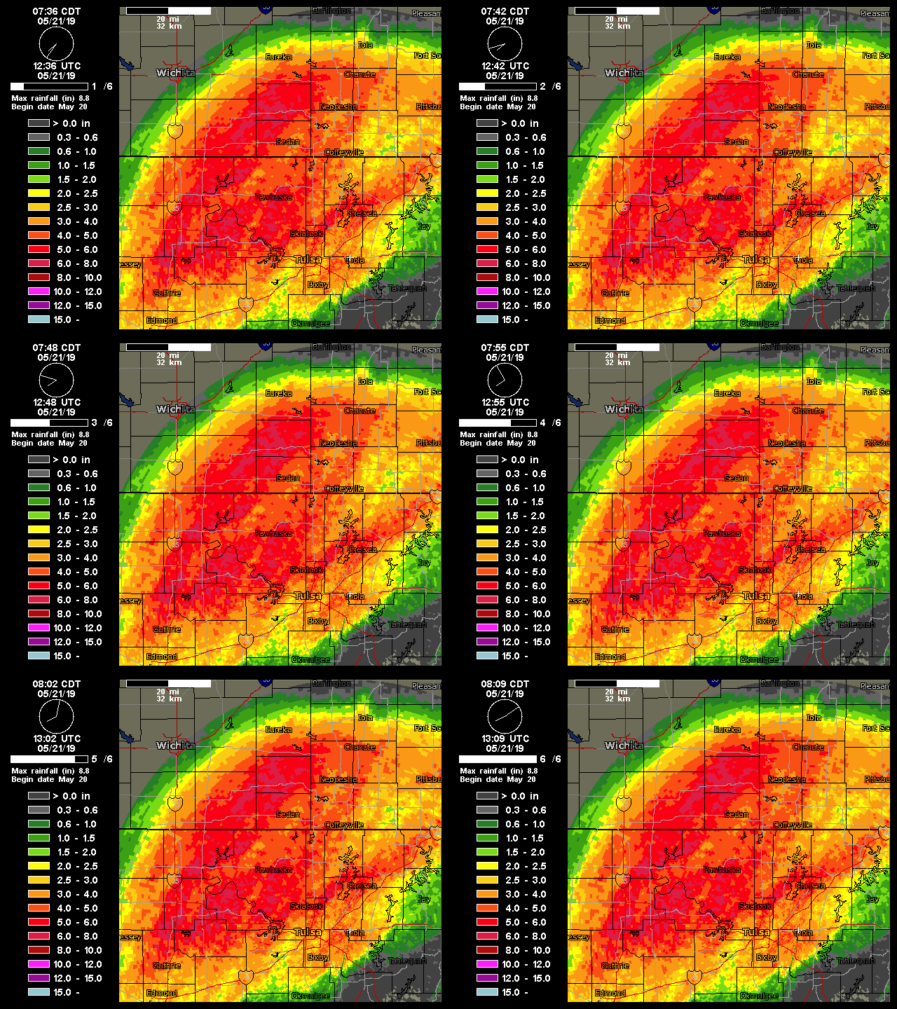
Flood rescues are in progress across parts of Oklahoma and Kansas.
Minnesota: Wind and rain by Tuesday night
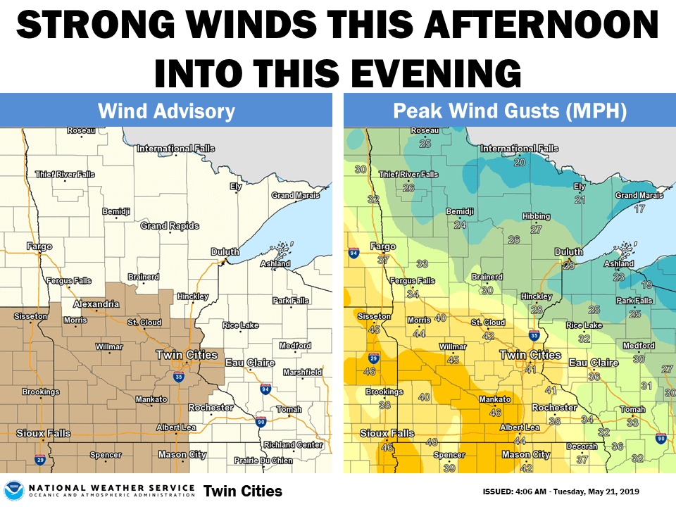
Out next system pushes in Tuesday night. First, winds increase. Wind advisories are up from the Twin Cities west. Gusts to 40-plus mph kick up Tuesday evening.
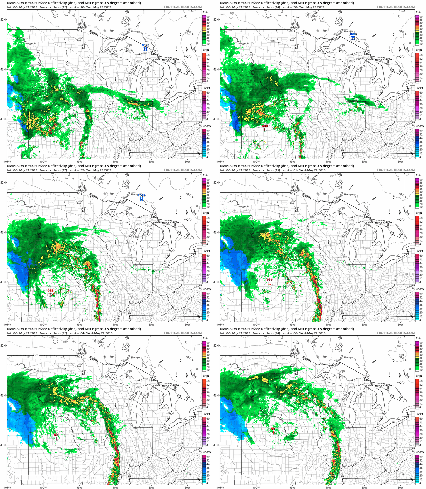
The rain spreads north from Iowa into Minnesota Tuesday. Showers push toward the metro in the evening.

Heavier rain around midnight?
I like the way the National Oceanic and Atmospheric Administration's NAM 3 km resolution model paints a few light showers moving into the Twin Cities late afternoon and evening, but holds the heaviest rains (and possible thunder) off until the hours surrounding midnight.
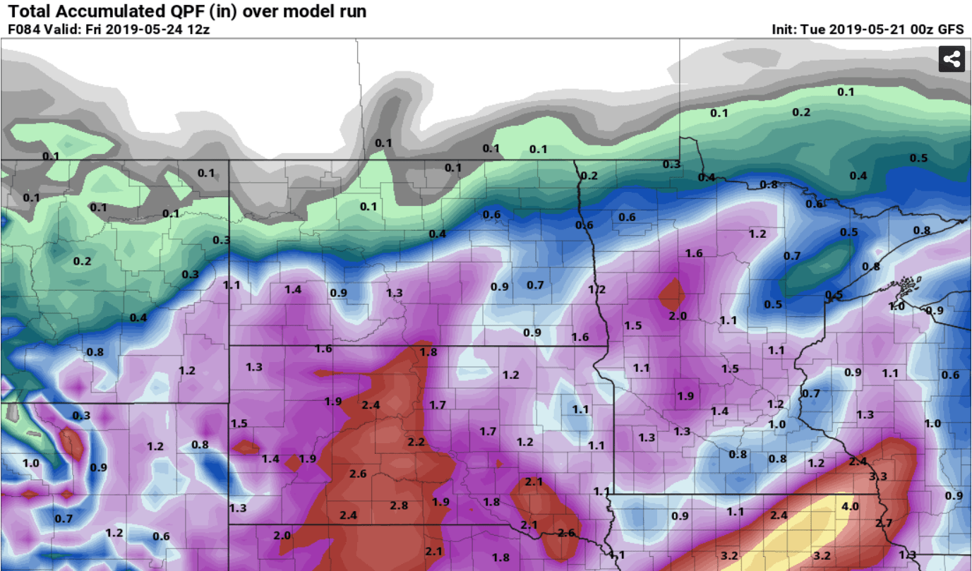
Another soaker
Most models suggest rainfall totals between one-half inch to 1-inch-plus across much of Minnesota.
Pretty nice weekend?
A few models suggest some light shower chances Sunday. But most models keep the bulk of the weekend dry with plenty of sunshine. Highs in the low 70s? We'll take it after last weekend.
Programming Note: I'm hosting a special one-hour Weather Lab and Climate Cast show at noon Wednesday on MPR News stations.
Stay tuned.

