
7th wettest year so far; good weather timing Memorial Day weekend
Go Deeper.
Create an account or log in to save stories.
Like this?
Thanks for liking this story! We have added it to a list of your favorite stories.


It's not your imagination.
This is indeed one of the wettest years on record so far for much of Minnesota. With yet another rain system on the way Friday, this is already the 7th wettest year on record in the Twin Cities. Our 13.74" or precipitation so far this year is 8.61" above average for the year. That's about 160-percent of average.
More rain Friday
It seems there are just two weather modes in Minnesota this spring. Rain. And, rain on the way.
Turn Up Your Support
MPR News helps you turn down the noise and build shared understanding. Turn up your support for this public resource and keep trusted journalism accessible to all.
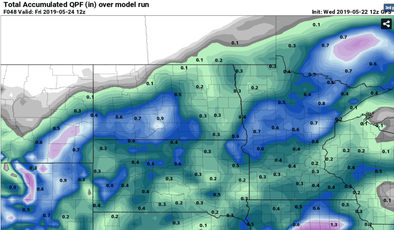
Our next rain system spreads into western Minnesota overnight. Showers reach the Twin Cities by morning and cover most of Minnesota by midday. NOAA's NAM 3 km resolution model paints the rain zone Friday.

Rainfall totals look lighter overall than our last system. But that's still a soaking on already saturated soils.
70s this weekend
Saturday and Sunday look nothing short of spectacular across much of Minnesota. Highs in the mid-70s will feel great. Memorial Day looks wet again. Temperatures stay relatively cool through most of next week.

Missouri tornadoes
Jefferson City Missouri was hit hard last night by tornadoes.
Damage is extensive.
It appears warnings were timely last night. Most tornado deaths and injuries are caused by flying debris. You can see why safe shelter, even tornado helmets are critical.
Severe weather is coming to Minnesota eventually. I just have this feeling that as warm summery air tries to push this cold spring out of here, the storms may get violent.
Stay tuned.

