Warmer and drier weather pattern evolving; U.S. tornado count skyrockets
Go Deeper.
Create an account or log in to save stories.
Like this?
Thanks for liking this story! We have added it to a list of your favorite stories.


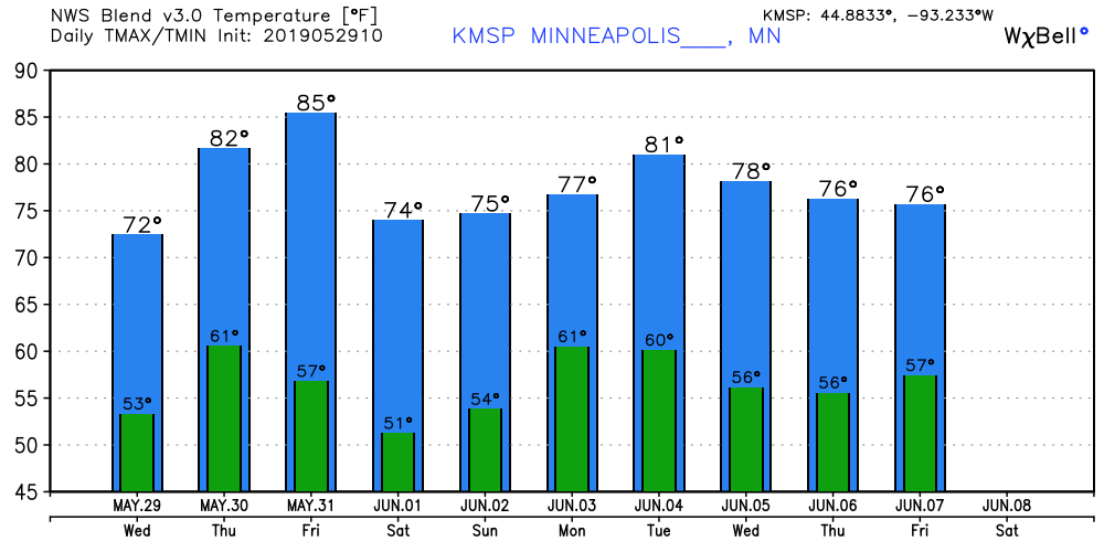
Here is some welcome weather news for rain-weary Minnesotans. The overall weather pattern looks warmer and drier. Highs in the 70s and 80s look much more common over the next two weeks. Rain chances appear to be on the wane. Not a moment too soon.
First, a few pesky showers Wednesday across southern Minnesota. They may run out of gas before they reach the Twin Cities, but a few spotty showers are possible.
80s emerge
How would you feel about high in the 80s? I thought so.
Turn Up Your Support
MPR News helps you turn down the noise and build shared understanding. Turn up your support for this public resource and keep trusted journalism accessible to all.
Highs push toward and past 80 degrees Thursday, Friday, and Tuesday.
Heatwave?
I'm still seeing hints of a possibly hotter pattern emerging around June 8-11. The upper air maps finally suggest a ridge of high pressure pumping summerlike air into the Upper Midwest the second week of June. Highs near 90 in the next two weeks?
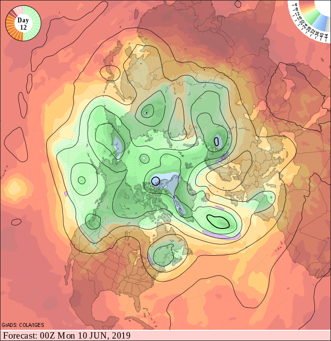
The National Oceanic and Atmospheric Administration's Climate Prediction Center picks up on the trend for sustained warmer than average air masses in the next two weeks.

And the most recent model trends suggest a drier than average weather pattern evolving for a change across the Upper Midwest.

Tornado count skyrockets
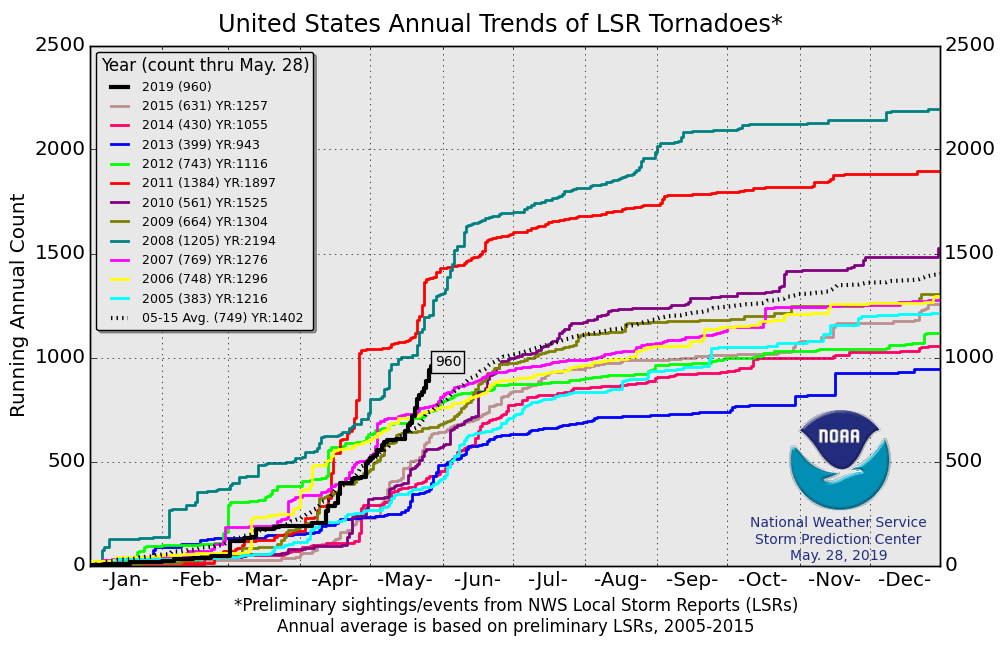
The 2019 tornado season started on a slow note. But the last six weeks have made up for lost time. Check out the numbers.
NOAA reports 960 tornadoes so far in 2019 through May 28.
That's on pace as the 3rd most active year on record.
The average number of U.S. tornadoes to date is 749.
Around 700 tornadoes have occurred since April 1.
The Memorial Day outbreak spawned 77 preliminary tornado reports.
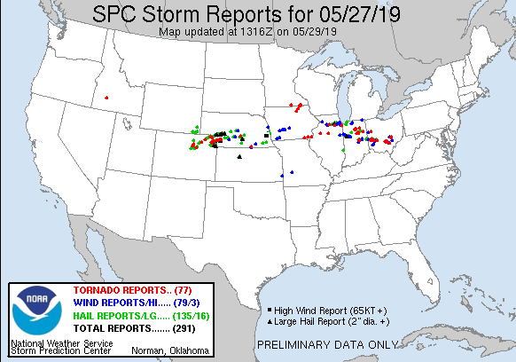
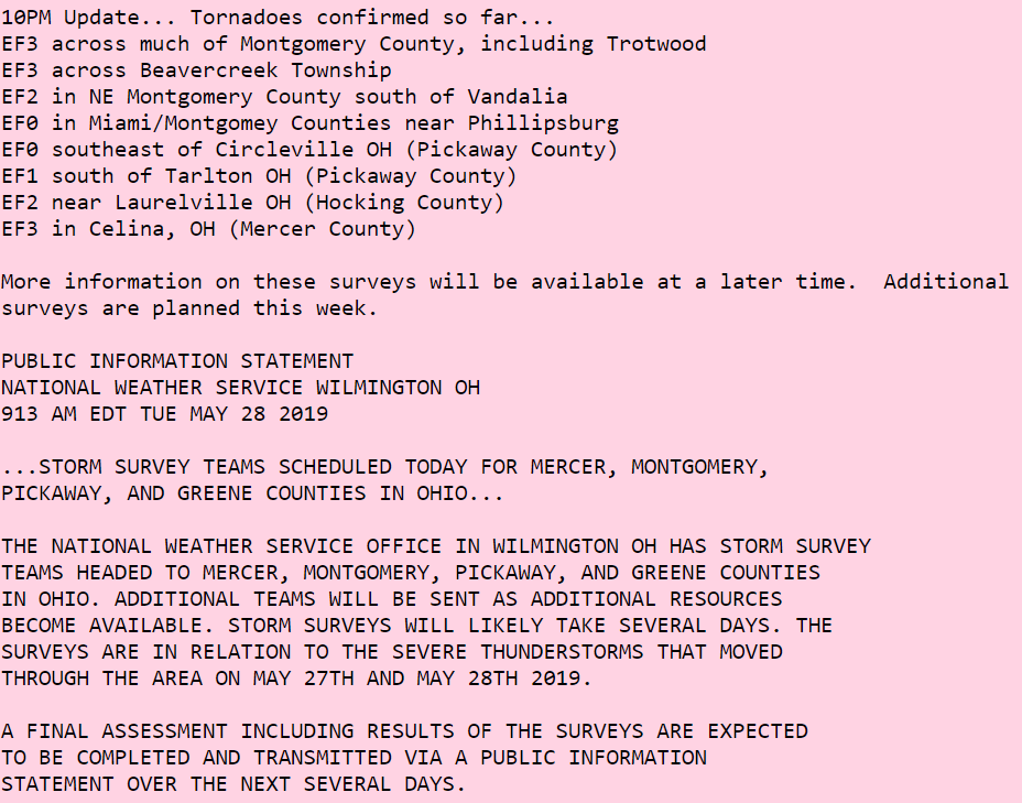
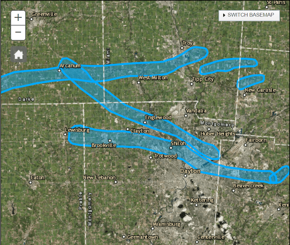
Some of the tornadoes that tore through the Dayton, Ohio area Monday night are rated at EF3.