
Severe thunderstorm watch until 8 p.m.
Go Deeper.
Create an account or log in to save stories.
Like this?
Thanks for liking this story! We have added it to a list of your favorite stories.


The National Oceanic and Atmospheric Administration's Storm Prediction Center issued a severe thunderstorm watch Tuesday, as expected. The watch covers most of Minnesota from the Canadian border all the way to the Twin Cities.
For up to the minute severe weather info click on the MPR News severe weather live blog here.
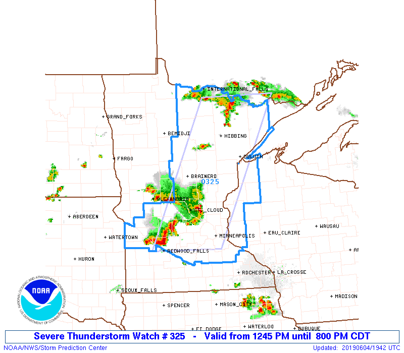
URGENT - IMMEDIATE BROADCAST REQUESTED
Severe Thunderstorm Watch Number 325
Turn Up Your Support
MPR News helps you turn down the noise and build shared understanding. Turn up your support for this public resource and keep trusted journalism accessible to all.
NWS Storm Prediction Center Norman OK
1245 PM CDT Tue Jun 4 2019
The NWS Storm Prediction Center has issued a
* Severe Thunderstorm Watch for portions of
Eastern and Central Minnesota
Western Wisconsin
Lake Superior
* Effective this Tuesday afternoon and evening from 1245 PM until
800 PM CDT.
* Primary threats include...
Scattered large hail likely with isolated very large hail events
Up to 2 inches in diameter possible
Scattered damaging wind gusts to 70 mph likely
A tornado or two possible
SUMMARY...Multiple clusters of thunderstorms are expected to
intensify this afternoon across the watch area, with a risk of
damaging wind gusts and hail in the strongest activity.

