
Summer breezes; drier pattern evolving; D-Day forecast; “Ladybug blooms?”
Go Deeper.
Create an account or log in to save stories.
Like this?
Thanks for liking this story! We have added it to a list of your favorite stories.


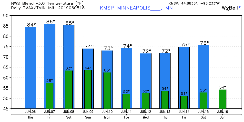
A summery breeze continues to blow this week. Minnesota is finally enjoying a run of warmer, sunnier days. The July-like weather pattern holds the rest of this week. Cooler, but still pleasant temperatures return next week.
Classic summer convective rainfall pattern
Tuesday's storms showed just how localized summer rainfall can be.
Drier pattern evolving
Turn Up Your Support
MPR News helps you turn down the noise and build shared understanding. Turn up your support for this public resource and keep trusted journalism accessible to all.
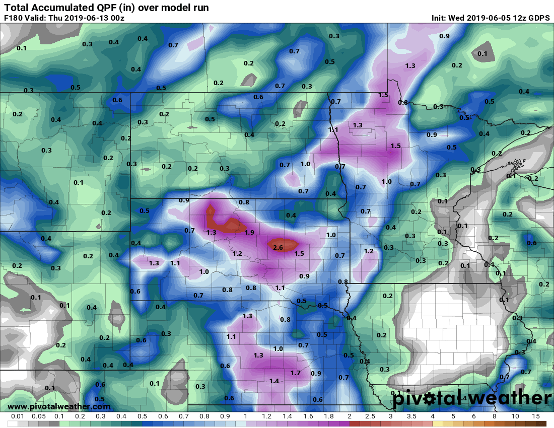
The upper wind flow favors fewer rain days over the next two weeks. Right now Sunday and next Wednesday appear to be the only chances for potential significant rain.
Most models limit rainfall across the southeast half of Minnesota to well under an inch in the next week. The northwest half of Minnesota may get more than an inch, but that's much less than we've had in many days recently. Here's the Canadian model rainfall output through next Wednesday.
D-Day: American meteorologists won
German meteorologists predicted stormy seas and unfavorable landing conditions on D-Day. But American meteorologists saw what looked like a favorable break in the weather. We're German troops caught napping?
It may have been the most important forecast in history.
"Ladybug bloom"
Doppler radar is so sensitive it picks up all kinds of flying objects. Even Ladybugs.
Check out this dust devil in Boone, Iowa.

