
Sun returns; refreshing now; June ripens next week
Go Deeper.
Create an account or log in to save stories.
Like this?
Thanks for liking this story! We have added it to a list of your favorite stories.


It's a refreshing air mass across Minnesota today. Northwest breezes and increasingly sunny skies combine for another day of free AC. Skies clear from west to east across Minnesota today.

Temperatures rebound
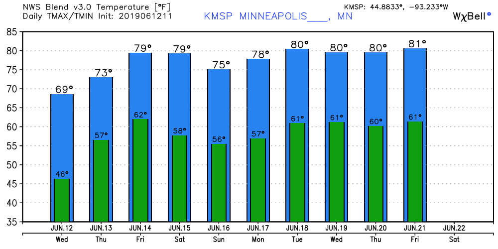
Today looks like it could be the coolest day for the rest of June across Minnesota. Maybe for the rest of the summer. Highs make the upper 60s. The 70s and 80s return later this week into next week.
Scattered storms Friday night and Saturday
Turn Up Your Support
MPR News helps you turn down the noise and build shared understanding. Turn up your support for this public resource and keep trusted journalism accessible to all.
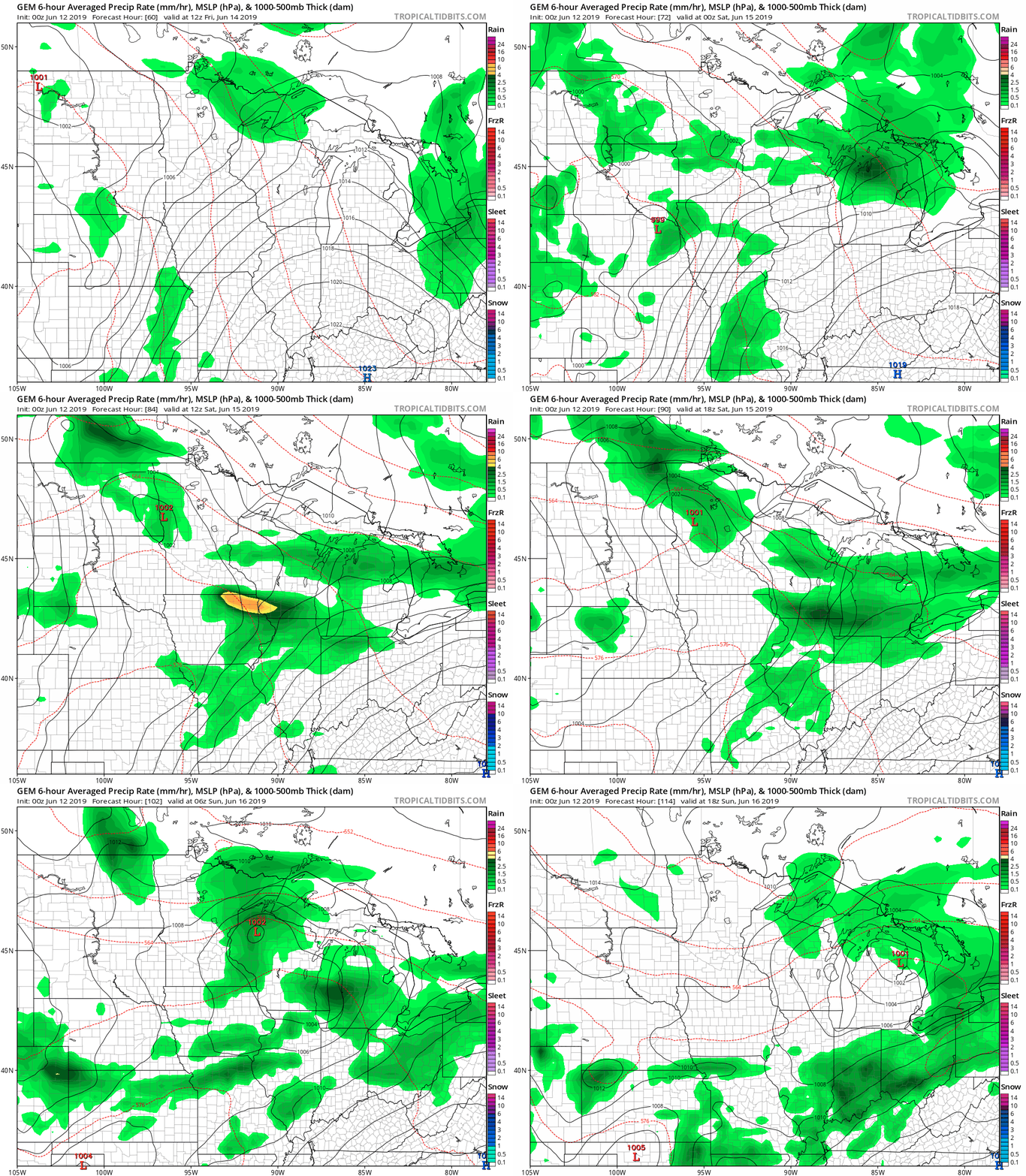
Thursday looks bright and sunny. Forecast models are still in flux on the timing for possible showers and thunderstorms Friday night through Saturday. The Canadian model suggests a couple of rain and thunder waves, then clearing for Father's Day.
Next week: Sticky and stormy?
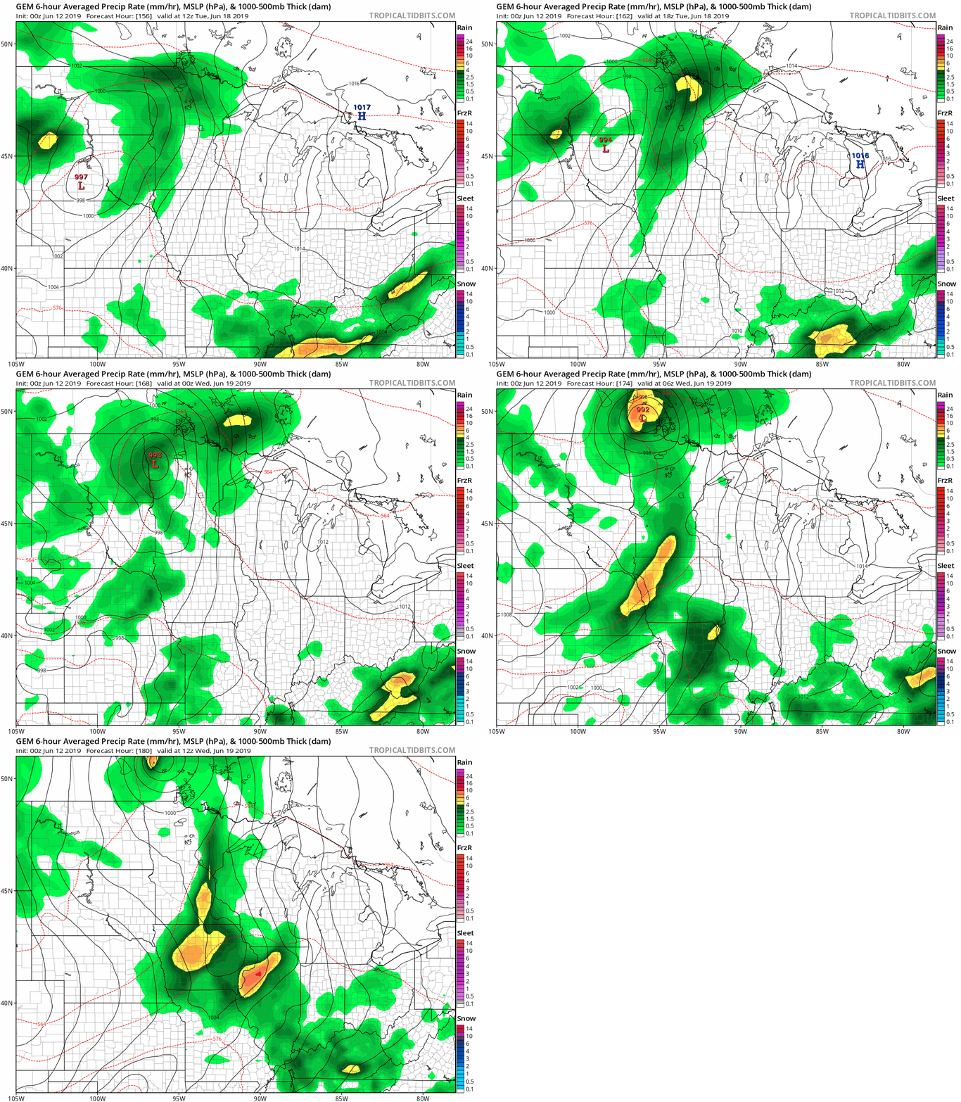
There are growing signs that humidity and storms may build next week. The Canadian model paints an active low-pressure storm next Tuesday and Wednesday.
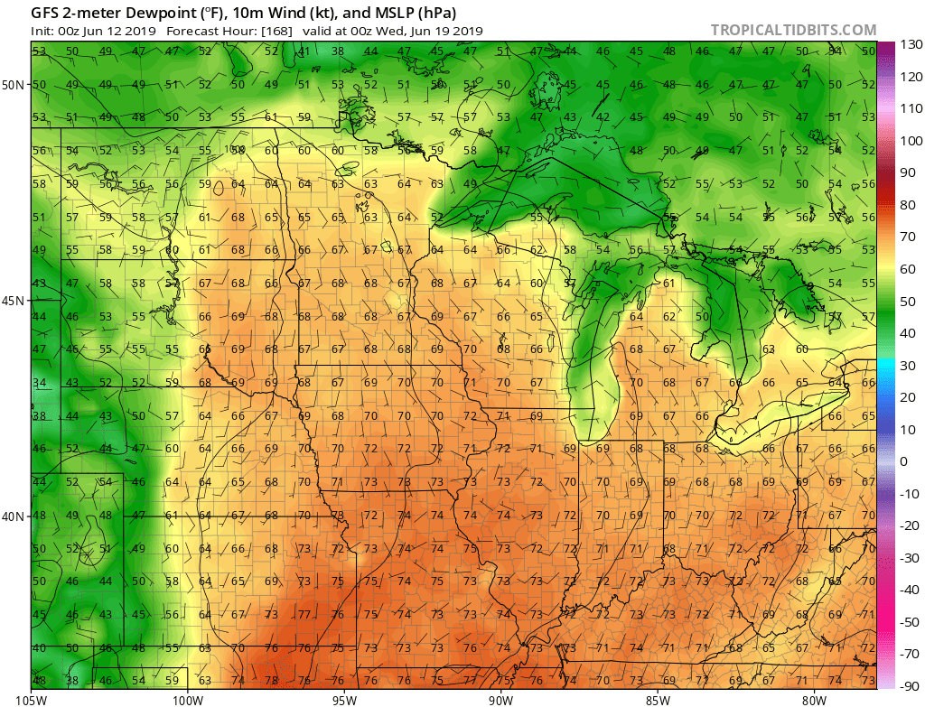
NOAA's GFS model pumps in sticky dew point in the upper 60s by next Tuesday. Fuel for thunderstorms.
Heat ahead?
We managed to eke out 90 degrees once so far in the Twin Cities this year. There are signs of more heat on the horizon. The upper air pattern suggests a possible heat dome building over the western U.S. the week of June 24.

NOAA's GFS 16-day output is cranking out highs in the low 90s that week.

Stay tuned.

