
Growing storm chances Tuesday; wettest year on record in Rochester
Go Deeper.
Create an account or log in to save stories.
Like this?
Thanks for liking this story! We have added it to a list of your favorite stories.


Our spectacular Monday weather is about to take a turn for the stormy.
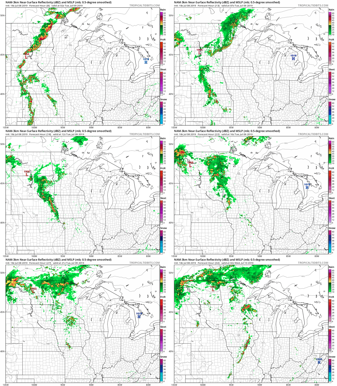
Strong to severe storms rumble across northwest Minnesota overnight.
The squall-line will probably fade before it reaches the Twin Cities as it moves south overnight.
Tuesday storm chances growing?
Turn Up Your Support
MPR News helps you turn down the noise and build shared understanding. Turn up your support for this public resource and keep trusted journalism accessible to all.
Monday afternoon's model runs have increased the chances for strong storms around the Twin Cities Tuesday afternoon and evening.
NOAA's NAM 3 km model shows the likely evolving scenario. Watch the squall line hit northwest Minnesota tonight, then fade. Then watch the storm cells blow up near the Twin Cities Tuesday afternoon and evening.
Severe risk
NOAA's currently paints a marginal risk for severe storms across Minnesota Tuesday. I have a hunch they may expand the slight risk zone to future updates.
Bottom line: Keep an eye out Tuesday for updates as storms may develop.
Rochester: Wettest year on record so far
Rochester has already logged more than 30 inches of precipitation this year. That's the wettest year on record to date for Rochester.

Twin Cities: 9th wettest year so far
The Twin Cities has already logged more than 20-inches of precipitation this year. That's good enough for the 9th wettest year on record so far.
The trend of a wetter Minnesota climate is going strong this year in southern Minnesota.

