
Summer ripens this week; smoke lingers up north
Go Deeper.
Create an account or log in to save stories.
Like this?
Thanks for liking this story! We have added it to a list of your favorite stories.


Monday brings classic July weather to Minnesota. Bank thermometers flash in the 80s across most of Minnesota. We've now reached our peak seasonal average high temperature at Minneapolis-St. Paul International Airport, which peaks at 84 degrees through July 22.
Strong storms develop in northwest Minnesota Monday evening. The best chance for any rain and thunder in the Twin Cities arrives Tuesday night.
A brief cool front brings refreshing breezes Wednesday before a steamy hot front arrives by Friday. Dew points in the 70s late this week bring us a free summer sauna. Forecast models still differ on the magnitude of heat in the forecast for next week.

Thunder threat
Turn Up Your Support
MPR News helps you turn down the noise and build shared understanding. Turn up your support for this public resource and keep trusted journalism accessible to all.
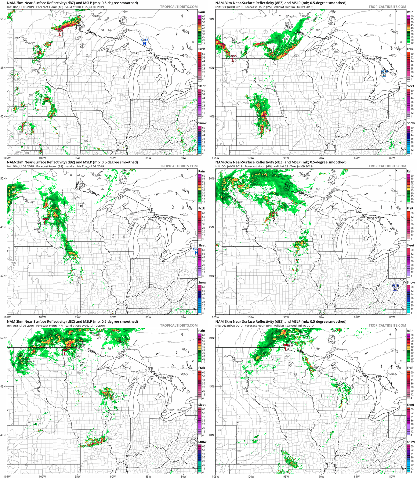
Strong storms are likely to develop in northwest Minnesota Monday evening. The line likely fades before it reaches the Twin Cities as it runs southward overnight.
Most models favor northern Minnesota for storms through Tuesday. Chances for rain and storms are more sketchy for the Twin Cities and southern Minnesota Tuesday afternoon and evening.
Here's the National Oceanic and Atmospheric Administration's NAM 3 km model:
Low severe risk Tuesday
NOAA's Storm Prediction Center paints a marginal risk for any severe storms Tuesday across Minnesota.
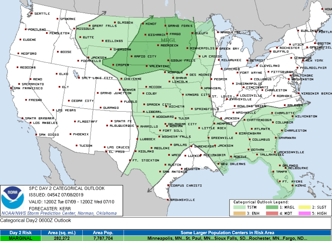
Marginal is the lowest category of risk in NOAA's convective outlooks.
Smoky up north
Dozens of wildfires continue to burn in Canada's Manitoba and Ontario just north of Minnesota.

Moderate smoke lingers across northern Minnesota Monday. Southerly winds will help blow some of that back toward Canada. You can see the thickest part of the smoke plume over Lake Superior and Ontario.
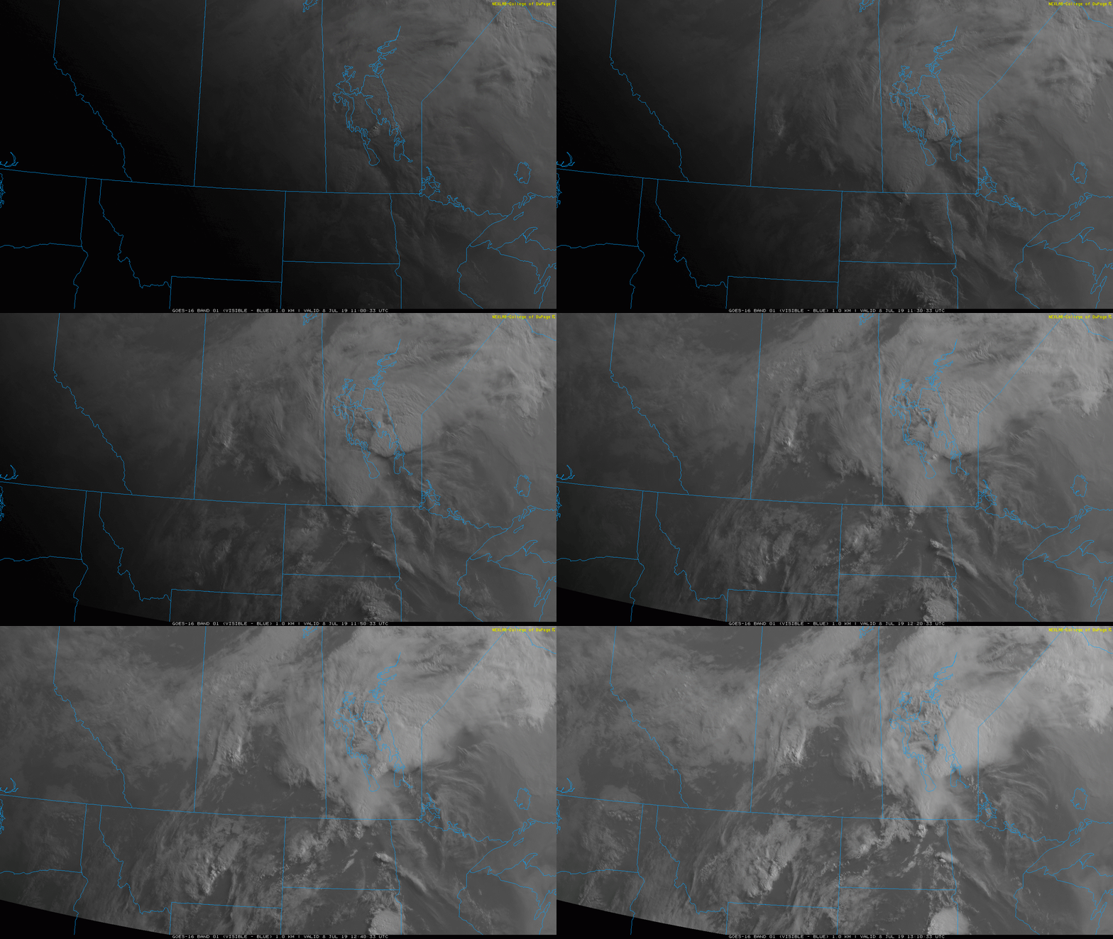
Thunderstorms are forecast to bring some significant rainfall to the fire zone in the next few days.


