
Sunday tornadoes; blissful forecast ahead
Multiple tornadoes sighted Sunday afternoon in southern Minnesota, western Wisconsin.

Go Deeper.
Create an account or log in to save stories.
Like this?
Thanks for liking this story! We have added it to a list of your favorite stories.


It was a crazy couple of hours Sunday afternoon. Multiple tornado sightings and damage reports streamed in from across southern Minnesota and Wisconsin. The first tornado reports came in around 3:16 p.m. from near Biscay to Silver Lake in McLeod County west of the Twin Cities.
By 4:30 p.m. rotating supercells were putting down tornadoes near Forest Lake and Scandia.
Multiple reports
NOAA’s Storm Prediction Center logs credible local storm reports as they come in. Often there may be multiple reports of the same tornado. Four of the seven preliminary tornado reports from Sunday came from Minnesota. Another occurred near Barron, Wis.
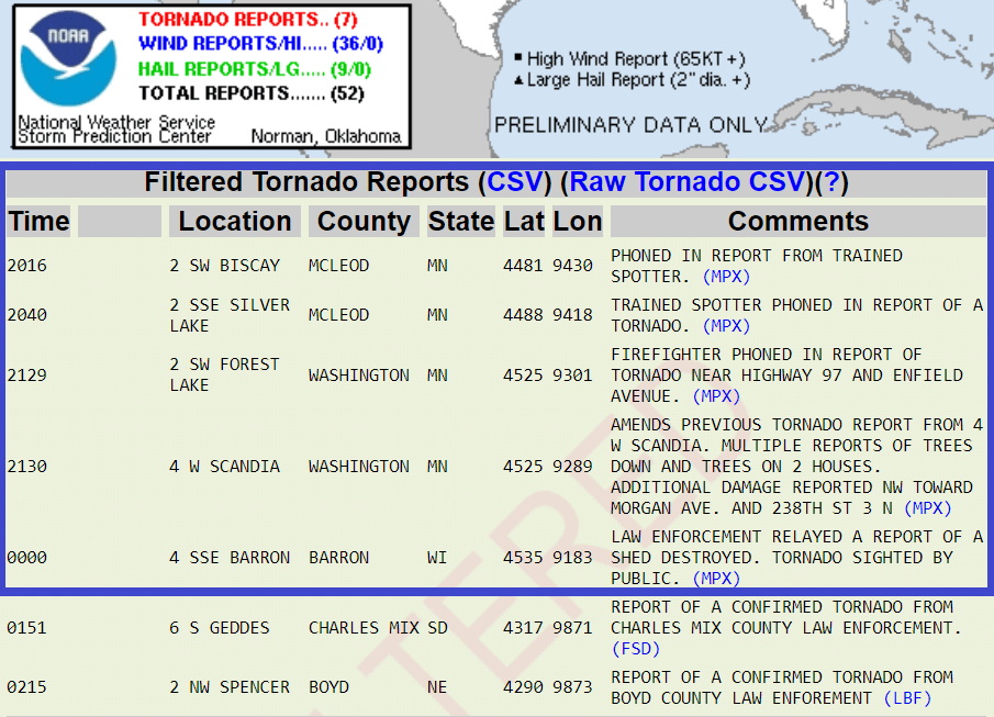
We’ll see what survey teams find in the field. My impression of Sunday’s events in real time combined with reports is that there were probably at least two separate tornadoes in Minnesota. The tornado from Biscay to Silver Lake may have been on the ground for at least 24 minutes and several miles.
Damage reports came in after the twisters passed. Fortunately there appear to be no injuries. The tornadoes hit relatively sparsely populated areas.
Tornado-free forecast
How do you know it’s Monday in Minnesota? Beautiful weather has returned. A cooler and drier air mass blows south from Canada the next few days. Dew points fall into the comfy 50s by late Monday. Highs return to the 80s later this week.
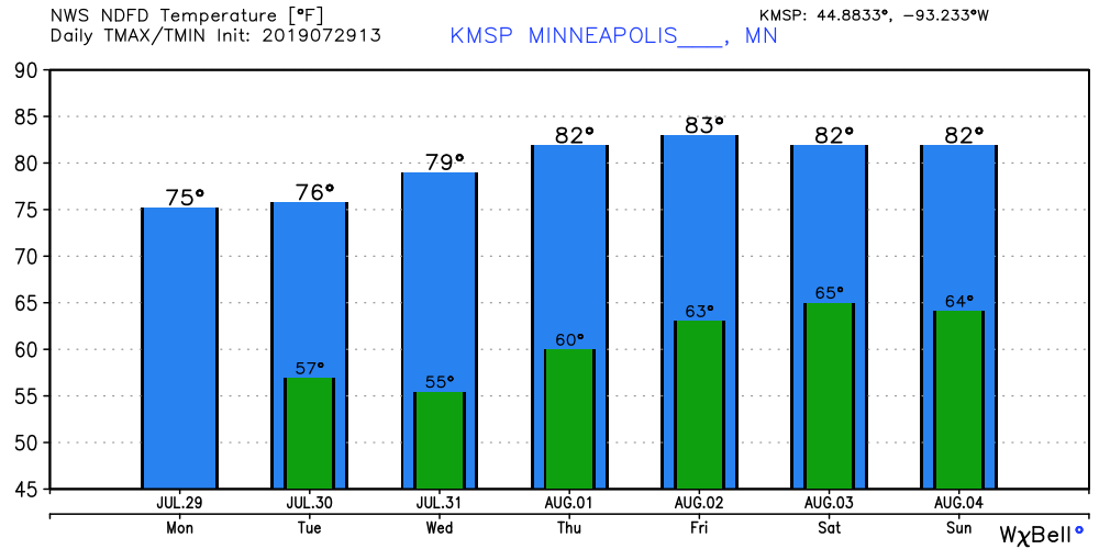
Enjoy our fresh Canadian air mass this week.
Turn Up Your Support
MPR News helps you turn down the noise and build shared understanding. Turn up your support for this public resource and keep trusted journalism accessible to all.

