
September breeze: Gusty passing thunderstorms Tuesday afternoon
Small severe risk; September-like temperatures early this week
Go Deeper.
Create an account or log in to save stories.
Like this?
Thanks for liking this story! We have added it to a list of your favorite stories.


Hello, September?
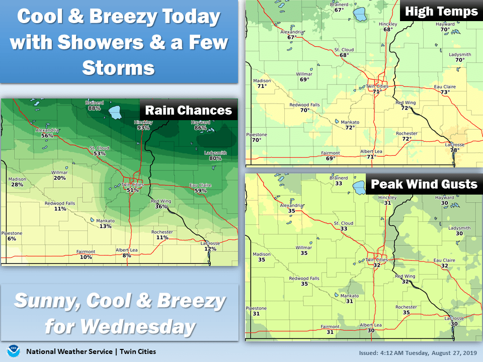
The calendar says Aug. 27, but Tuesday’s weather maps scream September. The high temperature of around 70 degrees in the Twin Cities is average for about Sept. 22.
Temperatures Tuesday and Wednesday feel more like late September. Throw in wind gusts to 30 mph and a few passing showers and the word blustery is back in the forecast.
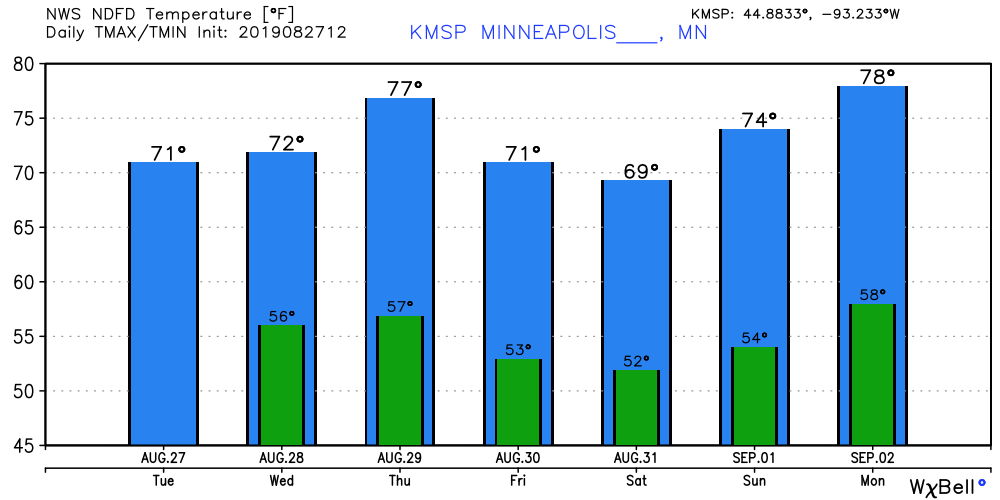
Our temperatures this week mimic a roller coaster ride at the State Fair. We peak Thursday in the upper 70s. Another cool front sends us crashing again by Saturday. Then warmer air glides back into Minnesota later this week with highs near 80 by Labor Day. Ups and downs. Strikes and gutters.
Turn Up Your Support
MPR News helps you turn down the noise and build shared understanding. Turn up your support for this public resource and keep trusted journalism accessible to all.
A few feisty thunderstorms
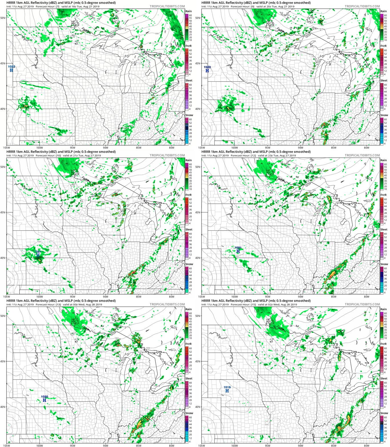
A pool of cold air aloft makes the atmosphere over Minnesota quite irritable Tuesday afternoon. Gusty winds over 30 mph at times will have fairgoers searching for cover. The unstable nature of the atmosphere means scattered showers and thunderstorm swill pop up and march quickly east.
The National Oceanic and Atmospheric Administration’s High-Resolution Rapid Refresh model paints spotty cells racing southeast Tuesday. Any downpours should last about 10 to 20 minutes then move quickly on.
There is a small risk a few storms could reach severe limits with wind gusts in excess of 50 mph.
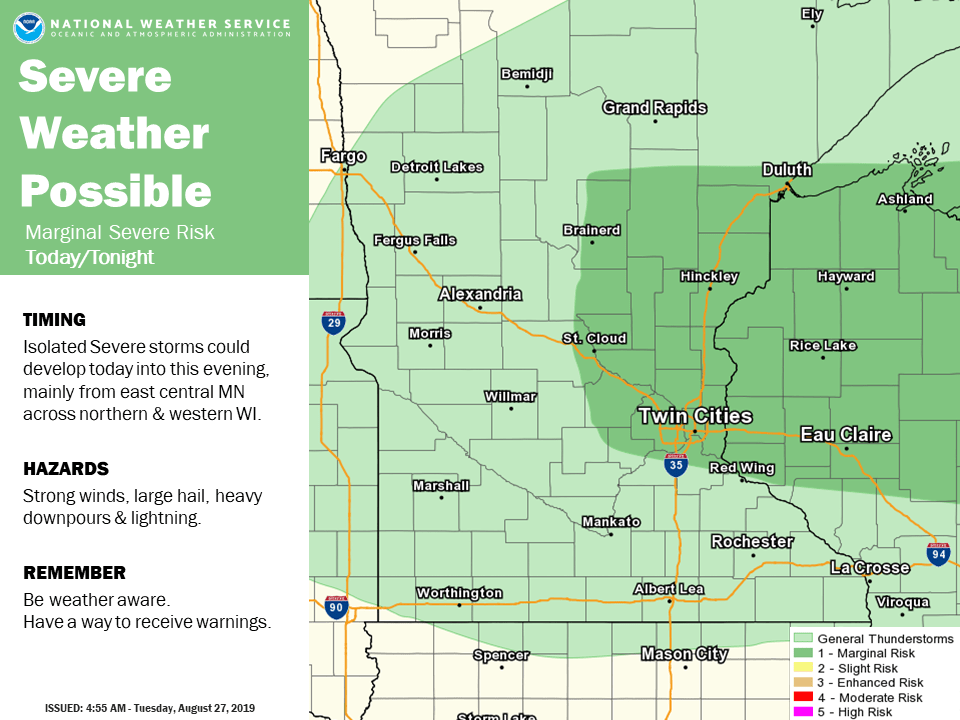
Keep an eye out for possible warnings later Tuesday afternoon.

