Dorian rakes Carolina coast; Spectacular Minnesota Friday ahead
Outer Banks are Dorian's next target
Go Deeper.
Create an account or log in to save stories.
Like this?
Thanks for liking this story! We have added it to a list of your favorite stories.


The big national weather story continues to be Hurricane Dorian.
Dorian rakes the Carolina coast today as expected. Up to 10 inches of rain and wind-driven storm surge is flooding parts of Charleston, S.C.
Trees and power lines also litter the many flooded streets. It could have been much worse, but impacts are significant.
Dorian’s eyewall structure is still clearly visible late Thursday. Dorian is forecast to gradually weaken as it tracks northeast. But it’s still strong enough to bring hurricane conditions to North Carolina’s Outer Banks overnight.
Turn Up Your Support
MPR News helps you turn down the noise and build shared understanding. Turn up your support for this public resource and keep trusted journalism accessible to all.

The storm picks up speed tonight, and Dorian’s track likely brings a direct hit onto North Carolina’s Outer Banks.

Tornado threat continues
The spiral bands swirling around hurricanes have plenty of vorticity. That translates into twisters that can strike quickly and do damage beyond the traditional environmental hurricane winds.
Here’s the resulting tornado damage in Emerald Isle, North Carolina.
Dorian-induced tremors
Did you know hurricanes can cause seismic tremors. Seismic monitors at the University of Tennessee-Chattanooga are picking up Dorian’s ground vibrations.
Spectacular Friday; October preview weekend
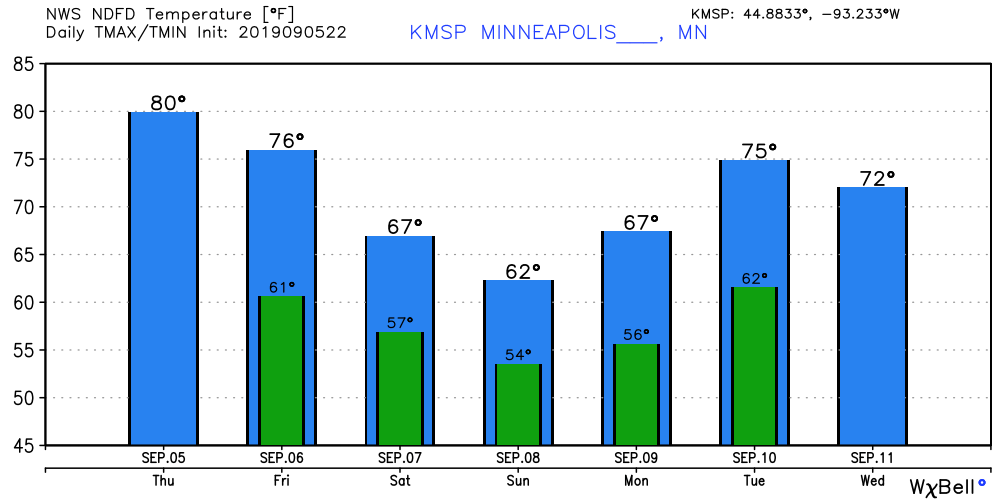
Friday’s weather looks phenomenal across Minnesota. We enjoy plenty of sun and highs in the 70s south, with 60s north. The weekend looks cooler with highs in the 60s, and party wet. The best chance for showers arrives late Saturday through Sunday.
Highs in the 70s return next week, but the overall pattern looks wet.
Again.