
Summery today; severe storm and tornado risk Tuesday evening
Storms developing during evening rush hour
Go Deeper.
Create an account or log in to save stories.
Like this?
Thanks for liking this story! We have added it to a list of your favorite stories.


Get ready for another June-like day.
A warm and incresingly humid air mass boosts high temperatures to near 80 degrees again Tuesday afternoon in the Twin Cities and southern Minnesota. Dew points soar through the sticky 60s to near 70 degrees. It feels like July again this afternoon in southern Minnesota.

A cool front slices into the steamy late-afternoon air mass. Violent updrafts will cause thunderstorms to blow up rapidly between about 5-7 p.m.
The National Oceanic and Atmospheric Administration’s Storm Prediction Center has upgraded the severe weather risk to “enhanced” from the southeast Twin Cities south and east across southern Minnesota and Wisconsin.
Turn Up Your Support
MPR News helps you turn down the noise and build shared understanding. Turn up your support for this public resource and keep trusted journalism accessible to all.
The big forecast question this afternoon is precisely where will storms develop as the frontal zone moves through the Twin Cities?
NOAA’s High-Resolution Rapid Refresh model develops a few storms in the Twin Cities between about 5-6 p.m., then more widespread activity toward 7-8 p.m. across southeast Minnesota and western Wisconsin.
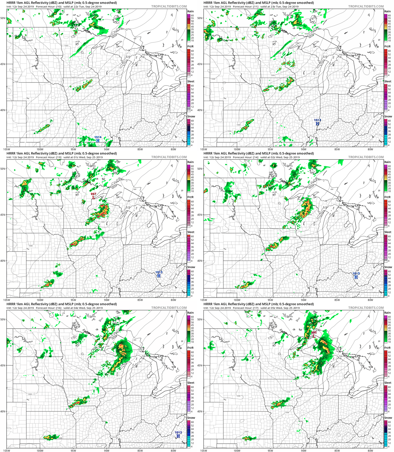
Bottom line: Severe weather is likely from the Twin Cities south and east Tuesday evening. Be prepared for severe weather watches and warnings between about 5-9 p.m. All modes of severe weather are possible including large hail, damaging winds, and tornadoes.
Stay tuned to MPR News for updates.

