
July flashback: Steamy summer air mass brings 80s, heavy rainfall
A few evening storms possible in the Twin Cities
Go Deeper.
Create an account or log in to save stories.
Like this?
Thanks for liking this story! We have added it to a list of your favorite stories.


Hello July. At least for a day. Our one hit wonder summer day feels more July 4 than Sept. 30.
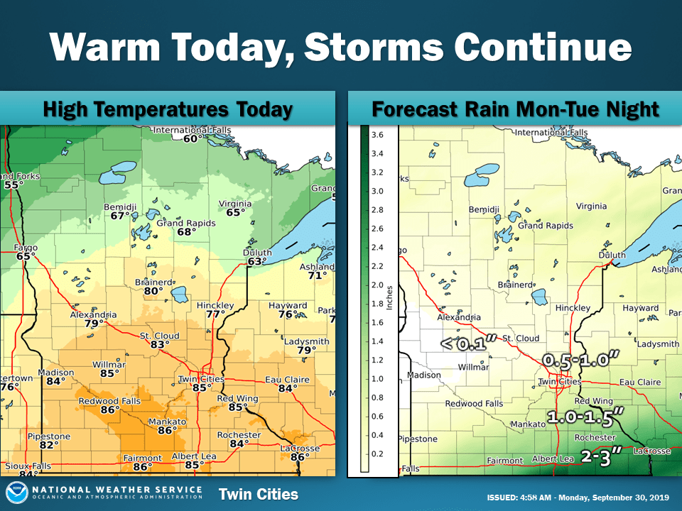
A powerful warm front is dumping heavy rain along the Interstate 35 corridor south of Duluth. Between 2 and 5 inches of rain has fallen in Brainerd, Holyoke (Carlton County, to near Duluth.)
Flash flood warnings blanket the region through midday Monday.
Summery air mass
The warm front is draped across Minnesota north of the Twin Cities Monday. The maritime tropical air mass south of the front was sitting over the Gulf of Mexico for the past several days.
Highs in the 80s and steamy dew points in the 70s across southern Minnesota feel more like July. The front stalls along the Interstate 90 corridor Tuesday. Another wave of heavy, multi-inch rainfall arrives Tuesday across southern Minnesota.
‘October-front’ Tuesday
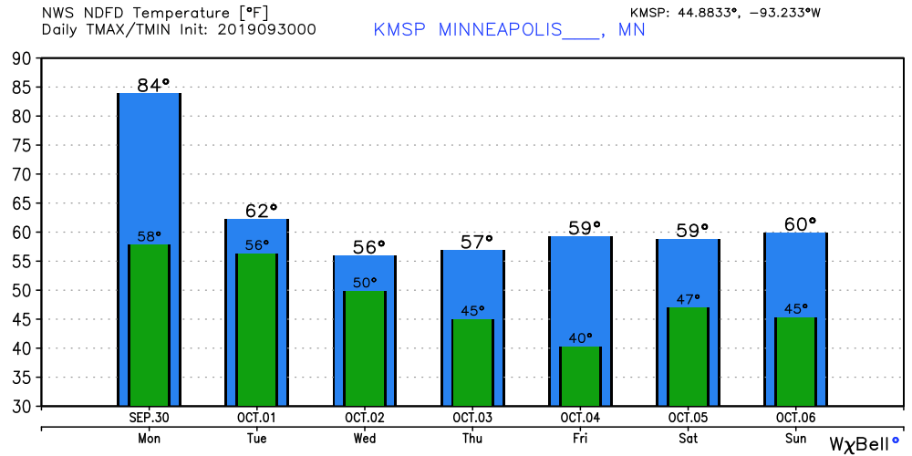
Temperatures crash behind the cold front the rest of the week. This week’s temperature graphic looks more like the stock market crash of 1929. Scattered frost could get close to the Twin Cities by Friday morning.
Turn Up Your Support
MPR News helps you turn down the noise and build shared understanding. Turn up your support for this public resource and keep trusted journalism accessible to all.

