
Beware of black ice and wheel track glazing
Minor snowfall may impact Thursday morning rush hour
Go Deeper.
Create an account or log in to save stories.
Like this?
Thanks for liking this story! We have added it to a list of your favorite stories.


The first widespread shot of subzero cold has arrived in Minnesota. Now we watch as two more minor clipper systems sweep through with light snowy dustings this week.
And with temperatures in the single digits and teens, it only takes a little snow to make roads dangerous with colder temperatures. Thursday morning could be “one of those mornings.”
Cold in place
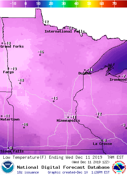
Tuesday was the coldest morning of the season so far at many Minnesota locations. The Twin Cities bottomed out at minus 4 Tuesday morning. That’s the first subzero day of the winter season. I saw temperatures as cold as 19 below zero Tuesday morning in Ely and Babbitt in northeastern Minnesota.
This cold snap peaks early Wednesday morning for many spots. The Twin Cities should bottom out somewhere between minus 10 and minus 12 early Wednesday morning. We’ll see more teens below across Minnesota overnight.
Turn Up Your Support
MPR News helps you turn down the noise and build shared understanding. Turn up your support for this public resource and keep trusted journalism accessible to all.
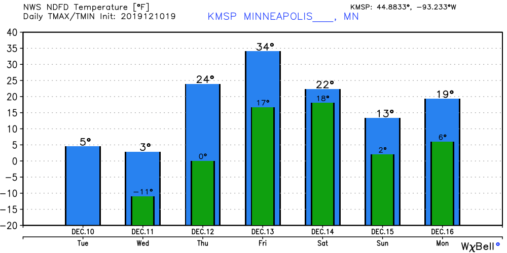
Temps moderate Thursday
Temperatures moderate quickly Thursday and Friday. Highs in the 20s — above zero — return. The temperature guidance below may be a few degrees optimistic for Friday.
Snowy dusting Thursday morning?
Snowfall impacts have as much to do with temperature and timing as total accumulation. An inch of snow at 5 degrees can be far more dangerous to drivers than 6 inches at 30 degrees. That’s because road chemicals don’t work as well when temperatures fall below 10 degrees.
Black ice and wheel track glazing are dangerous issues at cold temperatures.

Here’s an example of wheel track glazing on Interstate 35 in Iowa.

A minor inbound clipper Thursday morning may lay down just enough snow to create a dicey rush hour. NOAA’s Global Forecast System is typical of models that bring light snow to Minnesota Thursday morning.
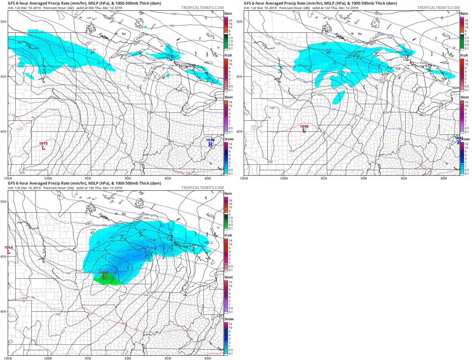
A second wave may bring another snowy dusting late Friday night.
Stay tuned.

