
December thaw ahead: A shot at 40 degrees this weekend
A beige Christmas with lawns reemerging next week?

Go Deeper.
Create an account or log in to save stories.
Like this?
Thanks for liking this story! We have added it to a list of your favorite stories.


One more cold front blows across Minnesota overnight.
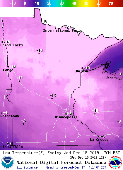
We feel the chill of subzero air once again through Wednesday. But this one is a glancing, brief cold puff. Temperatures dip below zero across most of Minnesota again Wednesday morning.
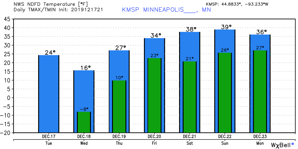
I think the forecast of minus 8 on the maps below is a little too cold for the Twin Cities. My calculations show we’re more likely to bottom out between minus 2 to minus 4 Wednesday morning in the inner (Interstate 494-694 loop) urban metro core. Plenty cold enough.
December thaw
The wind flow over Minnesota turns southerly Thursday. That blows milder air northward into Minnesota. The Twin Cities and southern Minnesota are likely to see four to five days at or (well) above freezing from Thursday through Monday.
Turn Up Your Support
MPR News helps you turn down the noise and build shared understanding. Turn up your support for this public resource and keep trusted journalism accessible to all.
Melting snow
We’re going to melt some snow across Minnesota in the next week. Right now snow depths range from a few inches in southern Minnesota to 2 feet along the North Shore ridges.

The extra moisture from snowmelt over the weekend could generate some ground fog at night and in the morning. But winds look strong enough to mix the lower atmosphere enough to dissipate fog in many areas. That means we should see enough sun most days to reach full warming potential in many areas.
I think we’ll see temperatures crack the 40-degree mark from the Twin Cities south and west this weekend. I wouldn’t be shocked to see 45 degrees in southwest Minnesota this weekend.
Beige Christmas?
The longer-range maps suggest mostly dry and good travel weather through Christmas Eve. Some models suggest a chance of rain on Christmas Day. That would eat away at snow cover even more.
I think we’re going to be seeing part of our lawns again in southern Minnesota Christmas week.
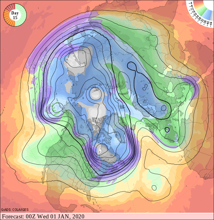
Current upper air projections favor remain well above average temperatures overall into New Year’s Day and early 2020.
Stay tuned.

