
Warm front: Temperatures rising overnight
Milder air blows into Minnesota Thursday
Go Deeper.
Create an account or log in to save stories.
Like this?
Thanks for liking this story! We have added it to a list of your favorite stories.


Here comes the thaw.
Milder breezes begin blowing into Minnesota Thursday. Southerly winds dominate the forecast pattern through the weekend. That means a string of days with high temperatures in the 30s across a good chunk of Minnesota.
I still think the numbers below are a few degrees too conservative for this upcoming weekend.
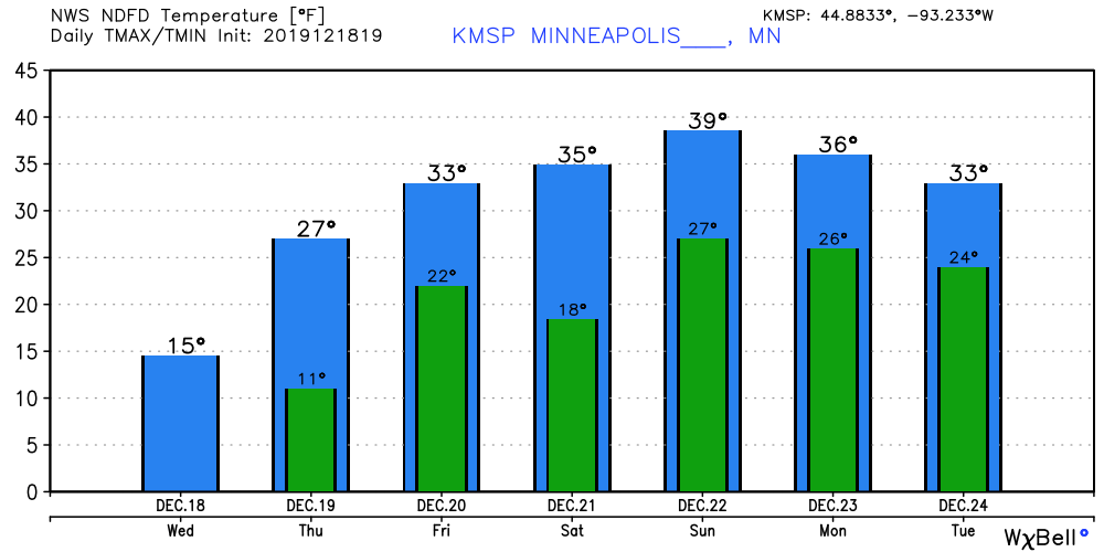
Warming trend peaks Sunday
It appears our extended thaw will peak Sunday across the Upper Midwest. I still think we’ll see highs in the 40s in Minnesota from the Twin Cities south and west. The air mass is warm enough that temperatures in the 50s will push as far north as Des Moines, Iowa.
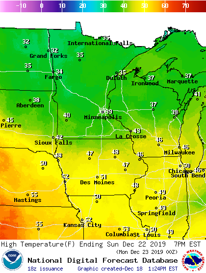
Little snow cover south and east
Our inbound air mass blows over snow-free areas in Iowa and Wisconsin. Wednesday’s GOES-16 visible satellite image shows mostly bare ground south of Minnesota.
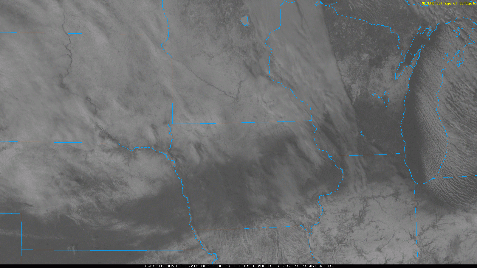
That’s going to help boost the warmup over still snow-covered Minnesota. We’re going to melt some snow in the next week across southern Minnesota.
Stay tuned.
Turn Up Your Support
MPR News helps you turn down the noise and build shared understanding. Turn up your support for this public resource and keep trusted journalism accessible to all.

