
Springlike air mass in Upper Midwest; subzero signs ahead?
50 degrees in Iowa on New Year's Day
Go Deeper.
Create an account or log in to save stories.
Like this?
Thanks for liking this story! We have added it to a list of your favorite stories.


January 2020 opens with an early thaw across southern Minnesota. In fact, the air mass across the Upper Midwest is more typical for early March than January 1.
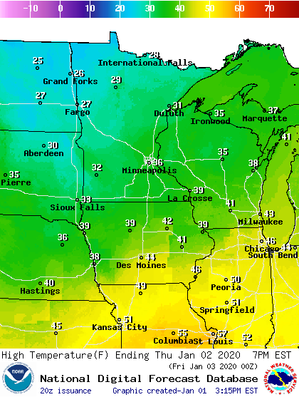
Temperatures soared into the 40s to near 50 degrees across Iowa Wednesday afternoon. Minnesota is at the top of a springlike air mass across the central U.S.

The mild air lingers one more day. Highs will hit the 30s once again across much of Minnesota Thursday. Highs reach the 40s and 50s once again south of Minnesota Thursday.
Colder next week
Temperatures run much closer to the average for early January Friday and Saturday. Sunday looks briefly milder again, before temperatures crash to more typical January levels next week.
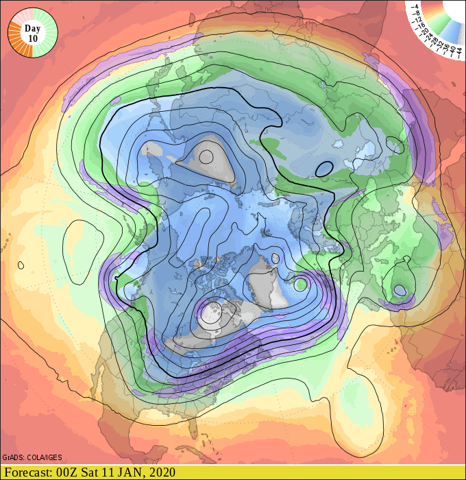
There are signs that the upper air pattern may buckle and send subzero toward Minnesota again after about January 10.
Stay tuned.
Turn Up Your Support
MPR News helps you turn down the noise and build shared understanding. Turn up your support for this public resource and keep trusted journalism accessible to all.

