
Southwest Minnesota snow grazes the Twin Cities Friday
Heaviest snowfall brackets the Minnesota River
Go Deeper.
Create an account or log in to save stories.
Like this?
Thanks for liking this story! We have added it to a list of your favorite stories.


A Friday Clipper system favors southwest Minnesota.
It may not be a major storm, but light snow Friday will create some slick roads across parts of Minnesota. Here’s the breakdown for our Friday snow system.
The system
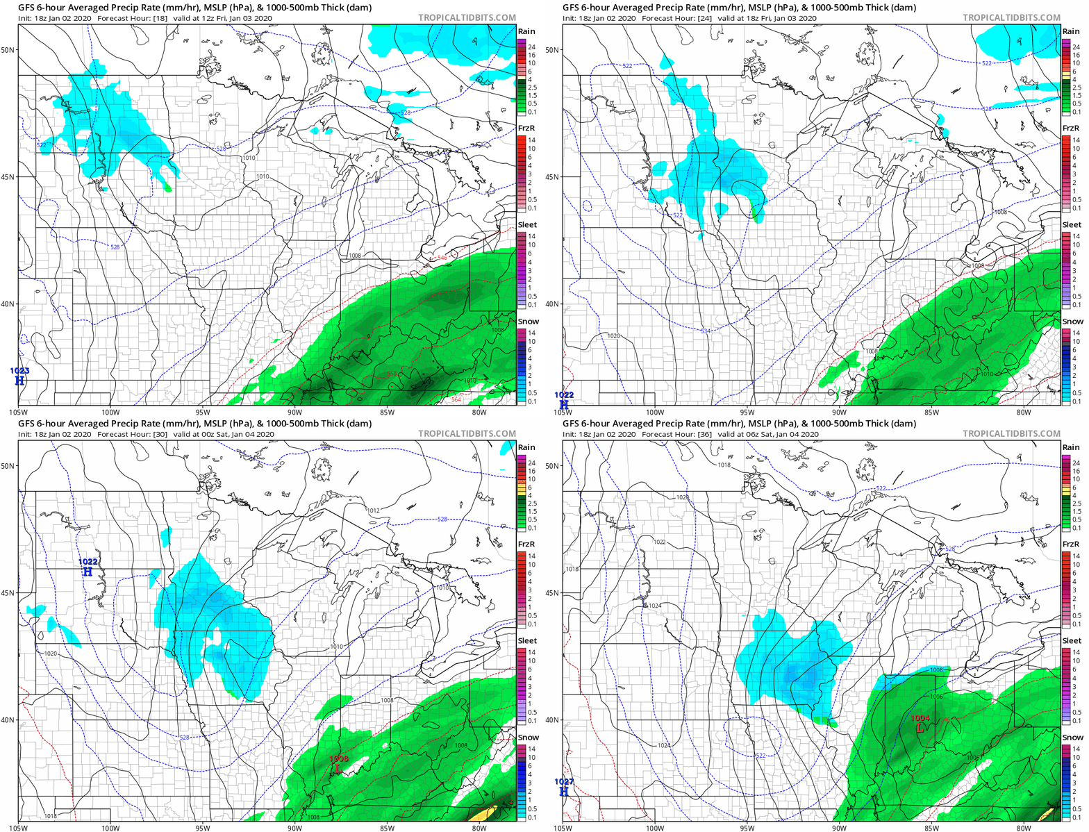
A weak Clipper sails through southwest Minnesota Friday. Snow begins in western Minnesota Friday morning and spreads east. Some models have the snow zone missing the Twin Cities entirely. Some have us getting an inch or less. NOAA’s GFS model seems to have a good handle by putting the Twin Cities on the northern edge of the snow zone Friday afternoon.
Snowfall totals
The heaviest snow zone brackets the Minnesota River Valley. That’s where a swath of 1 to 3 inches will fall by Friday evening. The European model is typical of many that keep the Twin Cities in the “dusting” zone at best.

Morning rush hours should be worry-free across most of Minnesota. Things will get slick south and west of MSP Friday afternoon and evening.
Turn Up Your Support
MPR News helps you turn down the noise and build shared understanding. Turn up your support for this public resource and keep trusted journalism accessible to all.

