
Friday snow fades; subzero cold still lurking?
Light snow accumulations southwest of Twin Cities
Go Deeper.
Create an account or log in to save stories.
Like this?
Thanks for liking this story! We have added it to a list of your favorite stories.


Our Friday clipper system is progressing as expected. Light snow tracks along the Minnesota River Valley. A few light snow showers graze the Twin Cities.
Roads in the Twin Cities are just wet. Snowy accumulations are causing slippery roads southwest of the Twin Cities. Check out this MnDOT plow cam view from Highway 23 southwest of Willmar, Minn.
The predicted snowfall accumulations along the Minnesota River Valley still look to be on track.
Gradually trending colder
We’ll see some unusual temperature patterns this weekend. Saturday morning starts chilly.
Turn Up Your Support
MPR News helps you turn down the noise and build shared understanding. Turn up your support for this public resource and keep trusted journalism accessible to all.
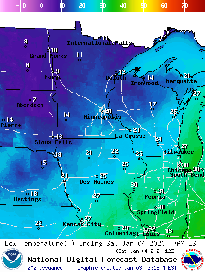
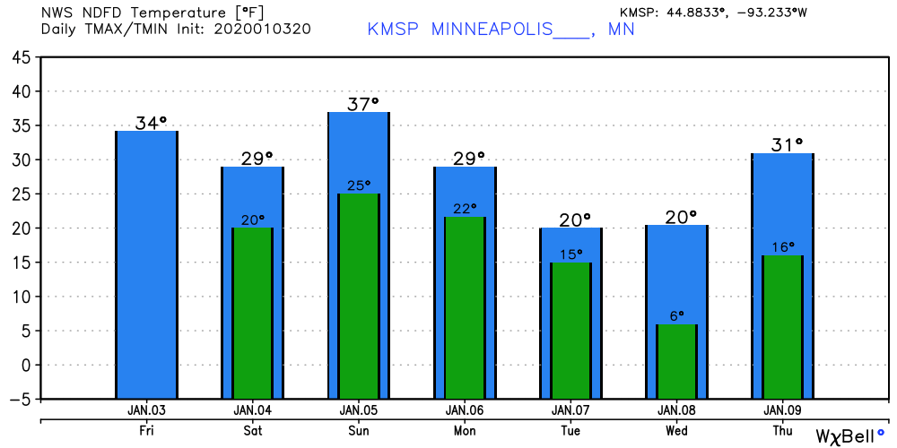
But warm advection kicks in Saturday afternoon, with the thermal ridge reaching Minnesota around midnight Saturday night. Temperatures may rise into the upper 30s to near 40 degrees across southern Minnesota at night, then fall during the day Sunday.
That could mean the daily high temperatures for both Saturday and Sunday could occur in the hours surrounding midnight Sunday.
Temperatures cool next week.
Subzero by mid-January?
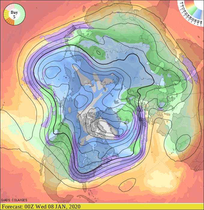
The medium-range forecast models still hint at bouts of colder northwest flow next week and the following week.
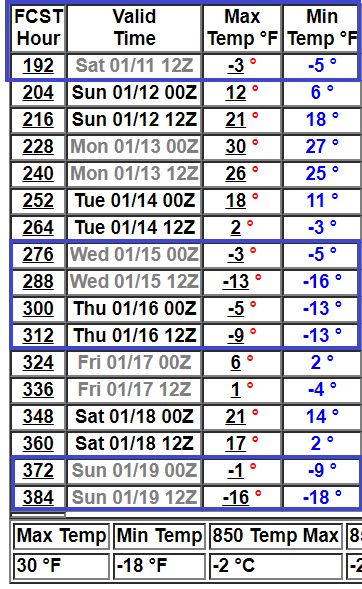
NOAA’s 16-day GFS output is still cranking out subzero temperatures by mid-January.
Stay tuned.

