
Unusual temperature rise ahead Saturday night?
Saturday's high temperature may occur just before midnight
Go Deeper.
Create an account or log in to save stories.
Like this?
Thanks for liking this story! We have added it to a list of your favorite stories.


It looks like we’ll see an unusual temperature trend Saturday night across Minnesota.
A typical day in Minnesota brings the daily high temperature in the afternoon. Then temperatures begin to fall in the evening and through the overnight hours until the lowest temperature is reached around sunrise. we call that difference between the daily high and low temperatures the diurnal variation in meteorology.
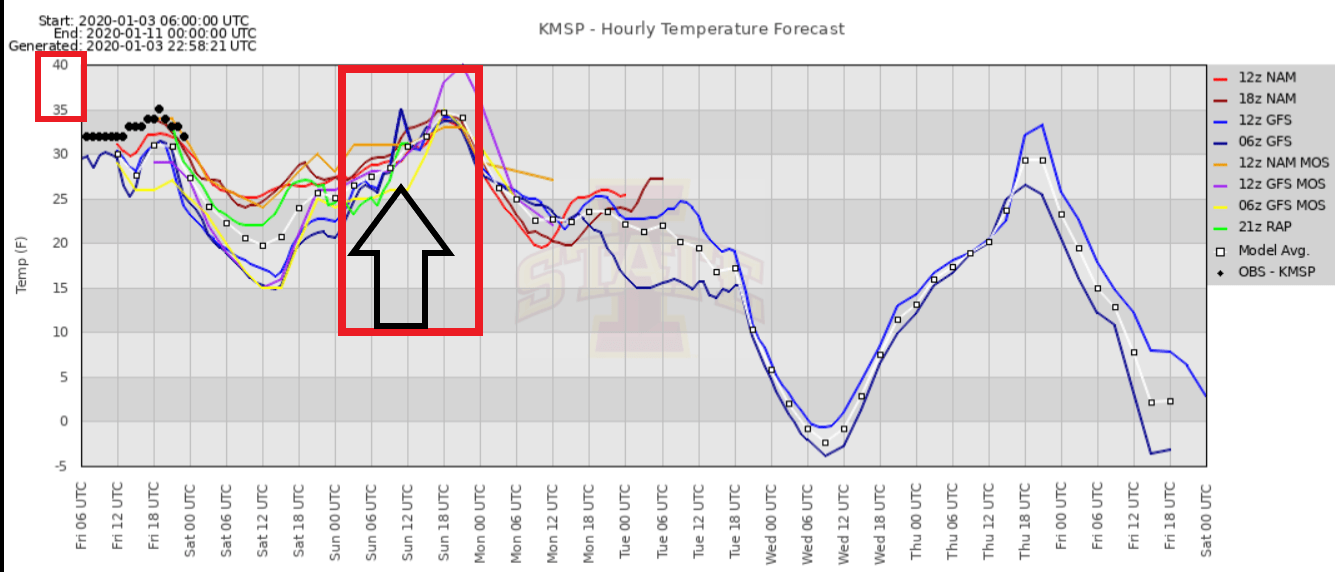
But a combination of clouds and what meteorologists call warm advection may keep temperatures steady, or even rising Saturday night through the 30s. Notice the rising lines Saturday night on this temperature plot of various forecast models?
Warm advection
Warm advection happens when a milder air mass blows north into Minnesota.
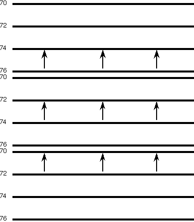
If it happens at night, temperatures can actually rise in the overnight hours. It’s unusual to see this in Minnesota, but it does happen a few times every year. It’s possible we may reach the day’s high temperature late Saturday night!
Turn Up Your Support
MPR News helps you turn down the noise and build shared understanding. Turn up your support for this public resource and keep trusted journalism accessible to all.

