
Ice box: Models suggest a shot at -20 in the Twin Cities next week
Multiple subzero waves heading for Minnesota in the last half of January?

Go Deeper.
Create an account or log in to save stories.
Like this?
Thanks for liking this story! We have added it to a list of your favorite stories.


It’s been a relatively tame winter so far. But the other shoe looks ready to drop on the medium-range forecast maps.
In the short term, temperatures chill this weekend, then recover early next week.
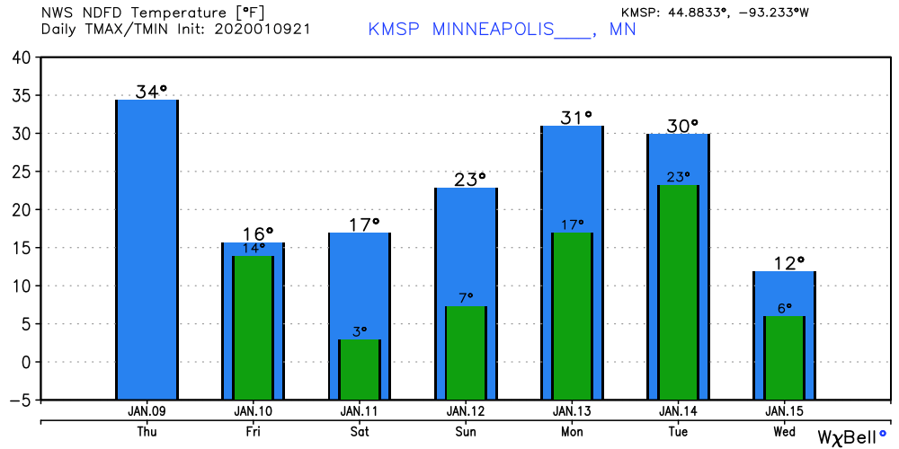
But the season’s coldest arctic outbreak so far is still on track to invade Minnesota by the middle of next week.
Arctic outbreak next week
The upper air forecast maps for next week continue to show a bitterly cold low-pressure trough diving into the northern United States from Canada.
Turn Up Your Support
MPR News helps you turn down the noise and build shared understanding. Turn up your support for this public resource and keep trusted journalism accessible to all.
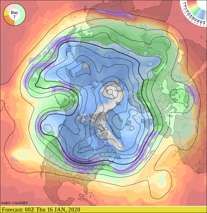
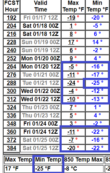
The latest forecast model runs suggest temperatures may make a valiant run at minus 20 across much of Minnesota including the Twin Cities by Thursday morning.
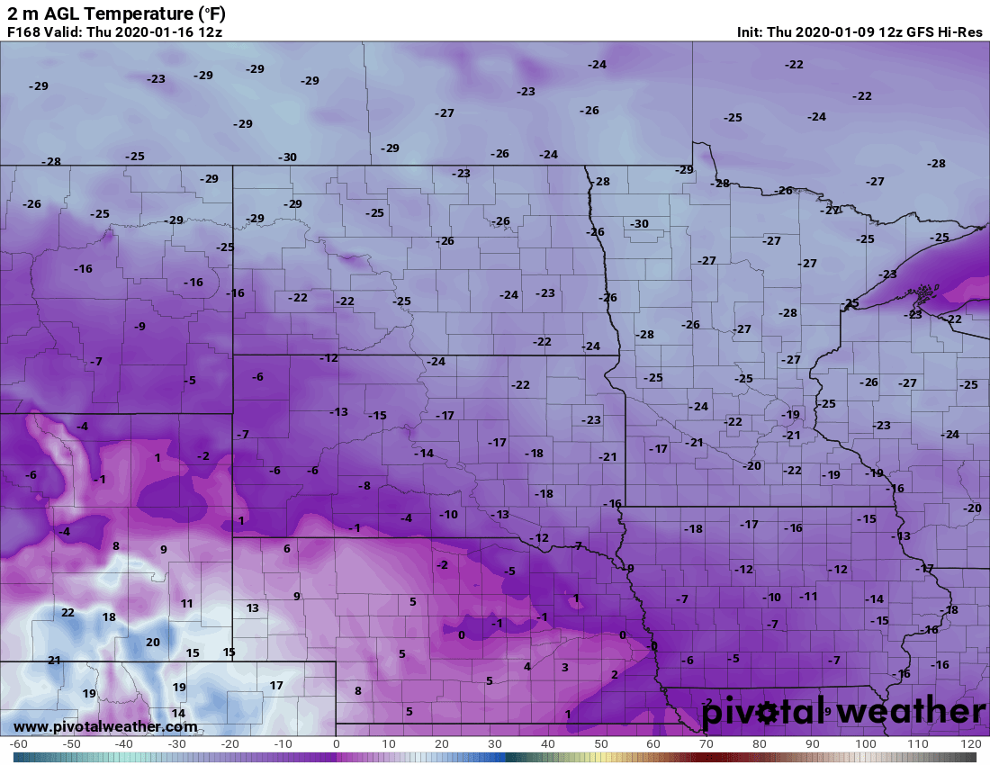
It should be noted that the GFS model is among the coldest solutions. Various GFS products crank out lows between minus 19 and minus 23 for the Twin Cities Thursday morning.
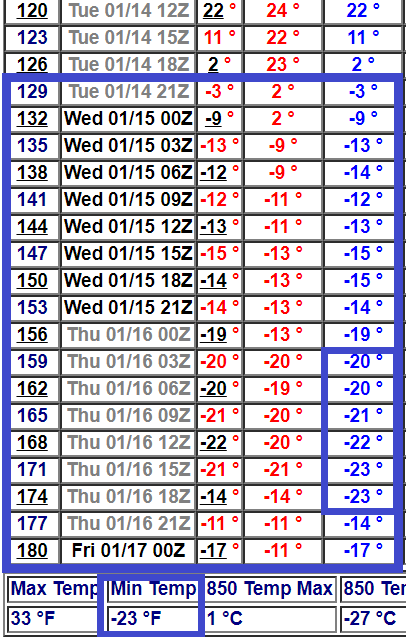
This could be a prolonged subzero outbreak next week. Some model solutions keep much of Minnesota below zero from Tuesday evening through Saturday afternoon.
Multiple cold waves?
The maps suggest there may be more than one subzero push in the next couple of weeks. NOAA’s GFS suggests a shorter, but potentially colder shots of bitterly cold air around Jan. 20, and again around Jan. 25.
Jekyll and Hyde January?
So far, January is running about 9 to 10 degrees warmer than average in much of Minnesota. But NOAA’s week 3 to 4 outlook favors colder than average temperatures for the rest of January.
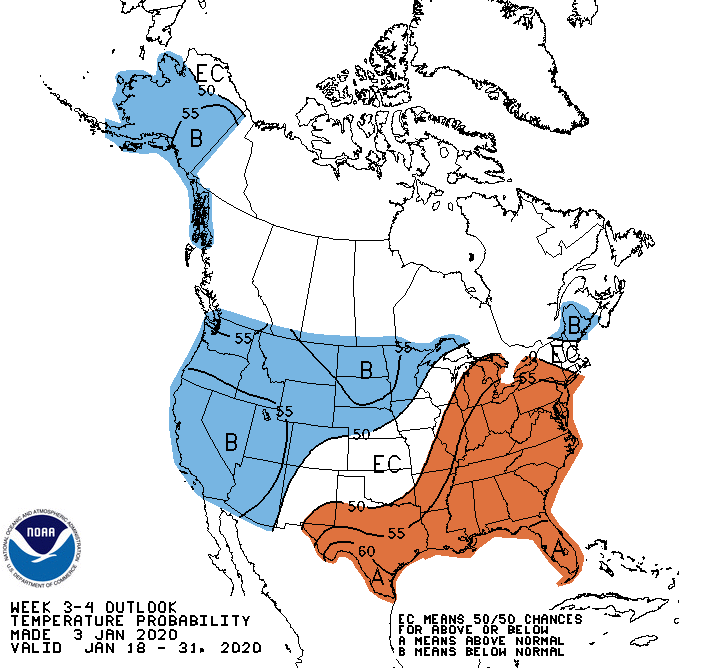
That’s going to even things out in a hurry for January temperatures overall. So, expect a transition to predominantly bitterly cold air for the last two weeks of January.
Stay tuned.

