
Snowy dusting Friday morning; weekend thaw ahead
Friday morning rush hour may feature light snow
Go Deeper.
Create an account or log in to save stories.
Like this?
Thanks for liking this story! We have added it to a list of your favorite stories.


Timing is everything in life and weather.
Friday morning’s rush hour features just a light snowy dusting. But as we know all too well in Minnesota, a little snow at the wrong time can go a long way.
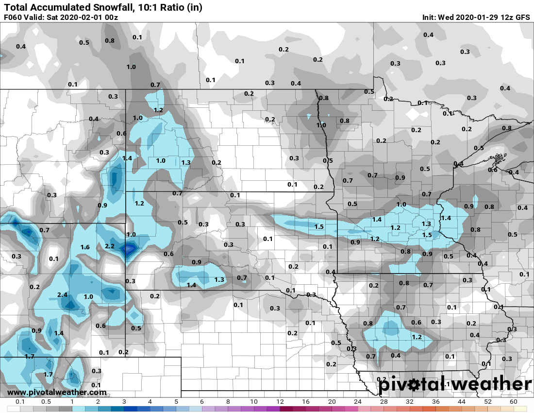
NOAA’s GFS model paints light snow moving across southern Minnesota Thursday night into midday Friday.

Accumulations look light. Around an inch of snow may fall in a band from Granite Falls, Minn., to near the Twin Cities Friday. Less than an inch will fall in most of Minnesota.
Weekend thaw
January goes into the books about 4 degrees warmer than average Friday. Our weekend thaw pushes temperatures into the 40s by Sunday.
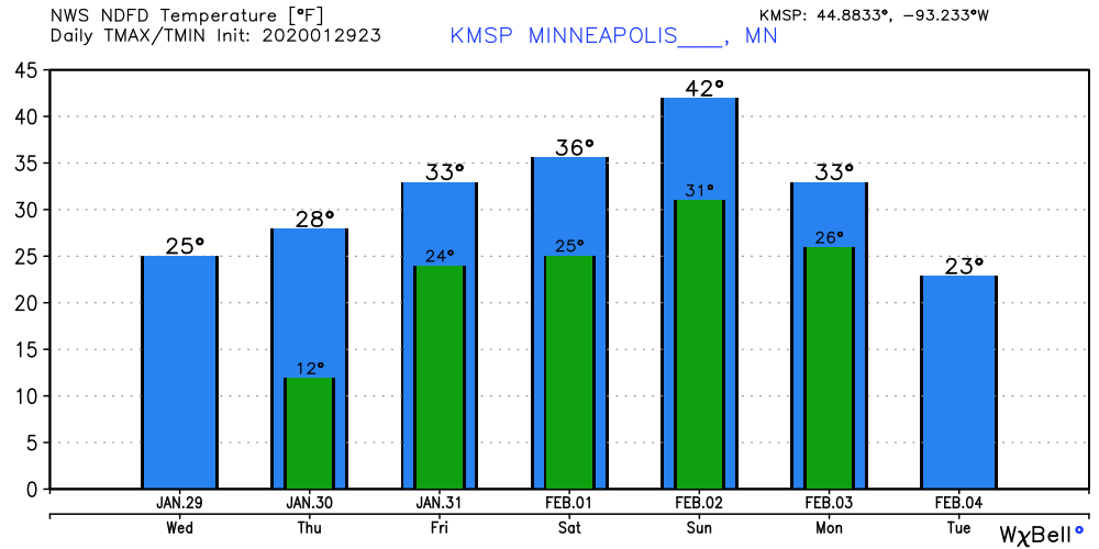
Next week looks colder with lows around zero again. But I don’t see any prolonged subzero streaks ahead. This winter is running out of time to inject a serious polar vortex into the Upper Midwest.
Stay tuned.
Turn Up Your Support
MPR News helps you turn down the noise and build shared understanding. Turn up your support for this public resource and keep trusted journalism accessible to all.

