Light snow into Friday a.m. rush hour; 45 degrees Sunday?
Slick roads may greet us Friday morning

Go Deeper.
Create an account or log in to save stories.
Like this?
Thanks for liking this story! We have added it to a list of your favorite stories.


Our next big winter thaw is on the way. But first, get ready for a little snow and freezing drizzle.
Friday system
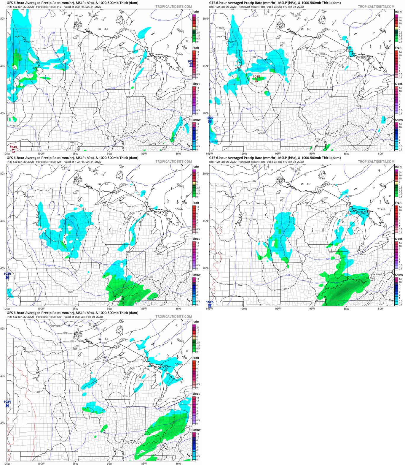
A weak low-pressure center rides across the Upper Midwest Friday. The system has Pacific moisture in tow. This will be enough to squeeze out around an inch of snow for many locations Friday morning.
The National Oceanic and Atmospheric Administration’s Global Forecast System model paints patches of light snow and some freezing drizzle across the region late Thursday night into midday Friday.
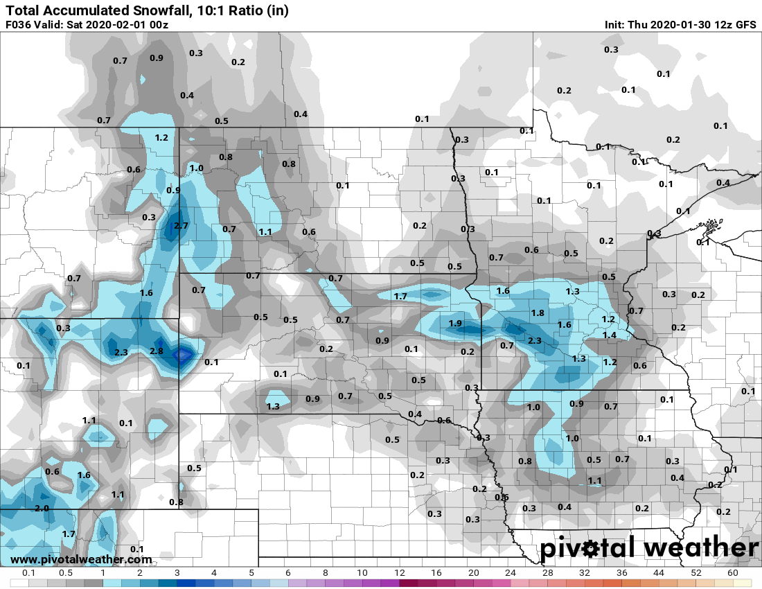
Around an inch
Snowfall will be generally light. But it may be enough to slow down rush hour Friday morning. Most areas will see around an inch. Some spots along the Minnesota River Valley may pick up as much as 2 inches.
Turn Up Your Support
MPR News helps you turn down the noise and build shared understanding. Turn up your support for this public resource and keep trusted journalism accessible to all.
Here’s NOAA’s GFS model solution:
Thaw: 40s this weekend
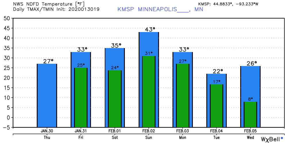
Milder southerly breezes blow in much warmer air this weekend. Temperatures surge Saturday afternoon into the upper 30s to near 40 degrees. Highs push well into the 40s across southern Minnesota Sunday.
Some of the models I rely on suggest we may hit 45 degrees in the Twin Cities early Sunday afternoon.
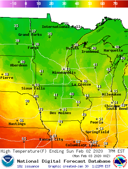
Groundhog Day golf in Kansas City anyone?
Colder next week
The first week of February looks colder, but not extreme. Temperatures will run much closer to the average high and low of 26 and 10 in the Twin Cities by the middle of next week.