
Another arctic adventure: More snow and cold arrive Wednesday
Subzero temps by Thursday morning
Go Deeper.
Create an account or log in to save stories.
Like this?
Thanks for liking this story! We have added it to a list of your favorite stories.


The truth about Minnesota weather? There’s rarely a dull week.
This week opened with significant snowfall Sunday.
Monday morning dawned with spectacular rime ice displays.
And now we watch the next arctic front barrel south Wednesday. It starts with a coating of snow.
Turn Up Your Support
MPR News helps you turn down the noise and build shared understanding. Turn up your support for this public resource and keep trusted journalism accessible to all.
Wednesday snow
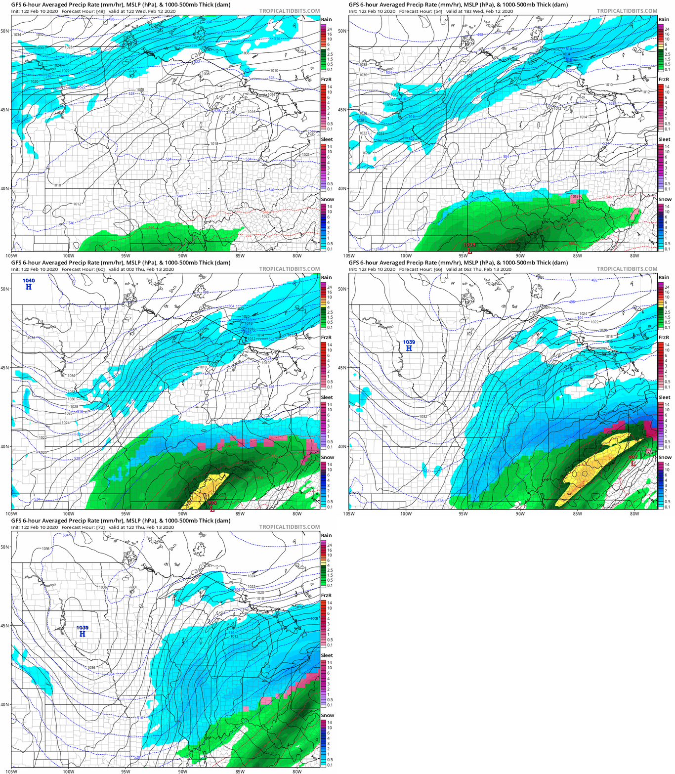
Arctic fronts show mastery at squeezing out limited amounts of moisture into a snowy coating to pave the way for arctic air masses. Wednesday brings a swath of light snow across Minnesota. It may only be an inch in most areas, but it will pack a punch in the Red River Valley as it blows around causing near-blizzard conditions.
NOAA’s GFS model paints the snow band moving across Minnesota Wednesday as arctic high pressure surges south.
The early read suggests many locations will see around an inch of snow Wednesday. Give or take.
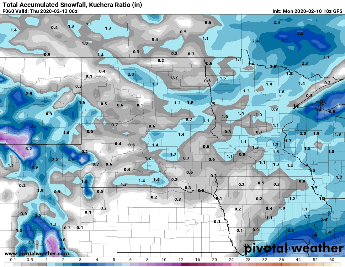
The south shore of Lake Superior in Wisconsin will see higher lake-enhanced snowfall totals.
Subzero surge
Subzero air surges south across Minnesota Wednesday night. The 36-hour period from Thursday morning to noon Friday looks bitter. Wind chills will reach minus 40 or colder up north.
Two-day cold snap
The Twin Cities likely feels two subzero mornings Thursday and Friday. Temperatures bottom out around minus 12 Friday morning. Our arctic affair is a brief one; temperatures warm back into the 30s next weekend.
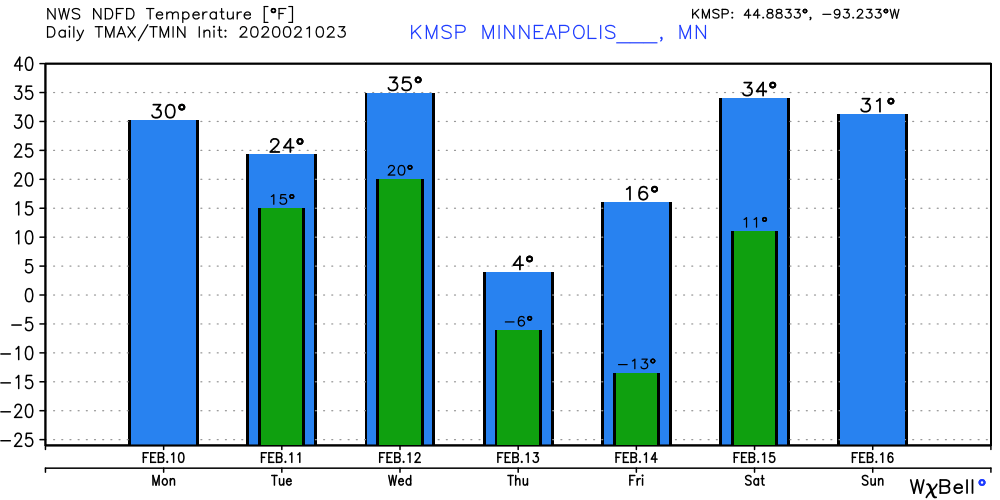
This winter is running about 4 degrees warmer than average so far in the Twin Cities.

