Lake Superior lake-effect snow plumes visible from space

Plumes stretch 450 miles downwind across Lake Michigan

Lake-effect snow over Lake Superior
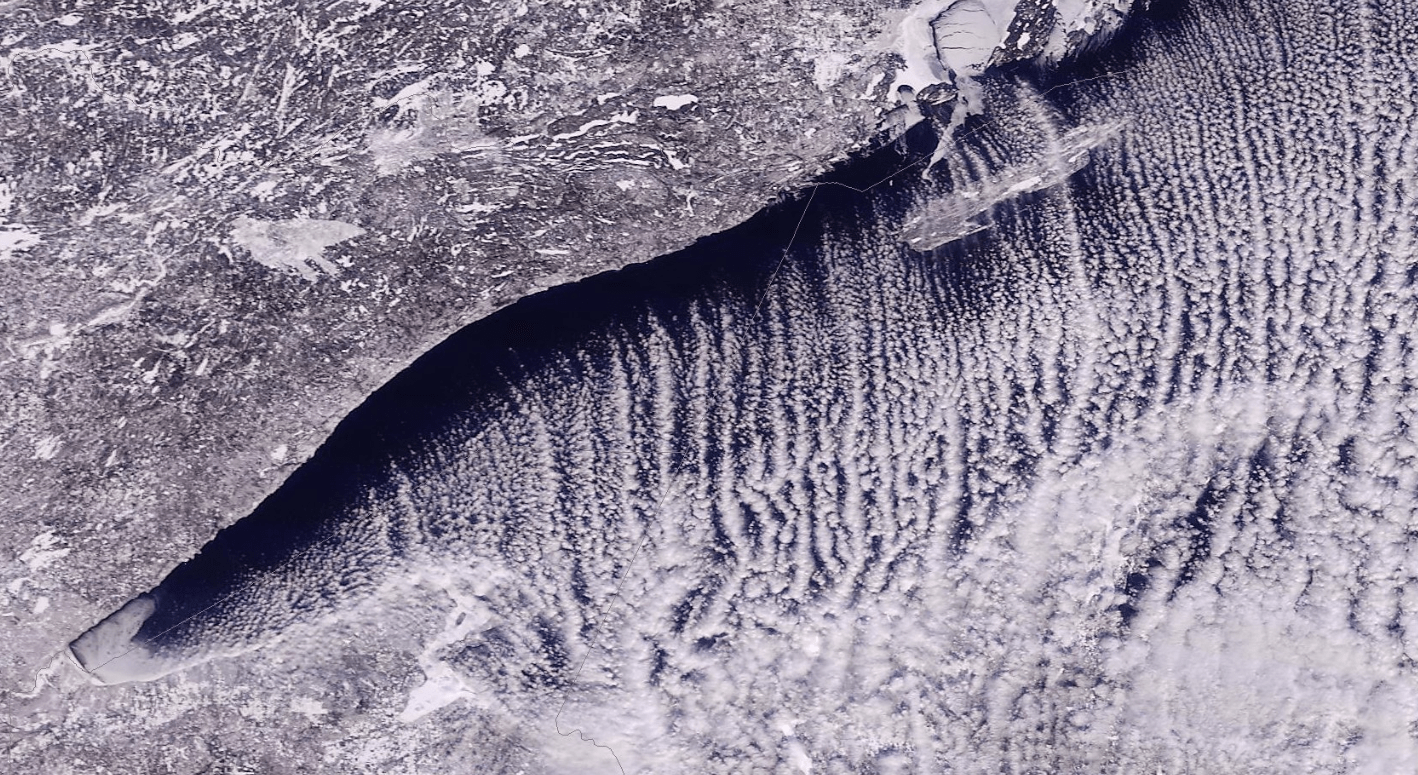
Lake-effect snow over Lake Superior on Thursday, February 13, 2020
NASA via University of Wisconsin-Madison

Weather geeks are geeking out over lake-effect snow plumes crossing Lake Superior and the Great Lakes.

The meteorologically impressive lake-effect snow plumes blowing across Lake Superior were visible Thursday in images from the National Oceanic and Atmospheric Administration’s GOES-16 satellite, 23,000 miles in space.

Lake-effect snow
Lake-effect snow over Lake Superior
NOAA

The plumes run in parallel bands and funnel lake-effect snow squalls downwind onto the south shores of Lake Superior.

Here’s another view from NASA’s MODIS Terra satellite, via the Duluth National Weather Service office.

Create a More Connected Minnesota

MPR News is your trusted resource for the news you need. With your support, MPR News brings accessible, courageous journalism and authentic conversation to everyone - free of paywalls and barriers. Your gift makes a difference.

450 miles long

The low-level air trajectory is pushing the Lake Superior plumes even farther downwind onto Lake Michigan Thursday.

Notice how the “cloud streets” continue and regenerate over the waters of Lake Michigan and push all the way into lower Michigan and Indiana. That’s a distance of 450 miles.

Lake-effect snow plumes over Lake Superior and Michigan
Lake-effect snow plumes blowing across Lake Superior and Michigan
NASA, via University of Wisconsin-Madison

Anatomy of lake-effect snow

Lake-effect snowfall occurs when colder arctic air blows over relatively warmer lake water on the open Great Lakes. Smaller lake-effect events can also occur on some of Minnesota’s bigger lakes, including Red, Leech and Mille Lacs.

As the colder air blows over the relatively milder waters, heat, and moisture are exchanged and lake-effect snow squalls form and dump out on the downwind side of lakes.

Lake-effect snow process
NOAA

Lake Superior on Thursday was just 8.7-percent ice-covered. Lake temperatures are around 34 degrees across the big lake.

Lake Superior water temperature
NOAA/GLERL

Generally, you need a temperature contrast of about 30 degrees between the lake and the overrunning air mass to generate lake-effect snow plumes.