Snowy burst during PM rush hours; 40 degree temps possible by this weekend
Advisory now includes southern Twin Cities. Pockets of heavy snow possible.
Go Deeper.
Create an account or log in to save stories.
Like this?
Thanks for liking this story! We have added it to a list of your favorite stories.


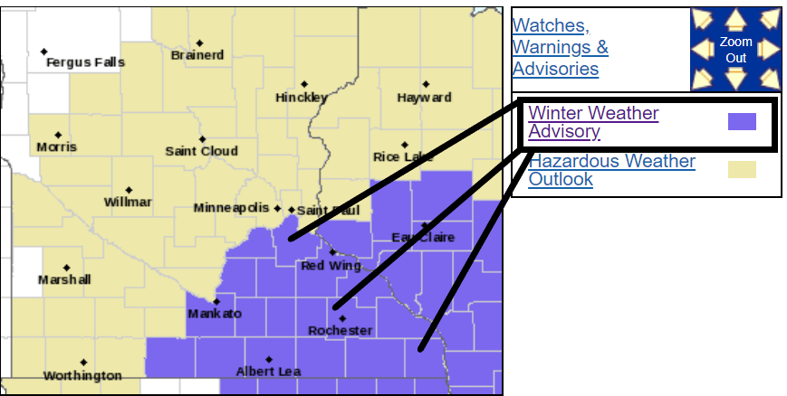
Radar is lighting up with snow across parts of Minnesota. A low-pressure system is generating bands of snow into Monday evening. A winter weather advisory now includes the southern Twin Cities area.
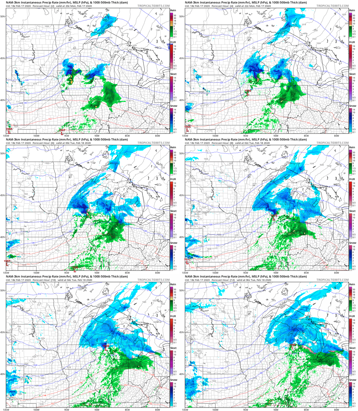
NOAA’s NAM 3-km resolution model paints the snow bands moving east through the evening hours.
Snow during rush hours
Bands of snow push through the Twin Cities during the Monday evening rush hours. Snow intensity is mostly light, but a few more vigorous pockets of moderate to heavy snow are embedded within the snow zone. Heavier snow bursts have been observed in southwest Minnesota. This burst of snow produced a quick decorative 2-inches near New Ulm.
Turn Up Your Support
MPR News helps you turn down the noise and build shared understanding. Turn up your support for this public resource and keep trusted journalism accessible to all.
Expect 2 to 3 hours of snow in some areas as the bands move through into this evening.
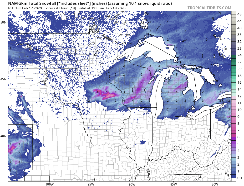
Accumulations for the Twin Cities should be light, generally an inch or less. But a quick burst of 1” to 2” of snow is possible in the southern Twin Cities. And several inches of wet sloppy snow is likely along the I-90 corridor near Albert Lea, Rochester and La Crosse.
40 by Friday?
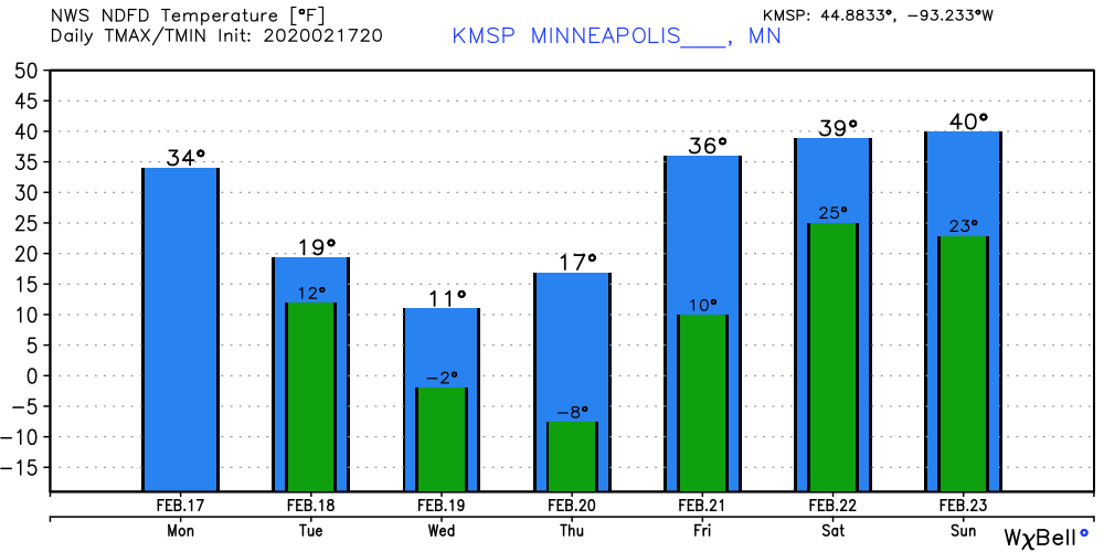
A cold shot of air flows today’s snow system. Lows will hover a few degrees below zero in the Twin Cities this week. But milder pacific air blows in by Friday. Highs will push 40 degrees Friday and into the weekend.