
Arctic now; feeling 40 degrees warmer in 48 hours
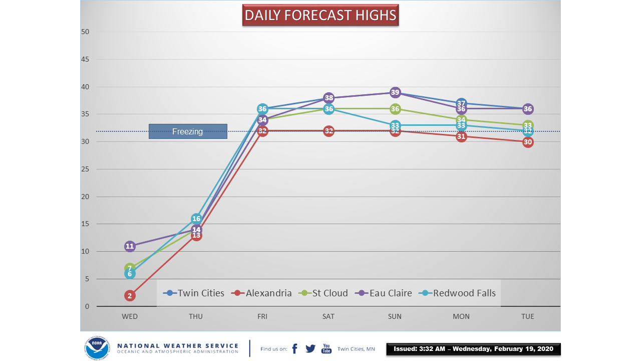
A major thaw begins Friday. Many locations will hit 40 degrees this weekend.
Go Deeper.
Create an account or log in to save stories.
Like this?
Thanks for liking this story! We have added it to a list of your favorite stories.


We’re less than 48 hours away from a major pattern change Minnesota.
Our current arctic chill lingers through Thursday night. But milder Pacific breezes blow in Friday, and temperatures will respond sharply upward by Friday afternoon.
But on Wednesday we are reminded that it’s still February in Minnesota. Wind chills are near or below zero across Minnesota.

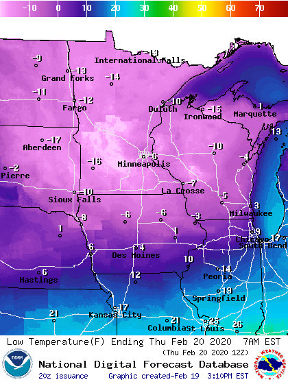
We endure one more very cold night Wednesday across the Upper Midwest. Temperatures likely dip just below zero in the Twin Cities. Teens and 20s below are likely again across northern Minnesota.
Turn Up Your Support
MPR News helps you turn down the noise and build shared understanding. Turn up your support for this public resource and keep trusted journalism accessible to all.
Pacific flow
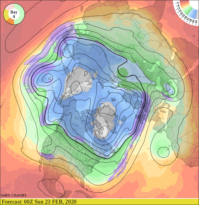
Big weather changes across the Upper Midwest start with changes in the upper winds. Fast-moving rivers of air several miles up in the atmosphere drive weather systems and air masses at ground level where we live.
The upper-air maps this weekend show a flow aloft directly from the North Pacific. That means milder air will spill into the Upper Midwest from Friday right through next Monday.
Highs will reach the 30s across most of Minnesota from Friday through Monday.

Forecast models are often too conservative with extreme temperature situations. My read of the inbound air mass suggests we’re likely to see highs push into the 40s across much of western and southern Minnesota including the Twin Cities between Friday and Monday.


