
Warm start to March; assessing temperature trends and snow chances ahead
Temperatures running 9 degrees warmer than average so far this month
Go Deeper.
Create an account or log in to save stories.
Like this?
Thanks for liking this story! We have added it to a list of your favorite stories.


What a difference a year makes in Minnesota weather.
Last February and early March featured a sustained snow barrage. This year, crocus shoots are emerging on the south sides of buildings.
Temperatures so far this month are running well above average across Minnesota and the Upper Midwest. So far, the Twin Cities is running 9.6 degrees warmer than average this month.
Temperatures have been running 5 to more than 10 degrees warmer than average across the Upper Midwest over the past week.
Turn Up Your Support
MPR News helps you turn down the noise and build shared understanding. Turn up your support for this public resource and keep trusted journalism accessible to all.

Less snow, too
We picked up a candy coating of snow across southern Minnesota last night. Here’s the snowfall map from the Twin Cities National Weather Service office.
I’m already watching my lawn reemerge as stronger March sun works even through the cloud cover. Over the past week, snowfall has been scare across most of the Upper Midwest.
Check out the amazing difference in snow cover year to year across the Upper Midwest.
Outlook: Slightly above average
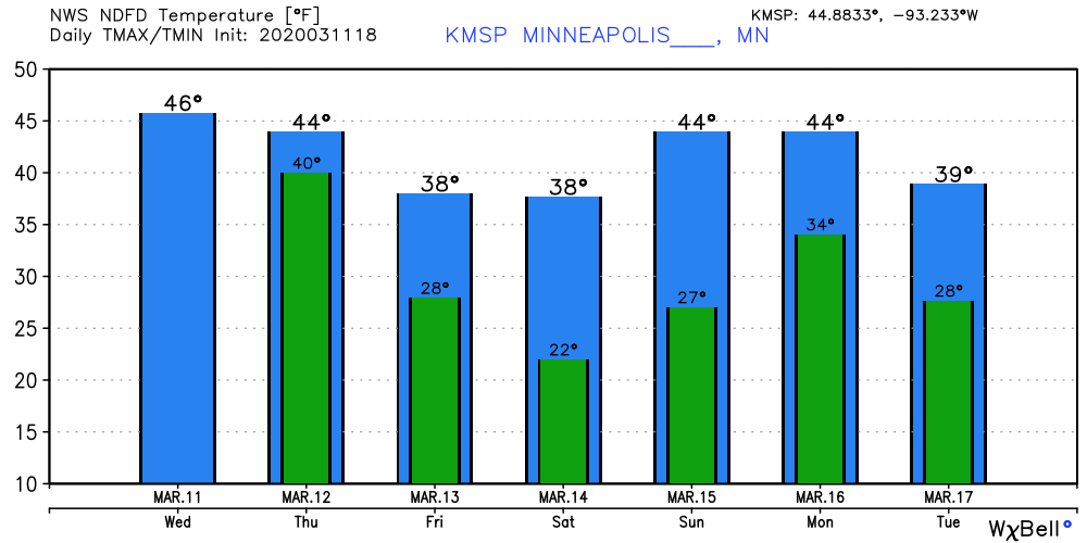
The overall temperature numbers favor temperatures closer to average for the next two weeks. That means highs in the 30s and 40s will be common.
The National Oceanic and Atmospheric Administration’s Climate Prediction Center temperature outlooks favor a cold west, warm east weather pattern. Minnesota sits between the two extremes.
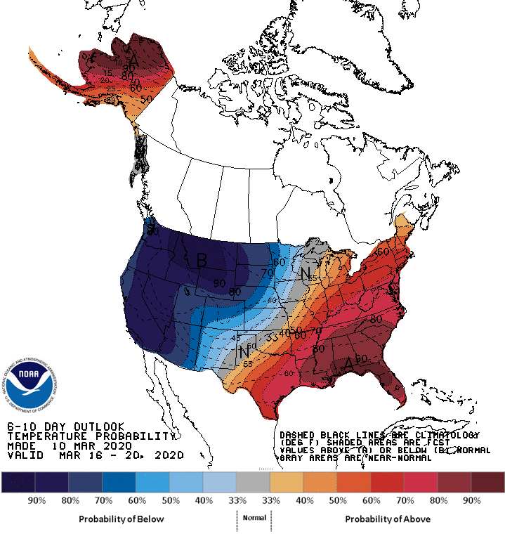
Our warm start to the first 10 days of March puts us in a position that strongly favors a milder-than-average finish overall this month.
Right now I don’t see any big snow in the short term. A few models hint at possible snow around March 19-20.
Stay tuned.

