
Showers move out; milder breezes return Sunday
Cool front Thursday night; highs return to the 40s next week
Go Deeper.
Create an account or log in to save stories.
Like this?
Thanks for liking this story! We have added it to a list of your favorite stories.


Thursday’s weather maps offer a gentle reminder that it’s still March in Minnesota. But it could be a much more forceful message. I think we all still remember the past two wintry springs in Minnesota.
March is running 9.5 degrees warmer than average in the Twin Cities through March 11. The overall weather trends still don’t show any big snow in sight just yet. There are still hints at the potential for some rain and or snow around March 19.
We’ll see.
Bands of mostly rain showers mix with light snow and flurries Thursday night as they gradually move off to the east.
Turn Up Your Support
MPR News helps you turn down the noise and build shared understanding. Turn up your support for this public resource and keep trusted journalism accessible to all.
Cold front
A cold front sweeps across Minnesota Thursday. Temperatures hovered around 40 degrees overnight with southwest winds ahead of the front. Check out the temperature plot below.
Spring has come early to much of the nation this year. It’s interesting to see how mild the days have been from Iowa southward. Highs in the 60s and 70s have been very common across the central and eastern United States. I see a few 80s flaring up Thursday in Oklahoma.
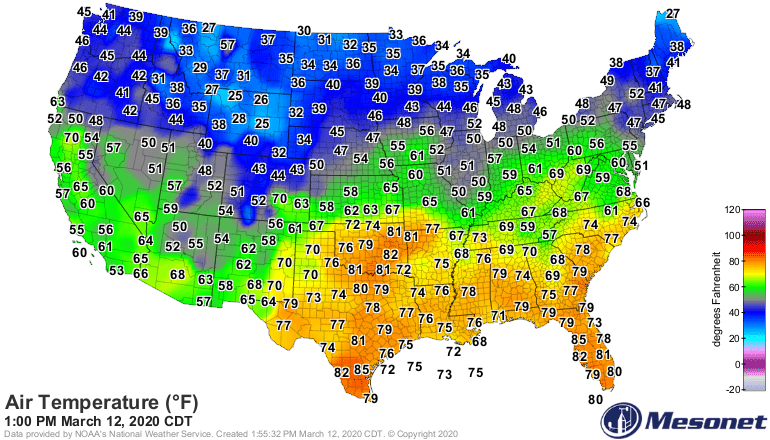
Minnesota has been warmer than average, but riding the boundary between what’s left of winter, and the spring that is to come.
Milder by Sunday
Highs hover in the 30s in southern Minnesota and 20s up north Friday and Saturday.
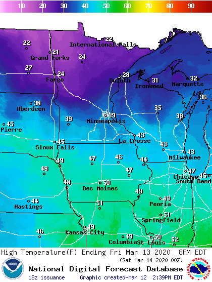
By Sunday, milder breezes return. Highs in the 40s run into next week.
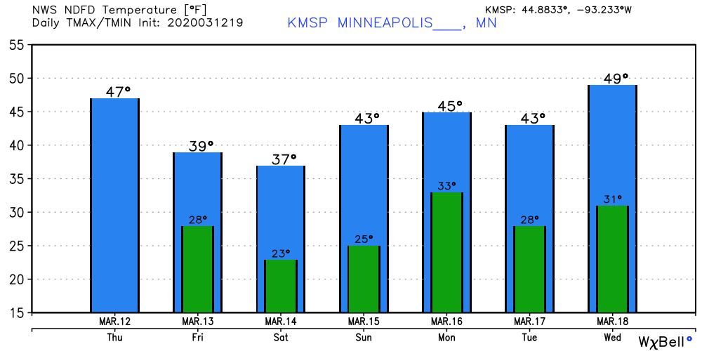
The average high and low temperatures for the Twin Cities by Monday are 41 and 24.

