
40s ahead; watching rain and snow chances Thursday and Friday
A potent March storm could bring rain and significant snow to parts of Minnesota Thursday and Friday
Go Deeper.
Create an account or log in to save stories.
Like this?
Thanks for liking this story! We have added it to a list of your favorite stories.


The weather maps become more colorful later this week.
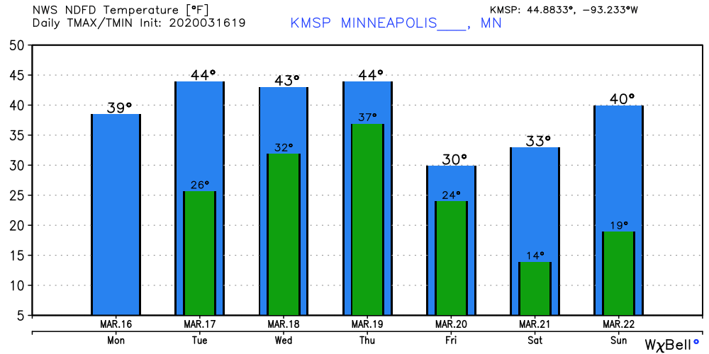
Our gray Monday snizzle gives way to mixed sunshine and higher temperatures Tuesday.
Highs reach the 40s once again Tuesday into Thursday for the Twin Cities and southern Minnesota. The average high and low for the Twin Cities this week are 42 and 25.
Thursday-Friday storm system
I’m still watching the evolution of a growingly likely storm system for Minnesota Thursday and Friday. This system has all the traits of a rain and snowmaker for Minnesota. Most models favor a rain-snow line setting up somewhere across central or southern Minnesota Thursday. Rain would likely transition to all snow in many areas Thursday night before tapering off Friday.
Turn Up Your Support
MPR News helps you turn down the noise and build shared understanding. Turn up your support for this public resource and keep trusted journalism accessible to all.

It’s still too early for high confidence in where the rain-snow line will set up. It’s also too early for high confidence in snowfall totals. That said, here’s NOAA’s GFS model for Thursday evening at 7 p.m. It sets the rain-snow line up right over the Twin Cities with heavy snow to the north and significant rain south.
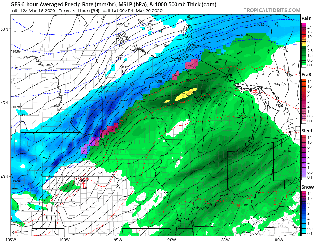
It should be noted that the Canadian model favors a more northerly solution, and the European model a more southerly solution right now. So, there is a good deal of model spread at this point.
Right now the best weather advice is to expect rain or snow Thursday and Friday. It’s still too early to be confident about who will get plowable snowfall. Many models crank out a maximum snowfall band of between 5 and 10 inches. There’s just no way to know where that might set up yet.
Stay tuned.

