
Milder 40s through Thursday; rain to snow scenario Thursday into Friday
Our inbound weather system Thursday and Friday will bring a mix of rain and snow to Minnesota.

Go Deeper.
Create an account or log in to save stories.
Like this?
Thanks for liking this story! We have added it to a list of your favorite stories.


Boy, is it nice to see the sun out there today Minnesota.
We’re taking all the rays of sunshine we can get this week. I’m still watching a weather system heading for Minnesota Thursday and Friday. The latest trends favor a rain to snow scenario Thursday for much of Minnesota. There are still significant model differences today in where the rain-snow line will eventually set up.
Let’s dig into the system a bit and see what the latest forecast models are saying.
Mild first
Turn Up Your Support
MPR News helps you turn down the noise and build shared understanding. Turn up your support for this public resource and keep trusted journalism accessible to all.
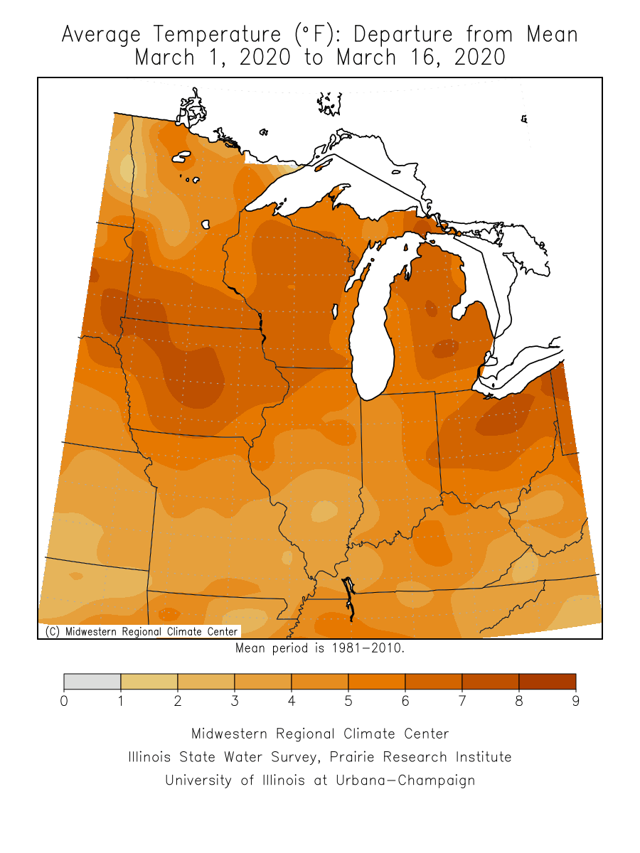
Spring is winning the battle of March over winter so far in Minnesota. So far March is running 6.7 degrees warmer than average in the Twin Cities, and 4.7 degrees warmer than average in Duluth. The Upper Midwest is bathed in warm colors this month.
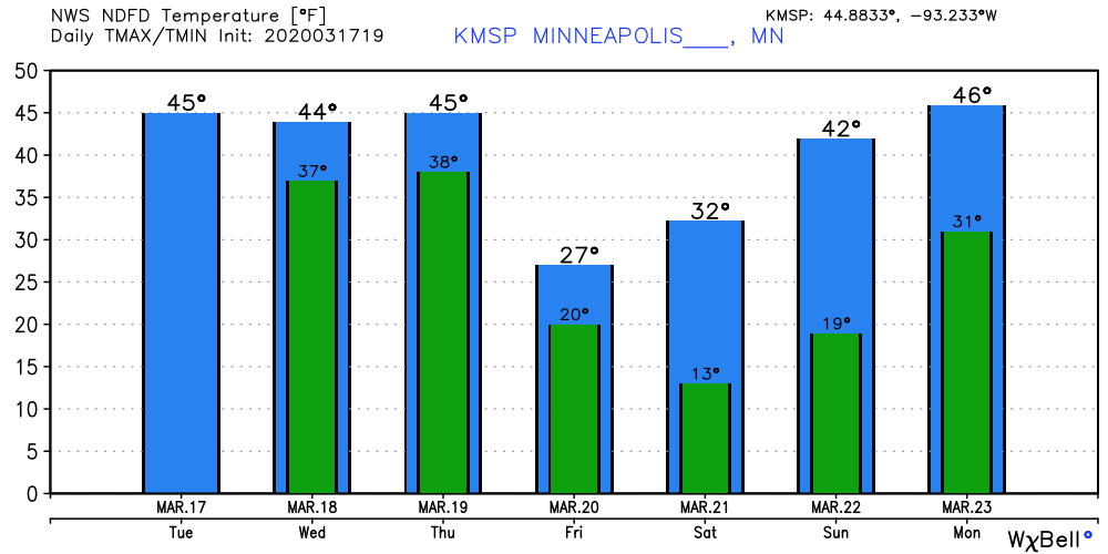
Expect highs in the 40s south and 30s north through Thursday. We cool a bit late this week, then temperatures rebound again starting Sunday.
Thursday: Rain to snow
Most of the models I trust paint a rain to snow scenario across Minnesota Thursday. The American GFS model and the Canadian models layout the rain-snow line from western Minnesota to the Iron Range Thursday. Thursday night it shifts south to the Twin Cities area. Precipitation transitions to all snow as the system sweeps by Friday early morning.
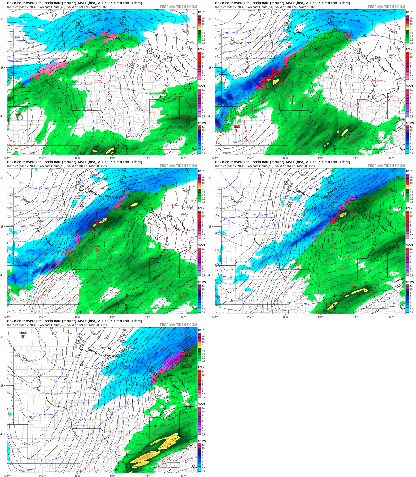
That would bring several hours of moderate to heavy snow across central Minnesota, and a shot of a few hours of vigorous snow for the Twin Cities Thursday night into Friday morning.
It’s still early and this will likely change, but here’s what seems like a reasonable attempt at snowfall ranges that might come with this system. Many may end up with 1 to 3 inches, with a band of 3 to 6 inches somewhere across Minnesota.
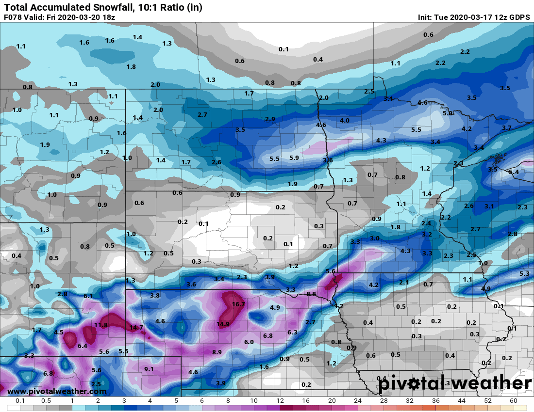
I wouldn’t trust this just yet, but the takeaway is that we could see shovelable to plowable snow in some areas.
Let’s see what changes or refinements the model runs bring tonight and Wednesday.
Stay tuned.

