
Astronomical spring arrives: Highs in the 50s and 60s ahead
It's the earliest spring in 124 years

Go Deeper.
Create an account or log in to save stories.
Like this?
Thanks for liking this story! We have added it to a list of your favorite stories.


Spring is here.
Well, technically meteorological spring already arrived March 1.
Astronomical spring occurs at 10:50 p.m. CDT Thursday night. So, why the difference between meteorological and astronomical seasons?
Here’s a good description from NOAA:
Turn Up Your Support
MPR News helps you turn down the noise and build shared understanding. Turn up your support for this public resource and keep trusted journalism accessible to all.
Meteorologists and climatologists break the seasons down into groupings of three months based on the annual temperature cycle as well as our calendar. We generally think of winter as the coldest time of the year and summer as the warmest time of the year, with spring and fall being the transition seasons, and that is what the meteorological seasons are based on. Meteorological spring includes March, April, and May; meteorological summer includes June, July, and August; meteorological fall includes September, October, and November; and meteorological winter includes December, January, and February.
Because of Earth’s variable orbit, leap year and the way we keep track of time, this is the earliest astronomical spring in 124 years.
The Vernal equinox marks the start of our progression toward summer in the northern hemisphere.

Cold front now; 50s next week
Our cold front brings a chill through Saturday. By Sunday milder air begins to work back into Minnesota. Highs reach the 50s again next week.
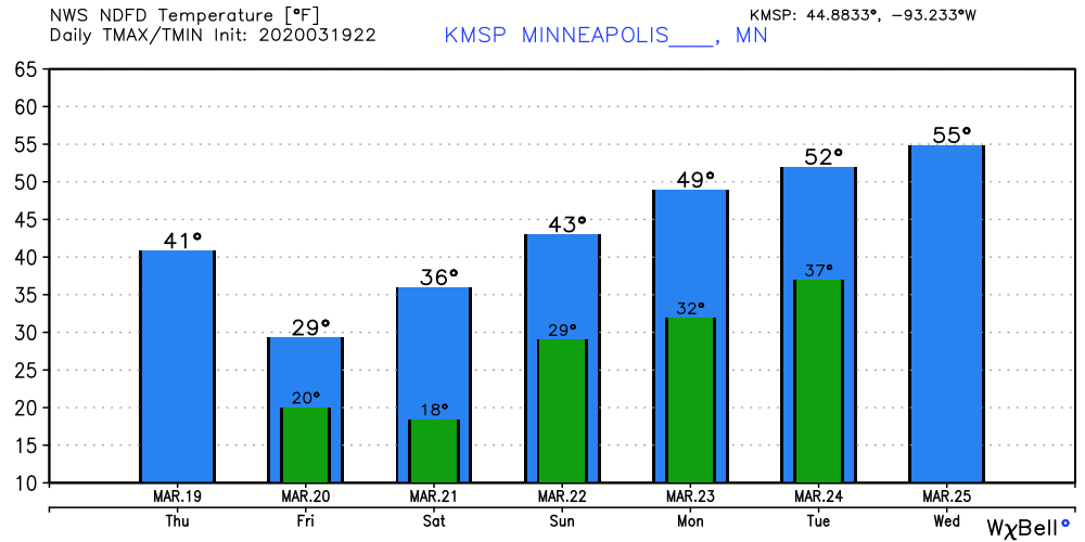
Early spring?
So far, March is running 6.5 degrees warmer than average in the Twin Cities. Duluth is running 4.3 degrees warmer than average this month.
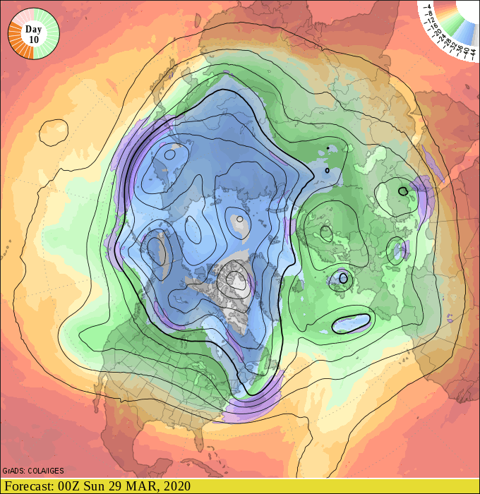
Our weather maps continue to suggest an early spring across the Upper Midwest this year. The upper air charts for next weekend suggest another push of mild Pacific air.
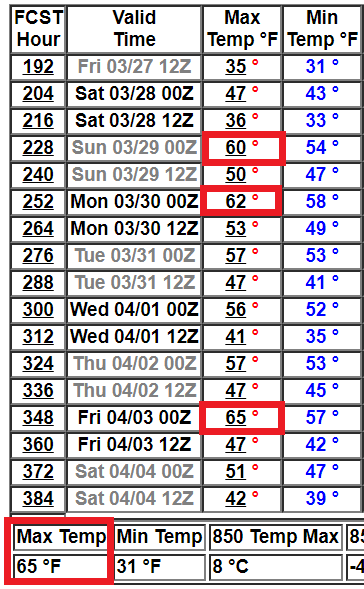
NOAA’s GFS 16-day temperature product suggests highs in the 60s in the Twin Cities by next weekend.
NOAA’s outlooks continue to favor warmer than average temperatures overall into early April.
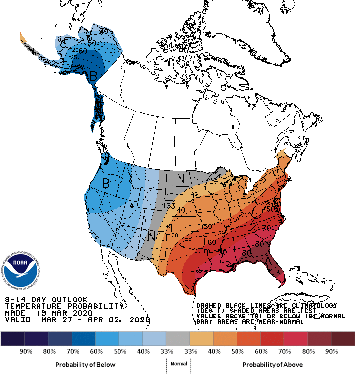
We can always get more snow, but the maps seem to suggest an early start to spring this year.
We’re due. Stay tuned.

