
Best days to get outside? Saturday afternoon through Tuesday
Milder air returns next week. 60s and possibly 70s are still on the horizon

Go Deeper.
Create an account or log in to save stories.
Like this?
Thanks for liking this story! We have added it to a list of your favorite stories.


How’s your self-isolation routine going?
I typically work from my home digital broadcast studio known as “The Huttner Weather Lab” about four days a week. So, my work routine hasn’t changed too much. But the rest of my life seems on hold.
I play hockey twice a week with two great groups of guys. The last time I skated was 12 days ago. I really, really miss that — and the fresh ice.

I play music with some great friends. We had to cancel two gigs last weekend. Our April gig was canceled Friday. My Telecaster and I are developing a deeper friendship at home these days.
Turn Up Your Support
MPR News helps you turn down the noise and build shared understanding. Turn up your support for this public resource and keep trusted journalism accessible to all.

I’m still running on the Weather Lab treadmill, doing weights and taking neighborhood walks.
But I made the mistake of stepping on the scale today — plus 3 pounds. Ouch.
The good weather and exercise news? There are going to be several days in the next week favorable to get outside.
Saturday afternoon through Tuesday look great for a brisk walk, run, or bike ride. The medium-range weather maps still hint at 60 degrees in the next two weeks.
Wishing you health, wellness and finding those moments of fun in these difficult days. I’m grateful to still have work, and pulling for all of you who are facing — hopefully temporary — employment challenges.
Hang in there. Brighter days are ahead.
Back to the 50s
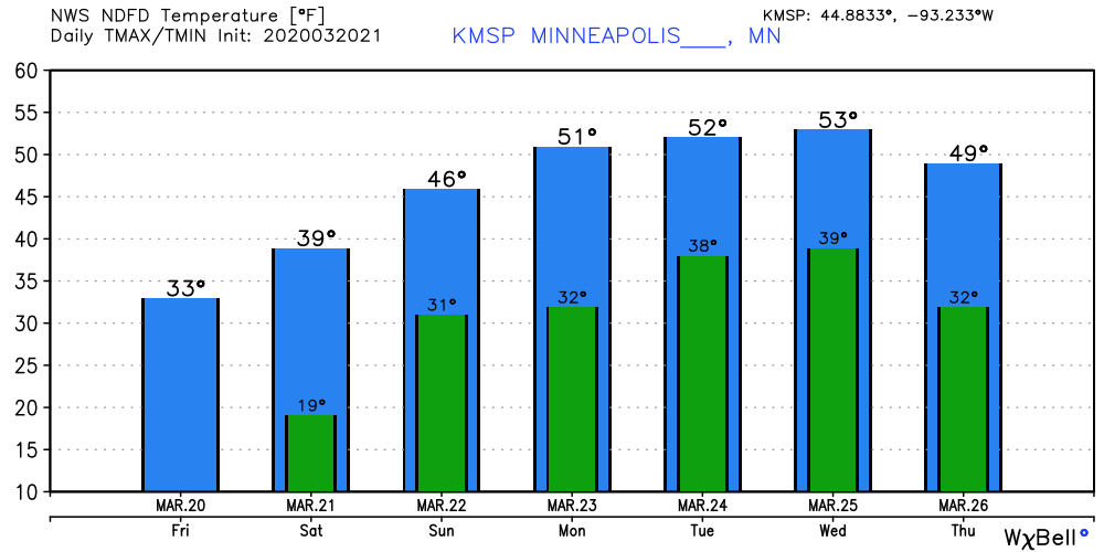
Our brisk interlude eases Sunday as temperatures begin to moderate. Highs in the low 50s return next week — just in time.
Rain to snow Wednesday?
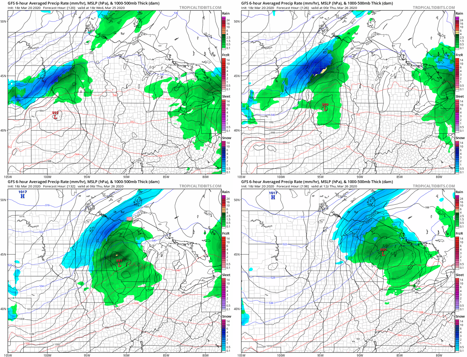
The maps are cranking out notions of a possible rain-to-snow mix next Wednesday across parts of Minnesota. The American, European and Candian models present pretty similar solutions at this far away point.
60s, possibly 70s in sight?
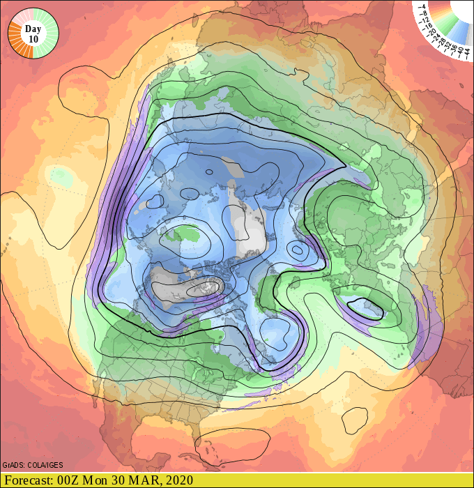
The medium-range weather maps continue to suggest a bigger warm up in seven to 14 days. The upper air forecast maps for next weekend still show a milder Pacific surge.
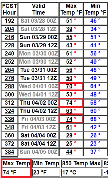
NOAA’s GFS model has been cranking out highs in the 60s, and even a few 70s as April approaches. The numbers could be an optimistic early April Fools joke, but a weather guy can dream.
NOAA’s updated week three and four outlook favors higher than average temperatures across the Upper Midwest and the central United States.
Bring on spring baby.

