Forecast models: 60s to near 70 next week?
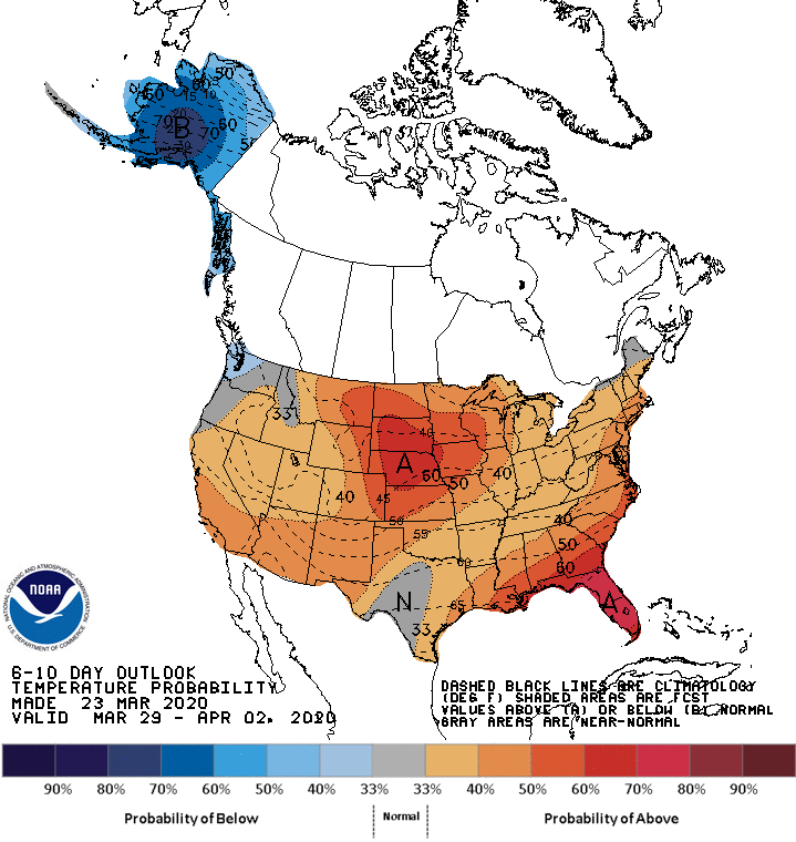
File this one under wishful thinking for many Minnesotans.
The major forecast models agree on what looks like a significant warmup for Minnesota next week. And as if medium-range forecasts don’t present enough uncertainty, this warmup appears to peak around April 1. How lovely.
Mild upper-air pattern
Next week’s upper-air maps still look mild. The jet stream lifts north into Canada. A mild flow of Pacific air dominates next week and extends through the first weekend of April.
If this pattern verifies, we can expect a string of days well into the 50s and 60s next week. A few models even hint at temperatures in the 70s for parts of Minnesota next week.
Here’s the European Centre for Medium-Range Weather Forecasts model temperature outlook for 1 p.m. on April 1.
The American models agree with 60s next week, and even a few 70s.
Stay tuned.
Create a More Connected Minnesota
MPR News is your trusted resource for the news you need. With your support, MPR News brings accessible, courageous journalism and authentic conversation to everyone - free of paywalls and barriers. Your gift makes a difference.