

Dry Friday then a Saturday soaker; pushing 60 by Monday?
Parts of Minnesota could see more than an inch of rain Saturday
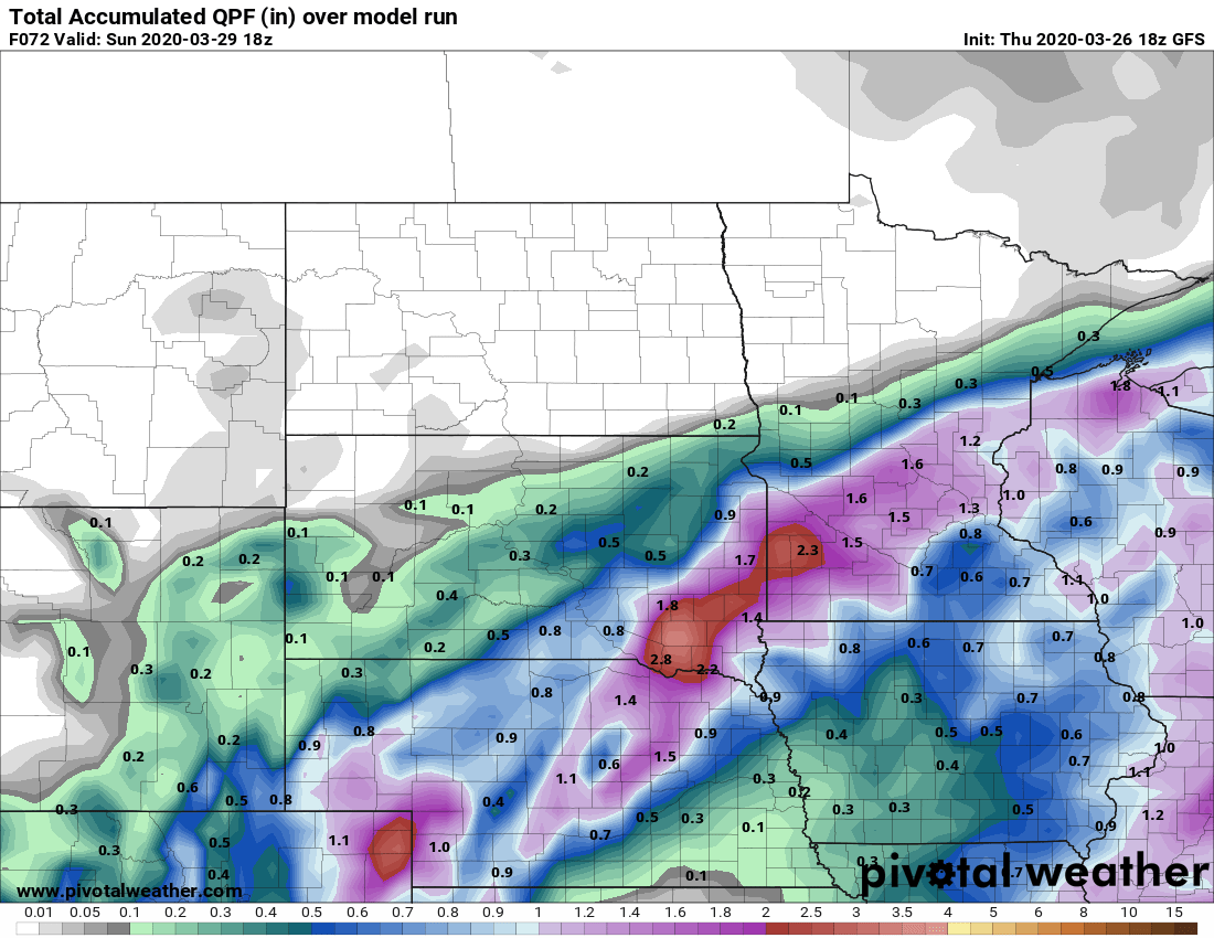
NOAA GFS precipitation forecast by midday Sunday
NOAA via pivotal weather
Go Deeper.
Create an account or log in to save stories.
Like this?
Thanks for liking this story! We have added it to a list of your favorite stories.
