
Friday morning ice storm possible, 60s return next week
A coating of ice looks likely for western Minnesota, and possibly the Twin Cities

Go Deeper.
Create an account or log in to save stories.
Like this?
Thanks for liking this story! We have added it to a list of your favorite stories.


Spring is a weather dance in Minnesota — two steps forward, one step back. Throw in the occasional April blizzard or ice storm just for kicks.
Our next inbound weather system starts as rain. But as cold air works into the backside of the slow-moving system, a zone of ice and snow will lay down an icy coating. Like most wintry weather blips in April, it won’t last long. But Thursday night and Friday morning could be icy in spots.
The system
This slow-moving spring storm pushes a few showers across our region tonight. The bulk of precipitation arrives later Thursday into Friday.
Precipitation begins as rain on the front side of the system. Rain coverage increases in western and northern Minnesota Thursday. By Thursday night, a wintry mix of ice and snow pushes into western Minnesota. That wintry mix likely arrives in the Twin Cities and eastern Minnesota Friday morning.
Turn Up Your Support
MPR News helps you turn down the noise and build shared understanding. Turn up your support for this public resource and keep trusted journalism accessible to all.
NOAA’s GFS model tracks the system across Minnesota from late Wednesday night through Friday.

Ice accumulations
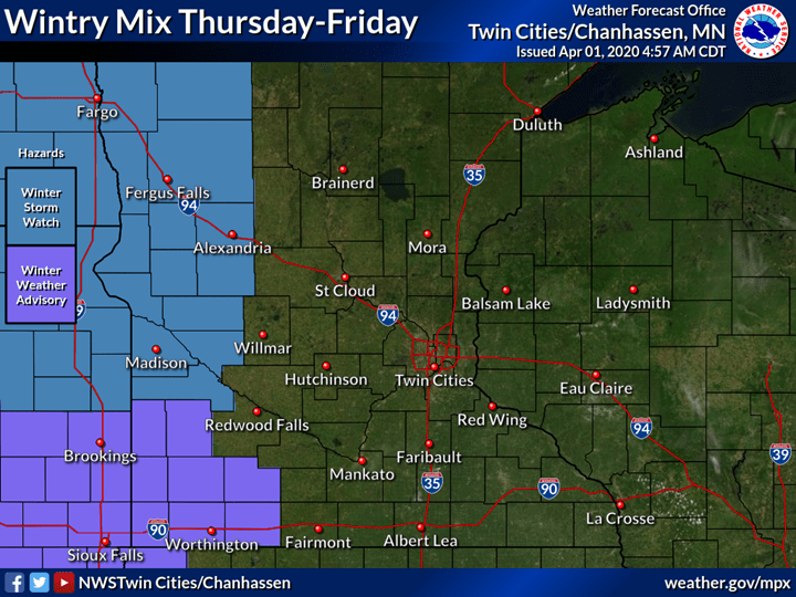
This system has the right temperature profile to produce a few hours of freezing rain as the colder air works in. The greatest ice accumulations favor western Minnesota. A quarter-inch of ice looks likely. Winds gusting to 30 mph could break ice-coated branches off of trees in western Minnesota. That could lead to power outages.
Ice accumulation Friday should be less in the Twin Cities and eastern Minnesota. Snowfall looks plowable in the Red River Valley. Less snow will fall across eastern Minnesota Friday.

Winter storm watches are posted for much of the eastern Dakotas and western Minnesota.
Spring returns: 60s again next week
The weekend looks sunny with moderating temperatures. Then what looks like the mildest shot of air so far this spring season pushes in starting Monday. Highs between 65 and 70 look promising in southern Minnesota by next Tuesday.
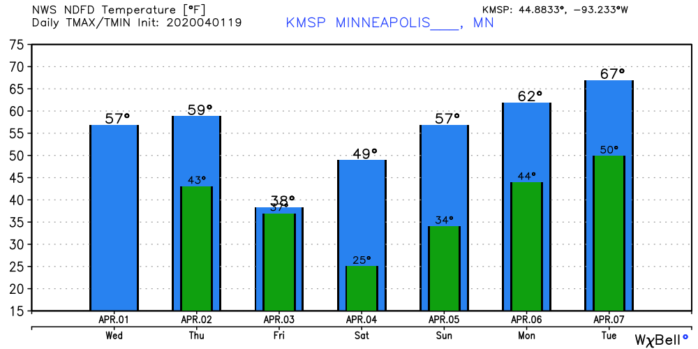
I’m already seeing growing green patches grass around the Weather Lab. By next Tuesday, your lawn may actually look like spring.
Stay tuned.

