
Wintry storm in progress in Red River Valley; main event overnight and Friday for Twin Cities
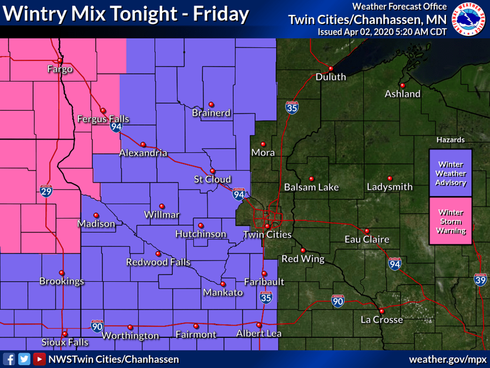
Rain, ice and snow sweep across Minnesota Thursday night and Friday
Go Deeper.
Create an account or log in to save stories.
Like this?
Thanks for liking this story! We have added it to a list of your favorite stories.


Our inbound wintry April storm is on track.
Snow and ice are falling in the Red River Valley. The slow-moving system fans out across Minnesota from west to east Thursday night and Friday. That brings a transition from rain to ice to snow from west to east through Friday.
Warm sector first
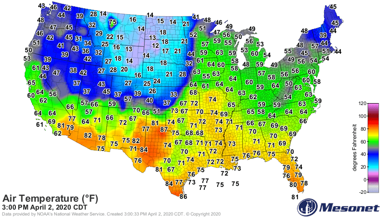
It’s a mild day in the warm sector ahead of the cold front. We hit 60 degrees at the Minneapolis-St. Paul International Airport and at many locations in central Minnesota.
The temperature contrast with this cold front is sharp. Check out the difference in air masses across Minnesota Thursday afternoon as the front approaches.
Rain, ice and snow
The sequence of events with this system is rain to ice to snow. NOAA’s GFS model paints the system as it moves east through Friday.

Here’s the likely transition time to an icy precipitation mix. The Twin Cities will likely see that changeover during the midmorning hours Friday.

Warmer next week
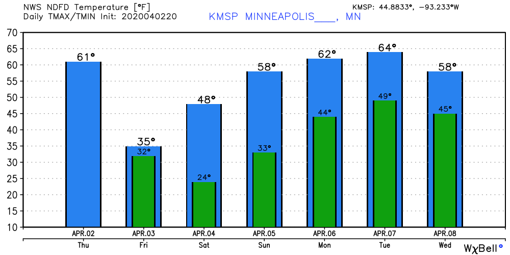
We’re still on track for a significant warmup next week. Highs in the 60s are likely Monday and Tuesday.
Turn Up Your Support
MPR News helps you turn down the noise and build shared understanding. Turn up your support for this public resource and keep trusted journalism accessible to all.

