
March flashback continues; 60s return this weekend
'True spring' arrives next week?
Go Deeper.
Create an account or log in to save stories.
Like this?
Thanks for liking this story! We have added it to a list of your favorite stories.


Three in a row.
Our latest April snow blast left another swath of snow across the Upper Midwest. This one centered on southeast Minnesota and Wisconsin as most of the forecast models predicted. That persistent band of vigorous snow Sunday afternoon dumped an extra inch or 2 on the southern half of the Twin Cities.
The final updated storm total at the Minneapolis-St. Paul International Airport is 6.6 inches.

March flashback continues
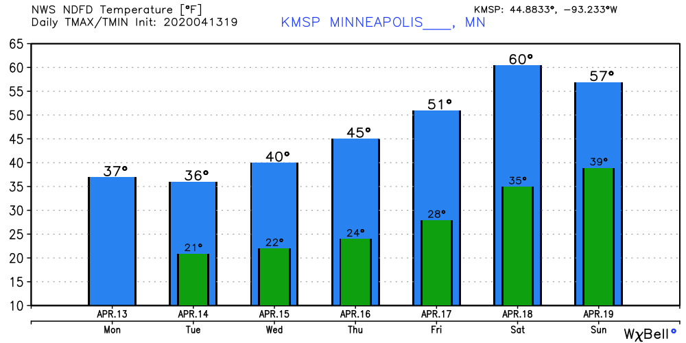
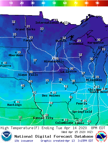
Our latest wintry flashback continues across Minnesota through midweek. Highs in the 30s and lows in the teens and 20s are more typical of March. Highs Tuesday mimic what we’re feeling out there Monday.
Turn Up Your Support
MPR News helps you turn down the noise and build shared understanding. Turn up your support for this public resource and keep trusted journalism accessible to all.
60s return
Spring in Minnesota is a relative concept. It usually goes like this: “Fake spring,” our first days in the 60s; “Final winter,” one more April snow event; Only then does “true spring” emerge in late April.
Saturday may be the first day we say it’s finally here.
There are signs that the upper air pattern will give way to a more consistent spring pattern this weekend and next week. A milder Pacific airflow is showing up through next week on the upper air maps.
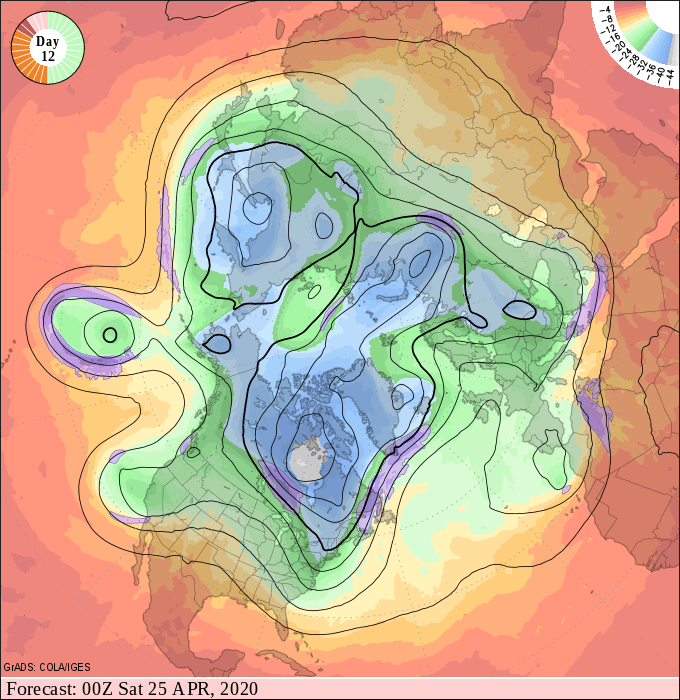
Look for more consistent highs in the 60s next week. True spring may be here for good starting this weekend.
Stay tuned.

