
Cold eases next 48 hours; pushing 60 again by Saturday
Our wintry mid-April gets back to normal this weekend
Go Deeper.
Create an account or log in to save stories.
Like this?
Thanks for liking this story! We have added it to a list of your favorite stories.


Welcome to Feb. 65.
Our latest mid-April wintry interlude winds down over the next 48 hours. Cold air gradually begins to retreat into Canada Wednesday. By Thursday afternoon we may believe in the season formerly known as spring once again.
Record cold overnight?
Low temperatures Wednesday morning dip into the teens once again across Minnesota. The record low at the Minneapolis-St. Paul International Airport Wednesday morning is 18 degrees. We have a shot. What a lovely way to begin April 15.
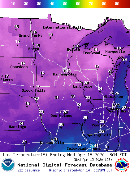
Cold eases
Temperatures begin to rebound slightly Wednesday afternoon. Highs gradually climb back to near average this weekend. Southern Minnesota and the Twin Cities push 60 degrees once again by Saturday.
Turn Up Your Support
MPR News helps you turn down the noise and build shared understanding. Turn up your support for this public resource and keep trusted journalism accessible to all.
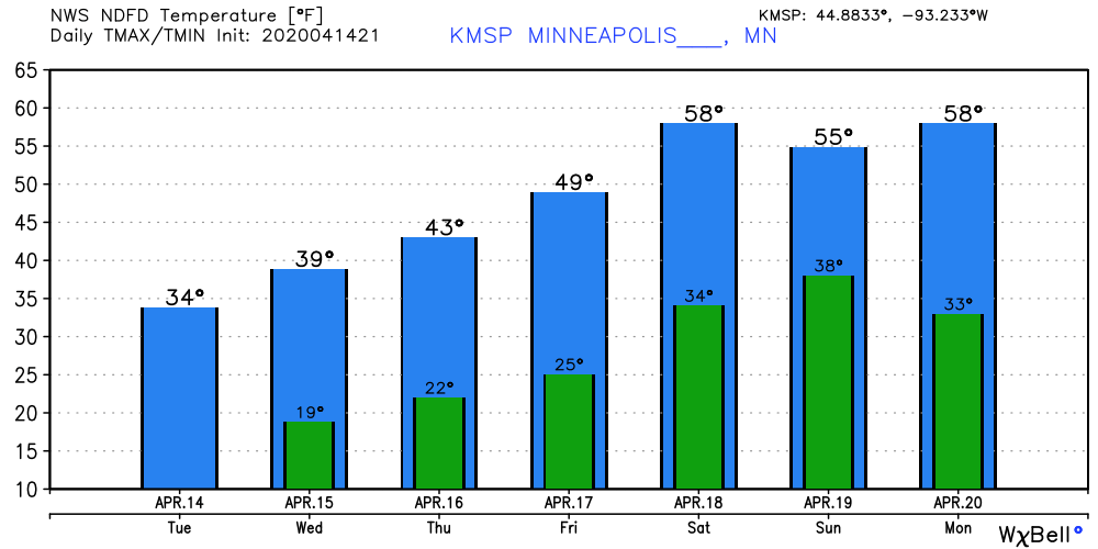
Searching for spring
I’m convinced Minnesotans are among the most resilient people on earth. We have to be to live in a climate where winter-like days are a real possibility at least six months out of the year.
The long-range maps continue to suggest a milder Pacific airflow next week.
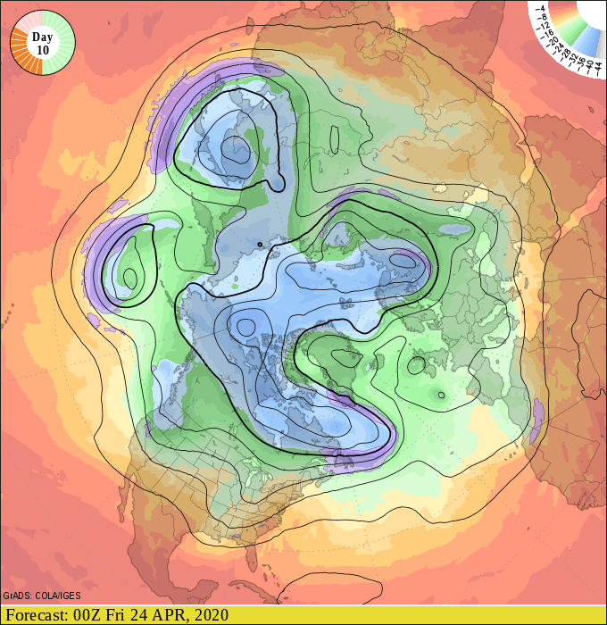
Some forecast models suggest highs well into the 60s next week.
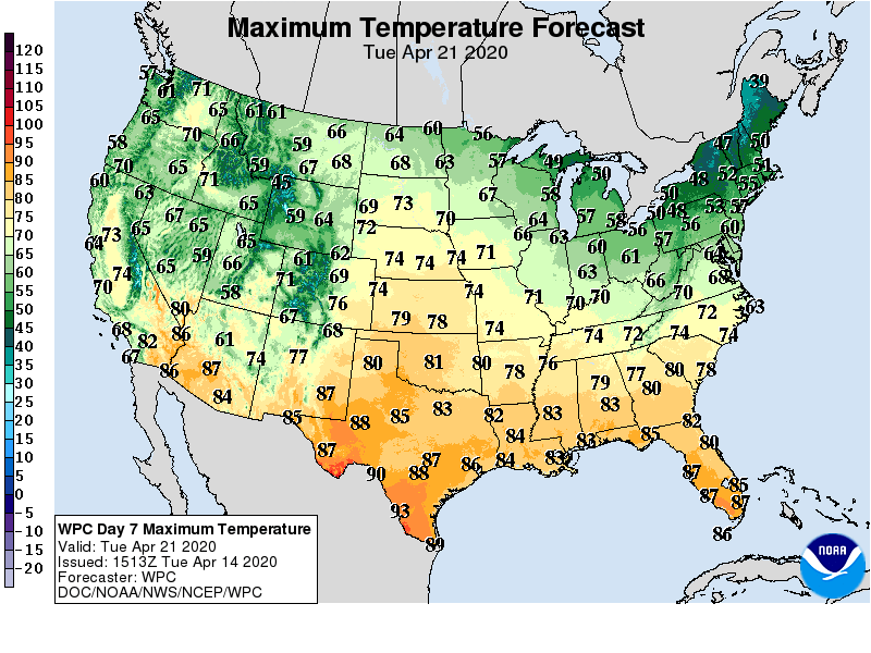
The skeptical Minnesota meteorologist in me wants to believe, but still needs to see more consistency.
Stay tuned.

