
Warming trend begins; more 60s ahead
Spring appears ready to finally turn the corner in Minnesota
Go Deeper.
Create an account or log in to save stories.
Like this?
Thanks for liking this story! We have added it to a list of your favorite stories.


This April week has been more winter than spring. But the season we like to call spring in Minnesota finally appears ready to turn the corner.
Warming trend begins
It feels better out there in Minnesota Thursday. Blue is still the dominant color on the temperature map across the Upper Midwest Thursday. But southerly winds will increasingly tap the deep reservoir of milder air to our south over the next week.

A shot at 60 Saturday
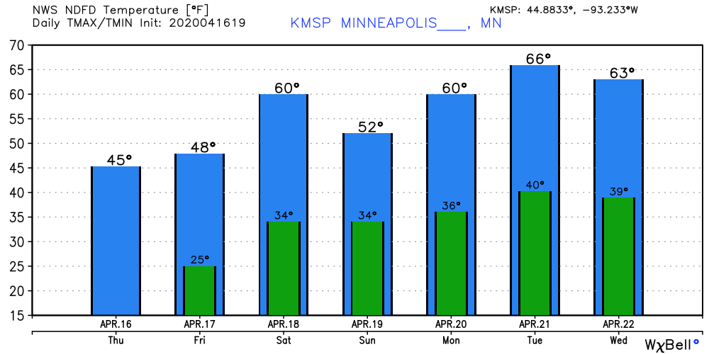
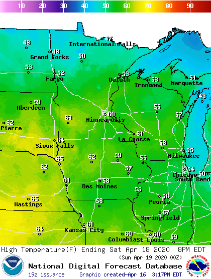
Highs moderate toward the 50-degree mark in southern Minnesota Friday. By Saturday afternoon, temperatures near 60 degrees will cover southern Minnesota once again. Highs in the 50s push well into northern Minnesota Saturday.
Even milder next week
Saturday will be the milder day this weekend. Highs in the 50s hang around Sunday. But then the next push of milder air appears ready to arrive early next week.
Turn Up Your Support
MPR News helps you turn down the noise and build shared understanding. Turn up your support for this public resource and keep trusted journalism accessible to all.
The upper air pattern for next week continues to favor a milder Pacific flow across the Upper Midwest. Notice how the blue frigid air retreats well north into Canada.
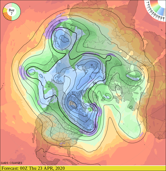
Highs in the 60s will feel very nice after this week’s unseasonable chill levels.
A shot at 70?
A few forecast models have suggested southern Minnesota could see 70 degrees next week. We’ll see how the models shake out over the weekend. NOAA’s digital graphics suggest 70 in Sioux Falls, S.D., next Wednesday.

Next week looks much more springlike that this week. Stay tuned.

