
Weekend warming trend: Back to the 60s
Milder air returns as spring takes hold

Go Deeper.
Create an account or log in to save stories.
Like this?
Thanks for liking this story! We have added it to a list of your favorite stories.


We all know about spring in Minnesota: two steps forward, one step back. Sometimes like this week, it’s three steps back.
But the calendar and our increasing April sun angle are working hard to change things. Chilly air masses will soon fade as they drift south. More frequent episodes of milder air will blow north. Eventually, warm and more humid air will arrive. Then we’ll have something else to complain about.
Milder weekend
Saturday will be the milder day this weekend. A bright sunny start gives way to a few more afternoon clouds. Highs push 60 degrees in southern Minnesota including the Twin Cities.
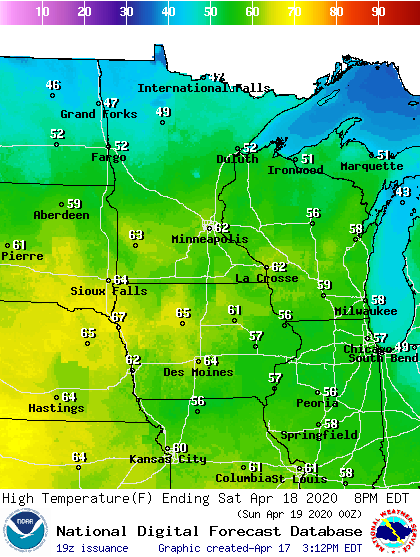
A weak cool front brings slightly cooler temperatures Sunday. But skies should be bright blue, and Sunday afternoon will feel nice in sunny microclimates.
Turn Up Your Support
MPR News helps you turn down the noise and build shared understanding. Turn up your support for this public resource and keep trusted journalism accessible to all.
Cue the tulips.
Back to the 60s
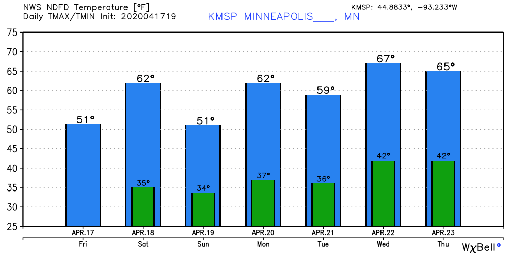
Temperatures now respond more easily to southerly flow and sunshine. Next week feels much more springy than this week. Highs in the 60s now mix in with highs in the 50s.
Searching for 70
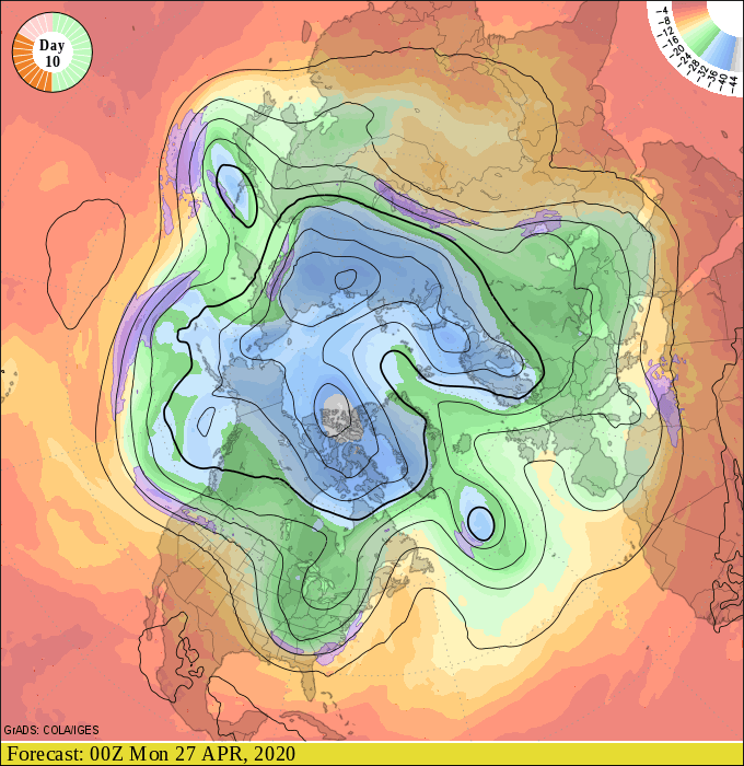
There’s a slight chance southern Minnesota hits 70 degrees next week. But looking at the maps I think the much better chance arrives the last week of April. The upper air maps suggest an even stronger push of mild air by then.
Stay tuned.

