
Feisty Monday: Fire weather, spotty thundershowers, and high winds
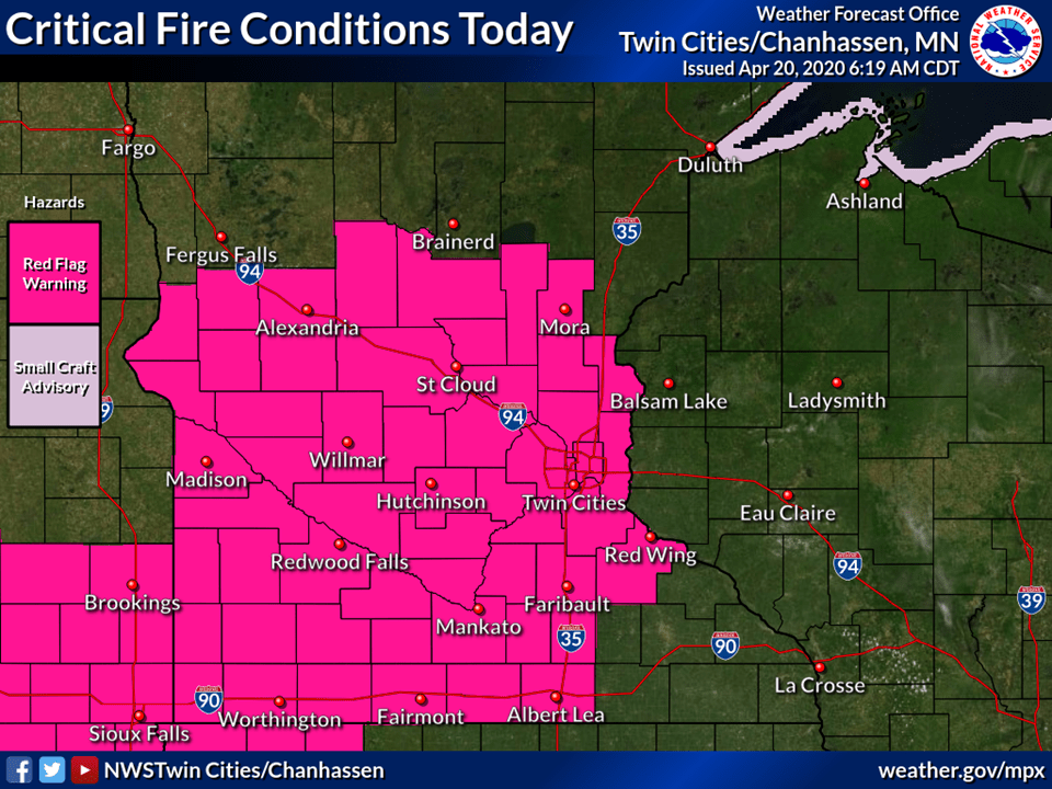
Red Flag Warning for high fire danger until 6 p.m.
Go Deeper.
Create an account or log in to save stories.
Like this?
Thanks for liking this story! We have added it to a list of your favorite stories.


It’s a feisty Monday across Minnesota. The combination of gusty winds and dry fuels has prompted a red flag warning for most of southern Minnesota.
A low-pressure system and a tight pressure gradient across Minnesota are causing gusty winds today. Winds gusting to over 40 mph in open areas mean any fires that start will spread rapidly across the dry landscape.

Isolated thundershowers
The atmosphere is unstable enough to pop a few spotty thundershowers across Minnesota Monday. The Twin Cities may see a band of bumpy thundershowers move through during what passes for afternoon rush hours these days.
Milder days ahead
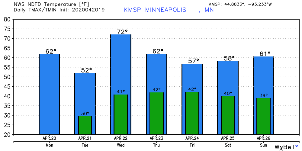
Our weather mellows Tuesday across Minnesota. Light winds and cooler weather dominate Tuesday. It will be a pretty but cool Tuesday.
Wednesday brings the warmest day this week. Highs make the upper 60s in the Twin Cities, and 70 degrees is possible in southern Minnesota. The rest of the week feels more like a typical April.
Turn Up Your Support
MPR News helps you turn down the noise and build shared understanding. Turn up your support for this public resource and keep trusted journalism accessible to all.

